Property Record
1453 20Th St, Vero Beach, FL 32960
Current Lease Availabilities
NEARBY LISTINGS FOR SALE OR LEASE
Property Detail
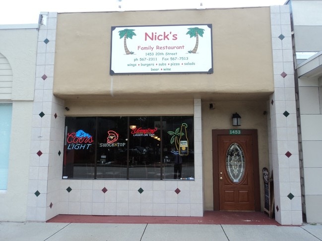
1453 20Th St
Sebastian-Vero Beach, FL
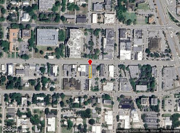
Map Of The Town Of Indian River
33-39-02-00001-0490-00012.0
VERO BEACH,CITY OF ORIGINAL TOWN BLK 49 E 20 FT OF LOT 12 PBS 2-12
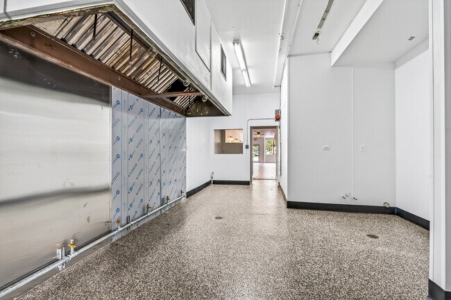
Restaurantbuilding
Indian River
X
Florida
12061C0244J
12
2025
0.06 AC
2025
Fort Pierce/Port St Lucie
050101
Other Market Areas
1,788 SF
DEMOGRAPHICS near 1453 20Th St
1 Mile
3 Mile
5 Mile
2024 Total Population
6,735
50,670
99,980
2029 Population
7,513
56,892
112,291
Pop Growth 2024-2029
+ 11.55%
+ 12.28%
+ 12.31%
Average Age
46
48
50
2024 Total Households
3,269
23,361
45,483
HH Growth 2024-2029
+ 11.10%
+ 12.13%
+ 12.15%
Median Household Inc
$45,098
$55,596
$59,241
Avg Household Size
1.90
2.10
2.10
2024 Avg HH Vehicles
1.00
2.00
2.00
Median Home Value
$268,432
$256,053
$291,432
Median Year Built
1967
1981
1988
Nearby Places
- Restaurants
- Banks
- Shops
- Fitness
- Groceries
PUBLIC TRANSPORTATION
AIRPORT
Melbourne Orlando International
DRIVE
WALK
Distance
Melbourne Orlando International
52 min
42.2 mi
Nearby Properties
Address
Land Use
TOTAL SIZE
Lot Size
Zoning
Address
Land Use
TOTAL SIZE
Lot Size
Zoning
634,259 SF
53.45 AC
MED
Address
Land Use
TOTAL SIZE
Lot Size
Zoning
303,447 SF
26.90 AC
M
Address
Land Use
TOTAL SIZE
Lot Size
Zoning
571,211 SF
26.38 AC
RM-10
Address
Land Use
TOTAL SIZE
Lot Size
Zoning
302,878 SF
40 AC
INST
Address
Land Use
TOTAL SIZE
Lot Size
Zoning
240,516 SF
39.71 AC
RM-8
Address
Land Use
TOTAL SIZE
Lot Size
Zoning
39,873 SF
7.61 AC
GU
Address
Land Use
TOTAL SIZE
Lot Size
Zoning
2,133 SF
772.04 AC
ALI-A1
Address
Land Use
TOTAL SIZE
Lot Size
Zoning
46,567 SF
19.61 AC
CG
Address
Land Use
TOTAL SIZE
Lot Size
Zoning
10,600 SF
36.80 AC
RS-6
Address
Land Use
TOTAL SIZE
Lot Size
Zoning
12,192 SF
40 AC
RS-6
Address
Land Use
TOTAL SIZE
Lot Size
Zoning
125,677 SF
2.17 AC
DTW
Address
Land Use
TOTAL SIZE
Lot Size
Zoning
49,513 SF
60.64 AC
ALI-MC
Address
Land Use
TOTAL SIZE
Lot Size
Zoning
106,904 SF
79.05 AC
M
Address
Land Use
TOTAL SIZE
Lot Size
Zoning
124.80 AC
Address
Land Use
TOTAL SIZE
Lot Size
Zoning
80,682 SF
24.97 AC
R-1A
Address
Land Use
TOTAL SIZE
Lot Size
Zoning
313,820 SF
21.83 AC
RM-10 EX
Address
Land Use
TOTAL SIZE
Lot Size
Zoning
235,921 SF
28.80 AC
RM-8
Address
Land Use
TOTAL SIZE
Lot Size
Zoning
67,334 SF
9.63 AC
MED
Address
Land Use
TOTAL SIZE
Lot Size
Zoning
149,178 SF
10.72 AC
C-1B
Address
Land Use
TOTAL SIZE
Lot Size
Zoning
206,738 SF
17.76 AC
PD
Address
Land Use
TOTAL SIZE
Lot Size
Zoning
82,427 SF
2.48 AC
C-1A
Address
Land Use
TOTAL SIZE
Lot Size
Zoning
69,942 SF
10.47 AC
MED
Address
Land Use
TOTAL SIZE
Lot Size
Zoning
102,808 SF
12.51 AC
CG
Address
Land Use
TOTAL SIZE
Lot Size
Zoning
231,651 SF
16.23 AC
RM-10
Address
Land Use
TOTAL SIZE
Lot Size
Zoning
39,798 SF
1.31 AC
C-1A
Address
Land Use
TOTAL SIZE
Lot Size
Zoning
2,888 SF
95.84 AC
R-1AA
Address
Land Use
TOTAL SIZE
Lot Size
Zoning
76,484 SF
7.03 AC
P-2
Address
Land Use
TOTAL SIZE
Lot Size
Zoning
91,904 SF
10 AC
CG
Address
Land Use
TOTAL SIZE
Lot Size
Zoning
1,500 SF
34.50 AC
P-2
Address
Land Use
TOTAL SIZE
Lot Size
Zoning
2,232 SF
8.35 AC
C-1B
The World's #1 Commercial Real Estate Marketplace
Connect with us
© 2025 CoStar Group
The information above has been obtained from sources believed reliable. While we do not doubt its accuracy we have not verified it and make no guarantee, warranty or representation about it. It is your responsibility to independently confirm its accuracy and completeness. Any projections, opinions, assumptions, or estimates used are for example only and do not represent the current or future performance of the property. The value of this transaction to you depends on tax and other factors which should be evaluated by your tax, financial, and legal advisors. You and your advisors should conduct a careful, independent investigation of the property to determine to your satisfaction the suitability of the property for your needs.