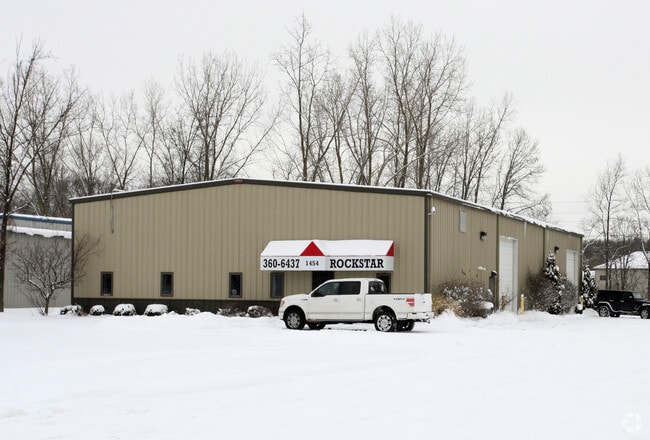
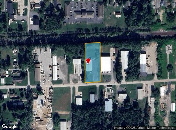
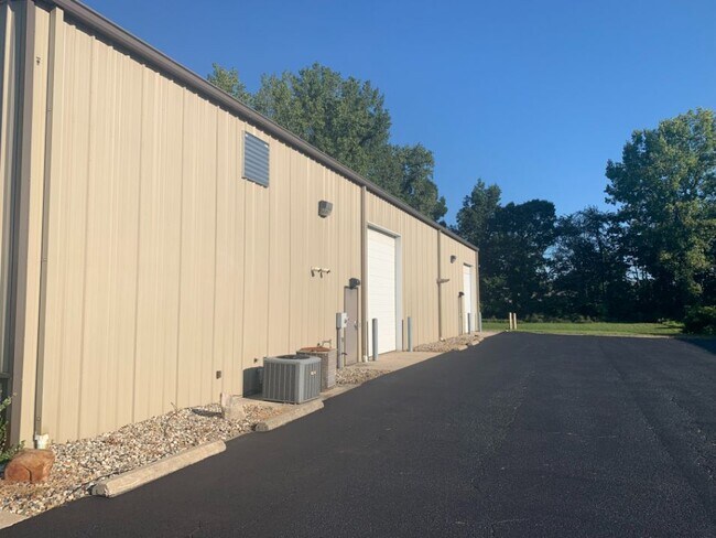
Property Record
1454 3Rd St, Osceola, IN 46561
NEARBY LISTINGS FOR SALE OR LEASE
Property Detail
1454 3Rd St
South Bend-Mishawaka, IN-MI
Hampton Mcmann Minor
71-10-17-252-004.000-030
LOT 2 HAMPTON MCMANN MINOR 03-04 SET UP NEW REPLAT PER TR 5094 7-17-02
Warehouse
St Joseph
X
Indiana
18141C0237E
2
2023
1.37 AC
2024
Mishawaka
011602
South Bend/Mishawaka
6,480 SF
DEMOGRAPHICS near 1454 3Rd St
1 Mile
3 Mile
5 Mile
2024 Total Population
3,639
26,924
68,602
2029 Population
3,595
26,598
68,065
Pop Growth 2024-2029
(1.21%)
(1.21%)
(0.78%)
Average Age
40
40
39
2024 Total Households
1,421
10,162
26,880
HH Growth 2024-2029
(1.34%)
(1.29%)
(0.81%)
Median Household Inc
$64,375
$75,693
$65,187
Avg Household Size
2.50
2.60
2.50
2024 Avg HH Vehicles
2.00
2.00
2.00
Median Home Value
$175,809
$178,916
$168,335
Median Year Built
1966
1974
1975
Nearby Places
Map Layers
Map Styles
 Street
 Aerial
- Restaurants
- Banks
- Shops
- Fitness
- Groceries
PUBLIC TRANSPORTATION
COMMUTER RAIL
Elkhart Amtrak Station (Capitol Limited - Amtrak, Lake Shore Limited - Amtrak)
DRIVE
WALK
Distance
Elkhart Amtrak Station (Capitol Limited - Amtrak, Lake Shore Limited - Amtrak)
12 min
6.5 mi
AIRPORT
South Bend International
DRIVE
WALK
Distance
South Bend International
34 min
15.5 mi
Freight Ports
Port Milwaukee
DRIVE
WALK
Distance
Port Milwaukee
230 min
191.4 mi
SALE & LEASE HISTORY
LISTING DATE
SALE/LEASE

Sep 20, 2021
For Lease
Oct 12, 2017
For Lease
Oct 12, 2017
For Sale
Jun 16, 2021
For Sale
Nearby Properties
Address
Land Use
TOTAL SIZE
Lot Size
Zoning
Address
Land Use
TOTAL SIZE
Lot Size
Zoning
2,584,820 SF
32.18 AC
Address
Land Use
TOTAL SIZE
Lot Size
Zoning
377,169 SF
23.85 AC
ZO01
Address
Land Use
TOTAL SIZE
Lot Size
Zoning
184,212 SF
23.71 AC
ZO01
Address
Land Use
TOTAL SIZE
Lot Size
Zoning
36,851 SF
22.72 AC
Address
Land Use
TOTAL SIZE
Lot Size
Zoning
3,692,640 SF
0.01 AC
Address
Land Use
TOTAL SIZE
Lot Size
Zoning
123,595 SF
7.92 AC
Address
Land Use
TOTAL SIZE
Lot Size
Zoning
115,990 SF
11.91 AC
Address
Land Use
TOTAL SIZE
Lot Size
Zoning
81,185 SF
23.42 AC
Address
Land Use
TOTAL SIZE
Lot Size
Zoning
279,230 SF
27.20 AC
Address
Land Use
TOTAL SIZE
Lot Size
Zoning
225,200 SF
25.73 AC
Address
Land Use
TOTAL SIZE
Lot Size
Zoning
49,293 SF
87 SF
Address
Land Use
TOTAL SIZE
Lot Size
Zoning
50,250 SF
16.70 AC
ZO01
Address
Land Use
TOTAL SIZE
Lot Size
Zoning
30,470 SF
20 AC
Address
Land Use
TOTAL SIZE
Lot Size
Zoning
47,240 SF
6.66 AC
Address
Land Use
TOTAL SIZE
Lot Size
Zoning
281,499 SF
21.32 AC
Address
Land Use
TOTAL SIZE
Lot Size
Zoning
42,500 SF
1.93 AC
Address
Land Use
TOTAL SIZE
Lot Size
Zoning
69,518 SF
33.38 AC
ZO01
Address
Land Use
TOTAL SIZE
Lot Size
Zoning
109,536 SF
106 AC
Address
Land Use
TOTAL SIZE
Lot Size
Zoning
55,428 SF
44 SF
Address
Land Use
TOTAL SIZE
Lot Size
Zoning
59,438 SF
10.73 AC
Address
Land Use
TOTAL SIZE
Lot Size
Zoning
30,344 SF
7.94 AC
Address
Land Use
TOTAL SIZE
Lot Size
Zoning
40,480 SF
3.62 AC
Address
Land Use
TOTAL SIZE
Lot Size
Zoning
61,384 SF
5.59 AC
Address
Land Use
TOTAL SIZE
Lot Size
Zoning
31,156 SF
4.93 AC
Address
Land Use
TOTAL SIZE
Lot Size
Zoning
25,588 SF
12 AC
Address
Land Use
TOTAL SIZE
Lot Size
Zoning
33,330 SF
4.27 AC
Address
Land Use
TOTAL SIZE
Lot Size
Zoning
16,034 SF
6.46 AC
Address
Land Use
TOTAL SIZE
Lot Size
Zoning
70,364 SF
11.40 AC
ZO01
Address
Land Use
TOTAL SIZE
Lot Size
Zoning
20,993 SF
123.19 AC
ZO01
Address
Land Use
TOTAL SIZE
Lot Size
Zoning
16,256 SF
74.61 AC
ZO01
The World's #1 Commercial Real Estate Marketplace
Connect with us
© 2025 CoStar Group
The information above has been obtained from sources believed reliable. While we do not doubt its accuracy we have not verified it and make no guarantee, warranty or representation about it. It is your responsibility to independently confirm its accuracy and completeness. Any projections, opinions, assumptions, or estimates used are for example only and do not represent the current or future performance of the property. The value of this transaction to you depends on tax and other factors which should be evaluated by your tax, financial, and legal advisors. You and your advisors should conduct a careful, independent investigation of the property to determine to your satisfaction the suitability of the property for your needs.