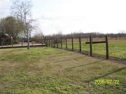
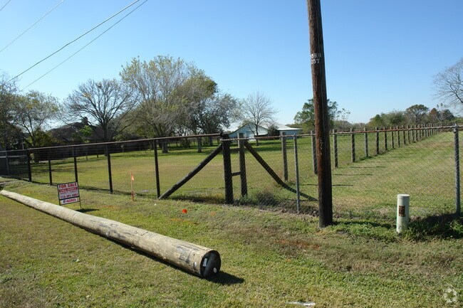
Property Record
1454 Oday Rd, Pearland, TX 77581
NEARBY LISTINGS FOR SALE OR LEASE
Property Detail
1454 Oday Rd
Houston-The Woodlands-Sugar Land, TX
H T & B R R
0219-0008-127
A0219 H T & B R R TRACT 6B-7D2-7E ACRES 1.00
Agriculturalland
Brazoria
X
Texas
48039C0030K
1.07 AC
2024
South
2025
Houston
660502
DEMOGRAPHICS near 1454 Oday Rd
1 Mile
3 Mile
5 Mile
2024 Total Population
4,793
51,155
180,965
2029 Population
5,314
55,436
192,646
Pop Growth 2024-2029
+ 10.87%
+ 8.37%
+ 6.45%
Average Age
35
35
36
2024 Total Households
1,488
17,035
60,180
HH Growth 2024-2029
+ 11.09%
+ 8.53%
+ 6.61%
Median Household Inc
$97,411
$80,402
$82,992
Avg Household Size
3.10
2.90
2.90
2024 Avg HH Vehicles
2.00
2.00
2.00
Median Home Value
$221,721
$239,574
$245,298
Median Year Built
2001
1999
1999
Nearby Places
Map Layers
Map Styles
 Street
 Aerial
- Restaurants
- Banks
- Shops
- Fitness
- Groceries
PUBLIC TRANSPORTATION
AIRPORT
William P Hobby
DRIVE
WALK
Distance
William P Hobby
16 min
6.7 mi
George Bush Intcntl/Houston
DRIVE
WALK
Distance
George Bush Intcntl/Houston
49 min
35.8 mi
Freight Ports
Port of Houston
DRIVE
WALK
Distance
Port of Houston
27 min
14.9 mi
Nearby Properties
Address
Land Use
TOTAL SIZE
Lot Size
Zoning
Address
Land Use
TOTAL SIZE
Lot Size
Zoning
1,226,700 SF
92.85 AC
Address
Land Use
TOTAL SIZE
Lot Size
Zoning
66.85 AC
0047
Address
Land Use
TOTAL SIZE
Lot Size
Zoning
603,780 SF
36.94 AC
Address
Land Use
TOTAL SIZE
Lot Size
Zoning
375,863 SF
16.35 AC
Address
Land Use
TOTAL SIZE
Lot Size
Zoning
589,830 SF
47.20 AC
Address
Land Use
TOTAL SIZE
Lot Size
Zoning
359,985 SF
12.56 AC
Address
Land Use
TOTAL SIZE
Lot Size
Zoning
421,680 SF
23.44 AC
Address
Land Use
TOTAL SIZE
Lot Size
Zoning
379,071 SF
20.02 AC
Address
Land Use
TOTAL SIZE
Lot Size
Zoning
316,800 SF
16.03 AC
Address
Land Use
TOTAL SIZE
Lot Size
Zoning
387,389 SF
21.40 AC
Address
Land Use
TOTAL SIZE
Lot Size
Zoning
252,472 SF
13.28 AC
Address
Land Use
TOTAL SIZE
Lot Size
Zoning
79.45 AC
1000
Address
Land Use
TOTAL SIZE
Lot Size
Zoning
16,677 SF
12.38 AC
Address
Land Use
TOTAL SIZE
Lot Size
Zoning
72,543 SF
22.64 AC
Address
Land Use
TOTAL SIZE
Lot Size
Zoning
221,401 SF
11 AC
Address
Land Use
TOTAL SIZE
Lot Size
Zoning
14.93 AC
Address
Land Use
TOTAL SIZE
Lot Size
Zoning
65,854 SF
18.96 AC
Address
Land Use
TOTAL SIZE
Lot Size
Zoning
344,782 SF
14.14 AC
Address
Land Use
TOTAL SIZE
Lot Size
Zoning
291,181 SF
11.07 AC
Address
Land Use
TOTAL SIZE
Lot Size
Zoning
285,328 SF
40.75 AC
Address
Land Use
TOTAL SIZE
Lot Size
Zoning
199,360 SF
11.13 AC
Address
Land Use
TOTAL SIZE
Lot Size
Zoning
161,000 SF
9.82 AC
Address
Land Use
TOTAL SIZE
Lot Size
Zoning
89.23 AC
Address
Land Use
TOTAL SIZE
Lot Size
Zoning
195,856 SF
20.81 AC
Address
Land Use
TOTAL SIZE
Lot Size
Zoning
67,755 SF
19.53 AC
Address
Land Use
TOTAL SIZE
Lot Size
Zoning
157,128 SF
10 AC
0041
Address
Land Use
TOTAL SIZE
Lot Size
Zoning
114,828 SF
7.94 AC
Address
Land Use
TOTAL SIZE
Lot Size
Zoning
67,218 SF
30.11 AC
Address
Land Use
TOTAL SIZE
Lot Size
Zoning
221,377 SF
26.83 AC
Address
Land Use
TOTAL SIZE
Lot Size
Zoning
44,546 SF
7.54 AC
The World's #1 Commercial Real Estate Marketplace
Connect with us
© 2025 CoStar Group
The information above has been obtained from sources believed reliable. While we do not doubt its accuracy we have not verified it and make no guarantee, warranty or representation about it. It is your responsibility to independently confirm its accuracy and completeness. Any projections, opinions, assumptions, or estimates used are for example only and do not represent the current or future performance of the property. The value of this transaction to you depends on tax and other factors which should be evaluated by your tax, financial, and legal advisors. You and your advisors should conduct a careful, independent investigation of the property to determine to your satisfaction the suitability of the property for your needs.