Property Record
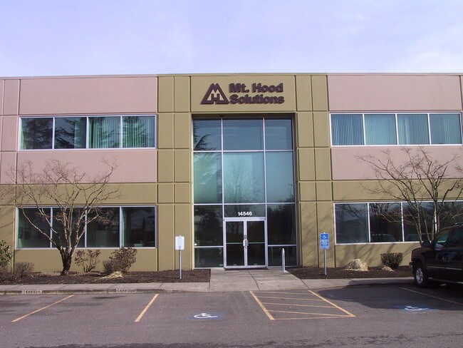
14546 N Columbia Blvd, Portland, OR 97203


NEARBY LISTINGS FOR SALE OR LEASE
Property Detail
14546 N Columbia Blvd
R256229
Rivergate Industrial Dis
Industrialgeneral
RIVERGATE INDUSTRIAL DIS, BLOCK 1&9&14 TL 700
ARE
Multnomah
53011C0344D
Oregon
2025
6.45 AC
2025
Rivergate
007202
Portland
131,570 SF
Portland-Vancouver-Hillsboro, OR-WA
DEMOGRAPHICS near 14546 N Columbia Blvd
1 mile
3 mile
5 mile
2024 Total Population
19
10,943
61,957
2029 Population
18
10,631
62,609
Pop Growth 2024-2029
(5.26%)
(2.85%)
+ 1.05%
Average Age
36
38
39
2024 Total Households
5
4,698
25,591
HH Growth 2024-2029
0.00%
(3.09%)
+ 1.72%
Median Household Inc
$67,500
$81,678
$76,464
Avg Household Size
1.80
2.20
2.20
2024 Avg HH Vehicles
2.00
2.00
2.00
Median Home Value
$50,000
$473,718
$461,994
Median Year Built
1977
1966
1969
Nearby Places
Map Layers
Map Styles
 Street
 Aerial
Transit
 Traffic
 Biking
Places
Listings with unknown addresses are not visible on the map
- Restaurants
- Banks
- Shops
- Fitness
- Groceries
PUBLIC TRANSPORTATION
COMMUTER RAIL
Drive
Walk
Distance
18 min
8.6 mi
AIRPORT
Portland International
Drive
Walk
Distance
Portland International
27 min
14.0 mi
Freight Ports
Port of Portland
Drive
Walk
Distance
Port of Portland
18 min
8.6 mi
SALE & LEASE HISTORY
LISTING DATE
SALE/LEASE

Apr 03, 2017
For Lease
Nearby Properties
Address
Land Use
TOTAL SIZE
Lot Size
Zoning
Address
Land Use
TOTAL SIZE
Lot Size
Zoning
546,069 SF
142 AC
IH
Address
Land Use
TOTAL SIZE
Lot Size
Zoning
332,800 SF
12.78 AC
IH
Address
Land Use
TOTAL SIZE
Lot Size
Zoning
890,408 SF
22.48 AC
IH
Address
Land Use
TOTAL SIZE
Lot Size
Zoning
Address
Land Use
TOTAL SIZE
Lot Size
Zoning
Address
Land Use
TOTAL SIZE
Lot Size
Zoning
335.31 AC
OS
Address
Land Use
TOTAL SIZE
Lot Size
Zoning
48.39 AC
NULL
Address
Land Use
TOTAL SIZE
Lot Size
Zoning
918,400 SF
48.13 AC
IH
Address
Land Use
TOTAL SIZE
Lot Size
Zoning
75.20 AC
IH
Address
Land Use
TOTAL SIZE
Lot Size
Zoning
Address
Land Use
TOTAL SIZE
Lot Size
Zoning
5,045,000 SF
116.53 AC
IH
Address
Land Use
TOTAL SIZE
Lot Size
Zoning
100 SF
82.93 AC
IH
Address
Land Use
TOTAL SIZE
Lot Size
Zoning
361,120 SF
20 AC
IH
Address
Land Use
TOTAL SIZE
Lot Size
Zoning
313,214 SF
NULL
Address
Land Use
TOTAL SIZE
Lot Size
Zoning
5,499,311 SF
40.90 AC
IH
Address
Land Use
TOTAL SIZE
Lot Size
Zoning
200 SF
50.40 AC
IH
Address
Land Use
TOTAL SIZE
Lot Size
Zoning
523,196 SF
21.97 AC
IHH
Address
Land Use
TOTAL SIZE
Lot Size
Zoning
425,395 SF
16.65 AC
IHH
Address
Land Use
TOTAL SIZE
Lot Size
Zoning
309,393 SF
14.87 AC
IH
Address
Land Use
TOTAL SIZE
Lot Size
Zoning
459,662 SF
19.41 AC
IHH
Address
Land Use
TOTAL SIZE
Lot Size
Zoning
385,275 SF
25.29 AC
IH
Address
Land Use
TOTAL SIZE
Lot Size
Zoning
573,020 SF
27.30 AC
IH
Address
Land Use
TOTAL SIZE
Lot Size
Zoning
96.34 AC
IH
Address
Land Use
TOTAL SIZE
Lot Size
Zoning
2,124 SF
417.17 AC
IH
Address
Land Use
TOTAL SIZE
Lot Size
Zoning
15 AC
IHH
Address
Land Use
TOTAL SIZE
Lot Size
Zoning
606,639 SF
27.62 AC
IH
Address
Land Use
TOTAL SIZE
Lot Size
Zoning
258.16 AC
OS
Address
Land Use
TOTAL SIZE
Lot Size
Zoning
137,784 SF
8.36 AC
RM1
Address
Land Use
TOTAL SIZE
Lot Size
Zoning
438,700 SF
21.30 AC
IH
Address
Land Use
TOTAL SIZE
Lot Size
Zoning
325,908 SF
17.61 AC
IHH
The World's #1 Commercial Real Estate Marketplace
Connect with us
© 2026 CoStar Group
The information above has been obtained from sources believed reliable. While we do not doubt its accuracy we have not verified it and make no guarantee, warranty or representation about it. It is your responsibility to independently confirm its accuracy and completeness. Any projections, opinions, assumptions, or estimates used are for example only and do not represent the current or future performance of the property. The value of this transaction to you depends on tax and other factors which should be evaluated by your tax, financial, and legal advisors. You and your advisors should conduct a careful, independent investigation of the property to determine to your satisfaction the suitability of the property for your needs.