Property Record
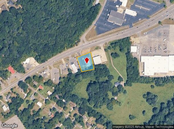
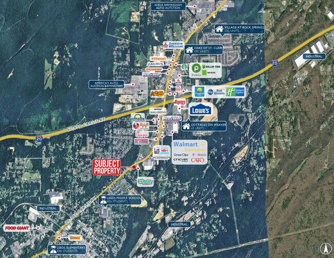
1455 Ashville Rd, Leeds, AL 35094
NEARBY LISTINGS FOR SALE OR LEASE
Property Detail
1455 Ashville Rd
26-05-15-0-001-030.000
Mcbriers Addition
Vacantlandnec
COM INT NE LN J P SEATON S/D W/SE R/W HWY 25 NE ALG R/W 510' TO POB CONT ALG R/W 160.9' SE 196.9' SW 132.7' NE 176.3' POB 15-
AE
St Clair
01115C0342H
Alabama
2024
0.56 AC
2024
St Clair County
040105
Birmingham
1,520 SF
Birmingham-Hoover, AL
DEMOGRAPHICS near 1455 Ashville Rd
1 Mile
3 Mile
5 Mile
2024 Total Population
3,229
15,560
27,891
2029 Population
3,288
15,913
28,554
Pop Growth 2024-2029
+ 1.83%
+ 2.27%
+ 2.38%
Average Age
40
40
40
2024 Total Households
1,328
6,379
10,984
HH Growth 2024-2029
+ 1.66%
+ 2.16%
+ 2.32%
Median Household Inc
$67,932
$57,399
$64,055
Avg Household Size
2.40
2.40
2.50
2024 Avg HH Vehicles
2.00
2.00
2.00
Median Home Value
$166,432
$161,943
$189,276
Median Year Built
1987
1989
1993
Nearby Places
Map Layers
Map Styles
 Street
 Aerial
- Restaurants
- Banks
- Shops
- Fitness
- Groceries
PUBLIC TRANSPORTATION
AIRPORT
Birmingham-Shuttlesworth International
DRIVE
WALK
Distance
Birmingham-Shuttlesworth International
22 min
16.9 mi
Freight Ports
Port of Mobile
DRIVE
WALK
Distance
Port of Mobile
293 min
268.1 mi
SALE & LEASE HISTORY
LISTING DATE
SALE/LEASE

Mar 04, 2024
For Sale
Nearby Properties
Address
Land Use
TOTAL SIZE
Lot Size
Zoning
Address
Land Use
TOTAL SIZE
Lot Size
Zoning
595,490 SF
42 AC
Address
Land Use
TOTAL SIZE
Lot Size
Zoning
6,600 SF
12.88 AC
Address
Land Use
TOTAL SIZE
Lot Size
Zoning
71,389 SF
8.20 AC
Address
Land Use
TOTAL SIZE
Lot Size
Zoning
15.90 AC
Address
Land Use
TOTAL SIZE
Lot Size
Zoning
123,425 SF
15.80 AC
Address
Land Use
TOTAL SIZE
Lot Size
Zoning
51,801 SF
7.45 AC
Address
Land Use
TOTAL SIZE
Lot Size
Zoning
57,399 SF
2.49 AC
Address
Land Use
TOTAL SIZE
Lot Size
Zoning
59,487 SF
9.20 AC
B2-R
Address
Land Use
TOTAL SIZE
Lot Size
Zoning
182,000 SF
12.10 AC
Address
Land Use
TOTAL SIZE
Lot Size
Zoning
46,031 SF
8.30 AC
Address
Land Use
TOTAL SIZE
Lot Size
Zoning
82,025 SF
Address
Land Use
TOTAL SIZE
Lot Size
Zoning
184,068 SF
62 AC
M2
Address
Land Use
TOTAL SIZE
Lot Size
Zoning
243,530 SF
29 AC
M2
Address
Land Use
TOTAL SIZE
Lot Size
Zoning
77,822 SF
6.12 AC
R-3
Address
Land Use
TOTAL SIZE
Lot Size
Zoning
139,086 SF
15 AC
M2
Address
Land Use
TOTAL SIZE
Lot Size
Zoning
18,128 SF
48 AC
Address
Land Use
TOTAL SIZE
Lot Size
Zoning
6,000 SF
8.30 AC
Address
Land Use
TOTAL SIZE
Lot Size
Zoning
29,580 SF
5.74 AC
Address
Land Use
TOTAL SIZE
Lot Size
Zoning
122,300 SF
5.70 AC
M2-I
Address
Land Use
TOTAL SIZE
Lot Size
Zoning
80,643 SF
4.22 AC
R3
Address
Land Use
TOTAL SIZE
Lot Size
Zoning
82,256 SF
6.60 AC
B-2
Address
Land Use
TOTAL SIZE
Lot Size
Zoning
113,550 SF
10 AC
M-2
Address
Land Use
TOTAL SIZE
Lot Size
Zoning
12,096 SF
4.34 AC
Address
Land Use
TOTAL SIZE
Lot Size
Zoning
141,610 SF
4.40 AC
M1-R
Address
Land Use
TOTAL SIZE
Lot Size
Zoning
45,900 SF
7.50 AC
Address
Land Use
TOTAL SIZE
Lot Size
Zoning
6.66 AC
The World's #1 Commercial Real Estate Marketplace
Connect with us
© 2025 CoStar Group
The information above has been obtained from sources believed reliable. While we do not doubt its accuracy we have not verified it and make no guarantee, warranty or representation about it. It is your responsibility to independently confirm its accuracy and completeness. Any projections, opinions, assumptions, or estimates used are for example only and do not represent the current or future performance of the property. The value of this transaction to you depends on tax and other factors which should be evaluated by your tax, financial, and legal advisors. You and your advisors should conduct a careful, independent investigation of the property to determine to your satisfaction the suitability of the property for your needs.