Property Record
1235 Fort Churchill Rd, Dayton, NV 89403
This Property Is For Sale
NEARBY LISTINGS FOR SALE OR LEASE
Property Detail
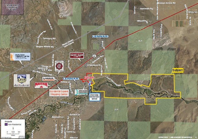
1235 Fort Churchill Rd
016-023-05
CHAVES RANCH
Agriculturalland
Lyon
AE
Nevada
32019C0312F
1,357.13 AC
2026
Lyon County
2025
Reno/Sparks
960304
Fernley, NV
1,270 SF
DEMOGRAPHICS near 1235 Fort Churchill Rd
1 Mile
3 Mile
5 Mile
2024 Total Population
1,144
8,323
14,217
2029 Population
1,284
9,212
15,604
Pop Growth 2024-2029
+ 12.24%
+ 10.68%
+ 9.76%
Average Age
45
44
45
2024 Total Households
417
3,150
5,526
HH Growth 2024-2029
+ 12.23%
+ 10.60%
+ 9.66%
Median Household Inc
$85,416
$80,743
$80,730
Avg Household Size
2.70
2.60
2.50
2024 Avg HH Vehicles
3.00
3.00
3.00
Median Home Value
$341,818
$348,059
$354,613
Median Year Built
2007
2003
2001
Nearby Places
- Restaurants
- Banks
- Shops
- Fitness
- Groceries
PUBLIC TRANSPORTATION
AIRPORT
Reno/Tahoe International
DRIVE
WALK
Distance
Reno/Tahoe International
84 min
36.5 mi
Freight Ports
Port of Stockton
DRIVE
WALK
Distance
Port of Stockton
257 min
172.6 mi
Nearby Properties
Address
Land Use
TOTAL SIZE
Lot Size
Zoning
Address
Land Use
TOTAL SIZE
Lot Size
Zoning
50,495 SF
10.76 AC
E1
Address
Land Use
TOTAL SIZE
Lot Size
Zoning
24.60 AC
MULT
Address
Land Use
TOTAL SIZE
Lot Size
Zoning
2,301 SF
4.98 AC
C2
Address
Land Use
TOTAL SIZE
Lot Size
Zoning
11,800 SF
3.42 AC
ME
Address
Land Use
TOTAL SIZE
Lot Size
Zoning
0.31 AC
SR-12000
Address
Land Use
TOTAL SIZE
Lot Size
Zoning
1,600 SF
1.95 AC
ME
Address
Land Use
TOTAL SIZE
Lot Size
Zoning
41.16 AC
RR2T
Address
Land Use
TOTAL SIZE
Lot Size
Zoning
5.56 AC
C2
Address
Land Use
TOTAL SIZE
Lot Size
Zoning
67.34 AC
MULT
Address
Land Use
TOTAL SIZE
Lot Size
Zoning
1,410 SF
612.85 AC
MULT
Address
Land Use
TOTAL SIZE
Lot Size
Zoning
3,000 SF
2.87 AC
ME
Address
Land Use
TOTAL SIZE
Lot Size
Zoning
228.08 AC
RR5
Address
Land Use
TOTAL SIZE
Lot Size
Zoning
2.82 AC
ME
Address
Land Use
TOTAL SIZE
Lot Size
Zoning
1.88 AC
C2
Address
Land Use
TOTAL SIZE
Lot Size
Zoning
2.62 AC
C-2
Address
Land Use
TOTAL SIZE
Lot Size
Zoning
1.51 AC
C2
Address
Land Use
TOTAL SIZE
Lot Size
Zoning
1.51 AC
C2
Address
Land Use
TOTAL SIZE
Lot Size
Zoning
10.10 AC
RR2T
Address
Land Use
TOTAL SIZE
Lot Size
Zoning
8.17 AC
MULT
Address
Land Use
TOTAL SIZE
Lot Size
Zoning
1.10 AC
E1
Address
Land Use
TOTAL SIZE
Lot Size
Zoning
2.87 AC
ME
Address
Land Use
TOTAL SIZE
Lot Size
Zoning
10 AC
RR2T
Address
Land Use
TOTAL SIZE
Lot Size
Zoning
0.28 AC
E1
Address
Land Use
TOTAL SIZE
Lot Size
Zoning
0.28 AC
E1
Address
Land Use
TOTAL SIZE
Lot Size
Zoning
0.28 AC
E1
The World's #1 Commercial Real Estate Marketplace
Connect with us
© 2025 CoStar Group
The information above has been obtained from sources believed reliable. While we do not doubt its accuracy we have not verified it and make no guarantee, warranty or representation about it. It is your responsibility to independently confirm its accuracy and completeness. Any projections, opinions, assumptions, or estimates used are for example only and do not represent the current or future performance of the property. The value of this transaction to you depends on tax and other factors which should be evaluated by your tax, financial, and legal advisors. You and your advisors should conduct a careful, independent investigation of the property to determine to your satisfaction the suitability of the property for your needs.