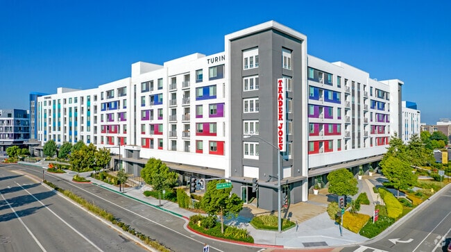
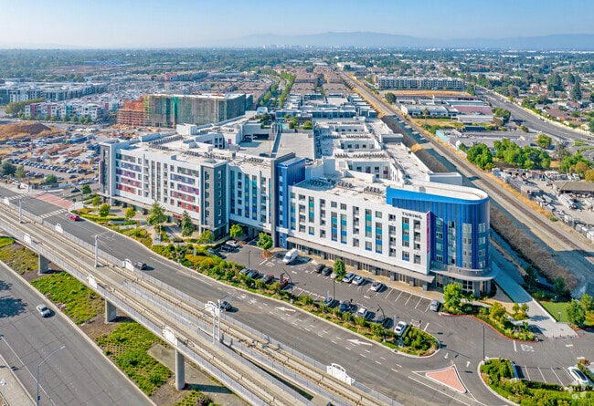
Property Record
1425 Mccandless Dr, Milpitas, CA 95035
Current Lease Availabilities
Property Detail
1425 Mccandless Dr
086-33-105
SANTA CLARA
Multifamilydwelling
California
MXD2
2.55 AC
AO River or stream flood hazard areas, and areas with a 1% or greater chance of shallow flooding each year. These areas have a 26% chance of flooding over the life of a 30-year mortgage.
Midtown Milpitas
2024
South Bay/San Jose
2025
San Jose-Sunnyvale-Santa Clara, CA
504505
NEARBY LISTINGS FOR SALE OR LEASE
DEMOGRAPHICS near 1425 Mccandless Dr
1 mile
3 mile
5 mile
2025 Total Population
26,301
173,699
346,754
2030 Population
27,690
177,762
354,175
Pop Growth 2025-2030
+ 5.28%
+ 2.34%
+ 2.14%
Average Age
35
39
39
2025 Total Households
9,280
57,628
114,442
HH Growth 2025-2030
+ 5.45%
+ 2.46%
+ 2.28%
Median Household Inc
$207,530
$187,540
$160,371
Avg Household Size
2.80
2.90
2.90
2025 Avg HH Vehicles
2.00
2.00
2.00
Median Home Value
$1,090,677
$1,091,190
$1,077,122
Median Year Built
2010
1991
1984
Nearby Places
Map Layers
Map Styles
 Street
 Aerial
Transit
 Traffic
 Biking
Places
Listings with unknown addresses are not visible on the map
- Restaurants
- Banks
- Shops
- Fitness
- Groceries
PUBLIC TRANSPORTATION
TRANSIT/SUBWAY
Great Mall Station (Mountain View - Alum Rock - VTA)
Drive
Walk
Distance
Great Mall Station (Mountain View - Alum Rock - VTA)
0 min
3 min
0.2 mi
Great Mall/Main Station (Alum Rock - Santa Teresa Line - Santa Clara VTA Light Rail)
Drive
Walk
Distance
Great Mall/Main Station (Alum Rock - Santa Teresa Line - Santa Clara VTA Light Rail)
1 min
4 min
0.2 mi
Montague Station (Alum Rock - Santa Teresa Line - VTA, Mountain View - Alum Rock - VTA)
Drive
Walk
Distance
Montague Station (Alum Rock - Santa Teresa Line - VTA, Mountain View - Alum Rock - VTA)
1 min
17 min
0.6 mi
Milpitas (Berryessa/North San Jose to Daly City - Bay Area Rapid Transit (BART), Berryessa/North San Jose to Richmond - Bay Area Rapid Transit (BART), Daly City to Berryessa/North San Jose - Bay Area Rapid Transit (BART), Richmond to Berryessa/North San Jose - Bay Area Rapid Transit (BART))
Drive
Walk
Distance
Milpitas (Berryessa/North San Jose to Daly City - Bay Area Rapid Transit (BART), Berryessa/North San Jose to Richmond - Bay Area Rapid Transit (BART), Daly City to Berryessa/North San Jose - Bay Area Rapid Transit (BART), Richmond to Berryessa/North San Jose - Bay Area Rapid Transit (BART))
2 min
16 min
0.7 mi
COMMUTER RAIL
Great America-Santa Clara (ACE Train - Capitol Corridor Joint Powers Authority, Capitol Corridor - Capitol Corridor Joint Powers Authority)
Drive
Walk
Distance
Great America-Santa Clara (ACE Train - Capitol Corridor Joint Powers Authority, Capitol Corridor - Capitol Corridor Joint Powers Authority)
10 min
4.5 mi
Santa Clara Caltrain Station Northbound (Limited - Caltrain (Caltrain), Local Weekday - Caltrain (Caltrain), Local Weekend - Caltrain (Caltrain))
Drive
Walk
Distance
Santa Clara Caltrain Station Northbound (Limited - Caltrain (Caltrain), Local Weekday - Caltrain (Caltrain), Local Weekend - Caltrain (Caltrain))
11 min
7.2 mi
AIRPORT
Norman Y Mineta San Jose International
Drive
Walk
Distance
Norman Y Mineta San Jose International
10 min
5.3 mi
Metro Oakland International
Drive
Walk
Distance
Metro Oakland International
39 min
31.0 mi
San Francisco International
Drive
Walk
Distance
San Francisco International
45 min
34.9 mi
Freight Ports
Port of Redwood City
Drive
Walk
Distance
Port of Redwood City
30 min
21.8 mi
Nearby Properties
Address
Land Use
TOTAL SIZE
Lot Size
Zoning
Address
Land Use
TOTAL SIZE
Lot Size
Zoning
7.49 AC
M2
Address
Land Use
TOTAL SIZE
Lot Size
Zoning
194,597 SF
20.10 AC
I
Address
Land Use
TOTAL SIZE
Lot Size
Zoning
636,145 SF
9.44 AC
IP
Address
Land Use
TOTAL SIZE
Lot Size
Zoning
74,528 SF
9.26 AC
TEC
Address
Land Use
TOTAL SIZE
Lot Size
Zoning
1,282,514 SF
99.02 AC
C2-S
Address
Land Use
TOTAL SIZE
Lot Size
Zoning
242,320 SF
8.01 AC
TEC
Address
Land Use
TOTAL SIZE
Lot Size
Zoning
281,574 SF
32.09 AC
IP
Address
Land Use
TOTAL SIZE
Lot Size
Zoning
423,160 SF
6.24 AC
A(PD)
Address
Land Use
TOTAL SIZE
Lot Size
Zoning
556,649 SF
8.09 AC
IP
Address
Land Use
TOTAL SIZE
Lot Size
Zoning
104,960 SF
10.19 AC
IP
Address
Land Use
TOTAL SIZE
Lot Size
Zoning
605,915 SF
5.36 AC
APD
Address
Land Use
TOTAL SIZE
Lot Size
Zoning
329,907 SF
3.94 AC
A(PD)
Address
Land Use
TOTAL SIZE
Lot Size
Zoning
227,939 SF
2.72 AC
IP
Address
Land Use
TOTAL SIZE
Lot Size
Zoning
227,939 SF
2.17 AC
IP
Address
Land Use
TOTAL SIZE
Lot Size
Zoning
12.40 AC
R3
Address
Land Use
TOTAL SIZE
Lot Size
Zoning
503,840 SF
5.02 AC
MXD2
Address
Land Use
TOTAL SIZE
Lot Size
Zoning
290,589 SF
15.09 AC
IP
Address
Land Use
TOTAL SIZE
Lot Size
Zoning
47,158 SF
23.94 AC
IP
Address
Land Use
TOTAL SIZE
Lot Size
Zoning
350,507 SF
6.17 AC
APD
Address
Land Use
TOTAL SIZE
Lot Size
Zoning
328,189 SF
4.01 AC
R3
Address
Land Use
TOTAL SIZE
Lot Size
Zoning
3.72 AC
M2S
Address
Land Use
TOTAL SIZE
Lot Size
Zoning
5.21 AC
APD
Address
Land Use
TOTAL SIZE
Lot Size
Zoning
1,659,060 SF
6.42 AC
APD
Address
Land Use
TOTAL SIZE
Lot Size
Zoning
350,267 SF
3.44 AC
A(PD)
Address
Land Use
TOTAL SIZE
Lot Size
Zoning
310,021 SF
5.45 AC
APD
Address
Land Use
TOTAL SIZE
Lot Size
Zoning
7.61 AC
A(PD)
Address
Land Use
TOTAL SIZE
Lot Size
Zoning
505,150 SF
35.68 AC
CIC
Address
Land Use
TOTAL SIZE
Lot Size
Zoning
324,610 SF
3.27 AC
APD
Address
Land Use
TOTAL SIZE
Lot Size
Zoning
257,196 SF
3.50 AC
A(PD)
Address
Land Use
TOTAL SIZE
Lot Size
Zoning
642,249 SF
6.89 AC
A(PD)
The World's #1 Commercial Real Estate Marketplace
Connect with us
© 2026 CoStar Group
The information above has been obtained from sources believed reliable. While we do not doubt its accuracy we have not verified it and make no guarantee, warranty or representation about it. It is your responsibility to independently confirm its accuracy and completeness. Any projections, opinions, assumptions, or estimates used are for example only and do not represent the current or future performance of the property. The value of this transaction to you depends on tax and other factors which should be evaluated by your tax, financial, and legal advisors. You and your advisors should conduct a careful, independent investigation of the property to determine to your satisfaction the suitability of the property for your needs.