Property Record
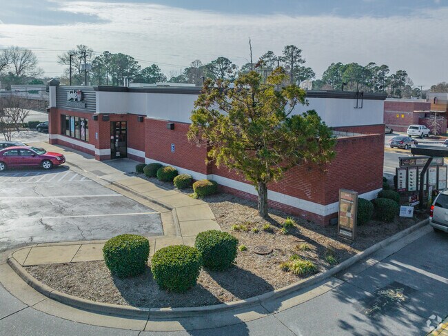
1456 Mount Pleasant Rd, Chesapeake, VA 23322


Property Detail
1456 Mount Pleasant Rd
0490000001660
LT C SUBD MT PLEASANT CROSSING PAR A SEAWALL .850
Restaurantdrivein
Chesapeake City
B2: GENERA
Virginia
B and X Area of moderate flood hazard, usually the area between the limits of the 100-year and 500-year floods.
0.85 AC
2024
Great Bridge
2025
Hampton Roads
021101
Virginia Beach-Chesapeake-Norfolk, VA-NC
2,843 SF
NEARBY LISTINGS FOR SALE OR LEASE
DEMOGRAPHICS near 1456 Mount Pleasant Rd
1 mile
3 mile
5 mile
2025 Total Population
4,981
32,987
114,106
2030 Population
5,047
33,485
114,734
Pop Growth 2025-2030
+ 1.33%
+ 1.51%
+ 0.55%
Average Age
40
41
40
2025 Total Households
1,614
11,418
41,416
HH Growth 2025-2030
+ 1.43%
+ 1.59%
+ 0.66%
Median Household Inc
$133,035
$131,086
$112,298
Avg Household Size
3.10
2.80
2.70
2025 Avg HH Vehicles
3.00
2.00
2.00
Median Home Value
$460,918
$462,281
$423,766
Median Year Built
1989
1993
1992
Nearby Places
Map Layers
Map Styles
 Street
 Aerial
Layers
 Traffic
 Biking
Places
Listings with unknown addresses are not visible on the map
- Restaurants
- Banks
- Shops
- Fitness
- Groceries
PUBLIC TRANSPORTATION
AIRPORT
Norfolk International
Drive
Walk
Distance
Norfolk International
30 min
19.0 mi
Freight Ports
Virginia Port Authority - Portsmouth
Drive
Walk
Distance
Virginia Port Authority - Portsmouth
29 min
18.0 mi
Nearby Properties
Address
Land Use
TOTAL SIZE
Lot Size
Zoning
Address
Land Use
TOTAL SIZE
Lot Size
Zoning
140,369 SF
10.35 AC
PUD: PLANN
Address
Land Use
TOTAL SIZE
Lot Size
Zoning
188,683 SF
13.14 AC
O-I: OFFIC
Address
Land Use
TOTAL SIZE
Lot Size
Zoning
422.43 AC
PUD: PLANN
Address
Land Use
TOTAL SIZE
Lot Size
Zoning
196,905 SF
46.84 AC
R15S: RESI
Address
Land Use
TOTAL SIZE
Lot Size
Zoning
99,662 SF
15.68 AC
B2: GENERA
Address
Land Use
TOTAL SIZE
Lot Size
Zoning
50,416 SF
13.30 AC
RMF1: MULT
Address
Land Use
TOTAL SIZE
Lot Size
Zoning
27,696 SF
15.80 AC
B1: NEIGHB
Address
Land Use
TOTAL SIZE
Lot Size
Zoning
129,138 SF
8.86 AC
RMF1: MULT
Address
Land Use
TOTAL SIZE
Lot Size
Zoning
59,892 SF
6.71 AC
PUD: PLANN
Address
Land Use
TOTAL SIZE
Lot Size
Zoning
269.85 AC
MULTI: MUL
Address
Land Use
TOTAL SIZE
Lot Size
Zoning
22,680 SF
7.97 AC
PUD: PLANN
Address
Land Use
TOTAL SIZE
Lot Size
Zoning
35,962 SF
15.91 AC
B2: GENERA
Address
Land Use
TOTAL SIZE
Lot Size
Zoning
88,567 SF
15 AC
R15S: RESI
Address
Land Use
TOTAL SIZE
Lot Size
Zoning
66,978 SF
14.61 AC
RMF1: MULT
Address
Land Use
TOTAL SIZE
Lot Size
Zoning
95,106 SF
5.12 AC
R15S: RESI
Address
Land Use
TOTAL SIZE
Lot Size
Zoning
40,337 SF
23.62 AC
AC: ASSEMB
Address
Land Use
TOTAL SIZE
Lot Size
Zoning
9,216 SF
3.30 AC
B2: GENERA
Address
Land Use
TOTAL SIZE
Lot Size
Zoning
82,215 SF
1.47 AC
B4: SHOPPI
Address
Land Use
TOTAL SIZE
Lot Size
Zoning
48,121 SF
8.66 AC
B1: NEIGHB
Address
Land Use
TOTAL SIZE
Lot Size
Zoning
35,550 SF
3.66 AC
B2: GENERA
Address
Land Use
TOTAL SIZE
Lot Size
Zoning
24,004 SF
13.56 AC
R15S: RESI
Address
Land Use
TOTAL SIZE
Lot Size
Zoning
43,523 SF
6.03 AC
B1: NEIGHB
Address
Land Use
TOTAL SIZE
Lot Size
Zoning
13,915 SF
5.46 AC
O-I: OFFIC
Address
Land Use
TOTAL SIZE
Lot Size
Zoning
41,362 SF
4.50 AC
B2: GENERA
Address
Land Use
TOTAL SIZE
Lot Size
Zoning
1,508 SF
5.35 AC
RMF1: MULT
Address
Land Use
TOTAL SIZE
Lot Size
Zoning
15,906 SF
7.94 AC
O-I: OFFIC
Address
Land Use
TOTAL SIZE
Lot Size
Zoning
44,181 SF
5.31 AC
R15: RESID
Address
Land Use
TOTAL SIZE
Lot Size
Zoning
64,829 SF
16.33 AC
R15S: RESI
Address
Land Use
TOTAL SIZE
Lot Size
Zoning
23,825 SF
6.58 AC
PUD: PLANN
Address
Land Use
TOTAL SIZE
Lot Size
Zoning
98.44 AC
R10S: RESI
The World's #1 Commercial Real Estate Marketplace
Connect with us
© 2026 CoStar Group
The information above has been obtained from sources believed reliable. While we do not doubt its accuracy we have not verified it and make no guarantee, warranty or representation about it. It is your responsibility to independently confirm its accuracy and completeness. Any projections, opinions, assumptions, or estimates used are for example only and do not represent the current or future performance of the property. The value of this transaction to you depends on tax and other factors which should be evaluated by your tax, financial, and legal advisors. You and your advisors should conduct a careful, independent investigation of the property to determine to your satisfaction the suitability of the property for your needs.