Property Record
1458 Jag Branch Blvd, Kernersville, NC 27284
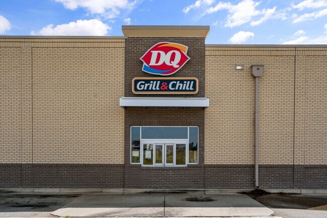
This Property Is For Sale
NEARBY LISTINGS FOR SALE OR LEASE
Property Detail
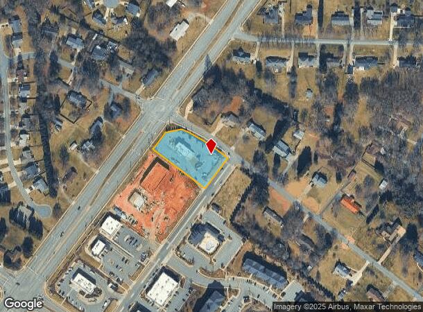
1458 Jag Branch Blvd
Winston-Salem, NC
Smith Crossing
6875-30-4172
SMITH CROSSING LO:176 TR:6 BL:5632
Commercialnec
Forsyth
X
North Carolina
3710687500J
176
2024
1.10 AC
2025
Kernersville
003312
Greensboro/Winston-Salem
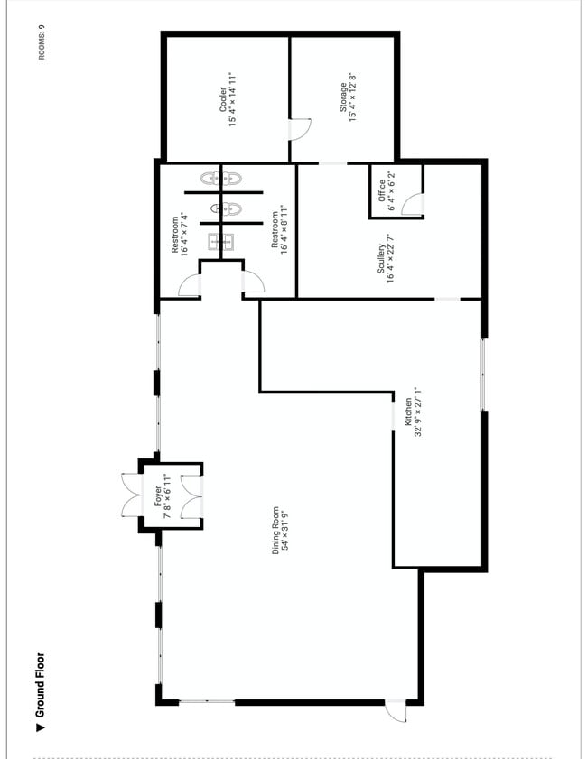
464 SF
DEMOGRAPHICS near 1458 Jag Branch Blvd
1 Mile
3 Mile
5 Mile
2024 Total Population
4,896
32,804
66,497
2029 Population
5,089
34,250
69,350
Pop Growth 2024-2029
+ 3.94%
+ 4.41%
+ 4.29%
Average Age
41
41
41
2024 Total Households
1,933
13,731
27,436
HH Growth 2024-2029
+ 3.93%
+ 4.41%
+ 4.29%
Median Household Inc
$95,118
$72,826
$67,720
Avg Household Size
2.50
2.40
2.40
2024 Avg HH Vehicles
2.00
2.00
2.00
Median Home Value
$216,938
$216,058
$218,537
Median Year Built
1994
1991
1989
Nearby Places
Map Layers
Map Styles
 Street
 Aerial
- Restaurants
- Banks
- Shops
- Fitness
- Groceries
PUBLIC TRANSPORTATION
AIRPORT
Piedmont Triad International
DRIVE
WALK
Distance
Piedmont Triad International
23 min
13.3 mi
Nearby Properties
Address
Land Use
TOTAL SIZE
Lot Size
Zoning
Address
Land Use
TOTAL SIZE
Lot Size
Zoning
903,034 SF
99.60 AC
GI-S
Address
Land Use
TOTAL SIZE
Lot Size
Zoning
735,329 SF
99.41 AC
LI-S
Address
Land Use
TOTAL SIZE
Lot Size
Zoning
122,848 SF
22.70 AC
RM18-S
Address
Land Use
TOTAL SIZE
Lot Size
Zoning
505,696 SF
34.94 AC
LI-S
Address
Land Use
TOTAL SIZE
Lot Size
Zoning
288,490 SF
13.46 AC
GB-S,RM18-
Address
Land Use
TOTAL SIZE
Lot Size
Zoning
96,078 SF
16.81 AC
MU-S
Address
Land Use
TOTAL SIZE
Lot Size
Zoning
79,154 SF
9.36 AC
TND-S
Address
Land Use
TOTAL SIZE
Lot Size
Zoning
93,691 SF
15.40 AC
MU-S
Address
Land Use
TOTAL SIZE
Lot Size
Zoning
70,113 SF
19.06 AC
RM18-S
Address
Land Use
TOTAL SIZE
Lot Size
Zoning
129,895 SF
30.33 AC
RM18
Address
Land Use
TOTAL SIZE
Lot Size
Zoning
202,539 SF
23.70 AC
HB-S
Address
Land Use
TOTAL SIZE
Lot Size
Zoning
109,457 SF
39.03 AC
AG
Address
Land Use
TOTAL SIZE
Lot Size
Zoning
87,741 SF
15.44 AC
RM18
Address
Land Use
TOTAL SIZE
Lot Size
Zoning
39,959 SF
11.29 AC
GB-S
Address
Land Use
TOTAL SIZE
Lot Size
Zoning
200,340 SF
21.50 AC
LI-S
Address
Land Use
TOTAL SIZE
Lot Size
Zoning
451.32 AC
MU-C
Address
Land Use
TOTAL SIZE
Lot Size
Zoning
258,154 SF
39.55 AC
GI
Address
Land Use
TOTAL SIZE
Lot Size
Zoning
277,250 SF
30.15 AC
GI
Address
Land Use
TOTAL SIZE
Lot Size
Zoning
136,068 SF
19.46 AC
HB-S
Address
Land Use
TOTAL SIZE
Lot Size
Zoning
121,981 SF
14.48 AC
HB-S
Address
Land Use
TOTAL SIZE
Lot Size
Zoning
109,169 SF
40.18 AC
RS30
Address
Land Use
TOTAL SIZE
Lot Size
Zoning
140,000 SF
11.17 AC
LI-S
Address
Land Use
TOTAL SIZE
Lot Size
Zoning
83,774 SF
7.51 AC
GB-S
Address
Land Use
TOTAL SIZE
Lot Size
Zoning
43,709 SF
9.47 AC
MU-S
Address
Land Use
TOTAL SIZE
Lot Size
Zoning
144,300 SF
21.12 AC
LI-S
Address
Land Use
TOTAL SIZE
Lot Size
Zoning
122,682 SF
9.07 AC
HB-S
Address
Land Use
TOTAL SIZE
Lot Size
Zoning
96,091 SF
11.77 AC
MU-S
Address
Land Use
TOTAL SIZE
Lot Size
Zoning
102,809 SF
16.74 AC
BI
Address
Land Use
TOTAL SIZE
Lot Size
Zoning
203,069 SF
71.34 AC
GI
Address
Land Use
TOTAL SIZE
Lot Size
Zoning
52,480 SF
30.51 AC
BI
The World's #1 Commercial Real Estate Marketplace
Connect with us
© 2025 CoStar Group
The information above has been obtained from sources believed reliable. While we do not doubt its accuracy we have not verified it and make no guarantee, warranty or representation about it. It is your responsibility to independently confirm its accuracy and completeness. Any projections, opinions, assumptions, or estimates used are for example only and do not represent the current or future performance of the property. The value of this transaction to you depends on tax and other factors which should be evaluated by your tax, financial, and legal advisors. You and your advisors should conduct a careful, independent investigation of the property to determine to your satisfaction the suitability of the property for your needs.