Property Record
146 W 60Th St, Minneapolis, MN 55419

Current Lease Availabilities
NEARBY LISTINGS FOR SALE OR LEASE
Property Detail
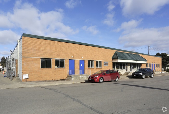
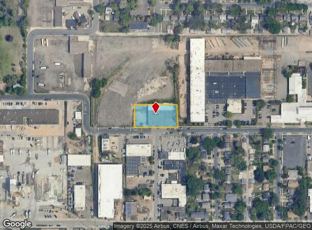
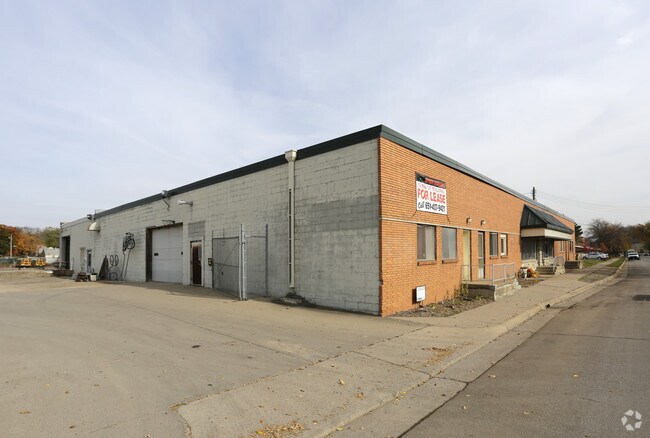
146 W 60Th St
Minneapolis-St. Paul-Bloomington, MN-WI
Auditors Subd. No. 149
22-028-24-34-0007
LOT 204 B AUDITORS SUBD. NO. 149 THAT PART OF LOT 204 LYING E OF A LINE DRAWN S FROM A PT IN N LINE OF LOT 203 SAID AUD SUBD DIS 428.6 FT E FROM MOST WLY LINE OF LOT 206 THOF T 236.00 X 125.00
Industrialgeneral
Hennepin
X
Minnesota
27053C0368F
204
2024
0.67 AC
2024
Minneapolis
012003
Minneapolis/St Paul
17,850 SF
DEMOGRAPHICS near 146 W 60Th St
1 Mile
3 Mile
5 Mile
2024 Total Population
17,388
143,209
364,061
2029 Population
17,046
140,771
358,263
Pop Growth 2024-2029
(1.97%)
(1.70%)
(1.59%)
Average Age
41
40
39
2024 Total Households
7,566
59,984
160,222
HH Growth 2024-2029
(2.09%)
(1.75%)
(1.62%)
Median Household Inc
$90,866
$94,783
$80,894
Avg Household Size
2.20
2.30
2.20
2024 Avg HH Vehicles
2.00
2.00
2.00
Median Home Value
$341,419
$356,851
$352,050
Median Year Built
1955
1953
1955
Nearby Places
- Restaurants
- Banks
- Shops
- Fitness
- Groceries
PUBLIC TRANSPORTATION
COMMUTER RAIL
Target Field Station (Northstar Corridor - Northstar Commuter Rail)
DRIVE
WALK
Distance
Target Field Station (Northstar Corridor - Northstar Commuter Rail)
14 min
7.1 mi
AIRPORT
Minneapolis-St Paul International/Wold-Chamberlain
DRIVE
WALK
Distance
Minneapolis-St Paul International/Wold-Chamberlain
13 min
6.7 mi
Freight Ports
Port Milwaukee
DRIVE
WALK
Distance
Port Milwaukee
380 min
341.1 mi
Nearby Properties
Address
Land Use
TOTAL SIZE
Lot Size
Zoning
Address
Land Use
TOTAL SIZE
Lot Size
Zoning
364,730 SF
13.40 AC
PCD3
Address
Land Use
TOTAL SIZE
Lot Size
Zoning
21.50 AC
Address
Land Use
TOTAL SIZE
Lot Size
Zoning
12,308 SF
1.25 AC
PCD3
Address
Land Use
TOTAL SIZE
Lot Size
Zoning
45.77 AC
Address
Land Use
TOTAL SIZE
Lot Size
Zoning
79,717 SF
4.62 AC
Address
Land Use
TOTAL SIZE
Lot Size
Zoning
35.28 AC
Address
Land Use
TOTAL SIZE
Lot Size
Zoning
1.50 AC
Address
Land Use
TOTAL SIZE
Lot Size
Zoning
3.51 AC
Address
Land Use
TOTAL SIZE
Lot Size
Zoning
50,484 SF
5.12 AC
Address
Land Use
TOTAL SIZE
Lot Size
Zoning
435,796 SF
36.44 AC
Address
Land Use
TOTAL SIZE
Lot Size
Zoning
31,646 SF
5.85 AC
Address
Land Use
TOTAL SIZE
Lot Size
Zoning
7,614 SF
2.01 AC
PCD3
Address
Land Use
TOTAL SIZE
Lot Size
Zoning
98,676 SF
8.77 AC
Address
Land Use
TOTAL SIZE
Lot Size
Zoning
94,827 SF
5.86 AC
RMD
Address
Land Use
TOTAL SIZE
Lot Size
Zoning
8.80 AC
Address
Land Use
TOTAL SIZE
Lot Size
Zoning
Address
Land Use
TOTAL SIZE
Lot Size
Zoning
21.69 AC
Address
Land Use
TOTAL SIZE
Lot Size
Zoning
2.23 AC
Address
Land Use
TOTAL SIZE
Lot Size
Zoning
6.87 AC
Address
Land Use
TOTAL SIZE
Lot Size
Zoning
32,748 SF
2.24 AC
Address
Land Use
TOTAL SIZE
Lot Size
Zoning
47,847 SF
2.36 AC
Address
Land Use
TOTAL SIZE
Lot Size
Zoning
19,441 SF
1.37 AC
Address
Land Use
TOTAL SIZE
Lot Size
Zoning
66,845 SF
6.44 AC
MDD6
Address
Land Use
TOTAL SIZE
Lot Size
Zoning
69,556 SF
6.50 AC
MDD6
Address
Land Use
TOTAL SIZE
Lot Size
Zoning
52,316 SF
4.81 AC
MDD6
Address
Land Use
TOTAL SIZE
Lot Size
Zoning
21,740 SF
3.60 AC
Address
Land Use
TOTAL SIZE
Lot Size
Zoning
2.01 AC
Address
Land Use
TOTAL SIZE
Lot Size
Zoning
283,912 SF
2.17 AC
R6
Address
Land Use
TOTAL SIZE
Lot Size
Zoning
20,548 SF
4.08 AC
Address
Land Use
TOTAL SIZE
Lot Size
Zoning
56,497 SF
6.18 AC
The World's #1 Commercial Real Estate Marketplace
Connect with us
© 2025 CoStar Group
The information above has been obtained from sources believed reliable. While we do not doubt its accuracy we have not verified it and make no guarantee, warranty or representation about it. It is your responsibility to independently confirm its accuracy and completeness. Any projections, opinions, assumptions, or estimates used are for example only and do not represent the current or future performance of the property. The value of this transaction to you depends on tax and other factors which should be evaluated by your tax, financial, and legal advisors. You and your advisors should conduct a careful, independent investigation of the property to determine to your satisfaction the suitability of the property for your needs.