Property Record
146 High St, Ipswich, MA 01938

Save to a Folder
{{folder.Name}}
{{folder.ListingIds.length}} Properties
{{folder.ListingIds.length}} Property
Create a New Folder
Property Detail
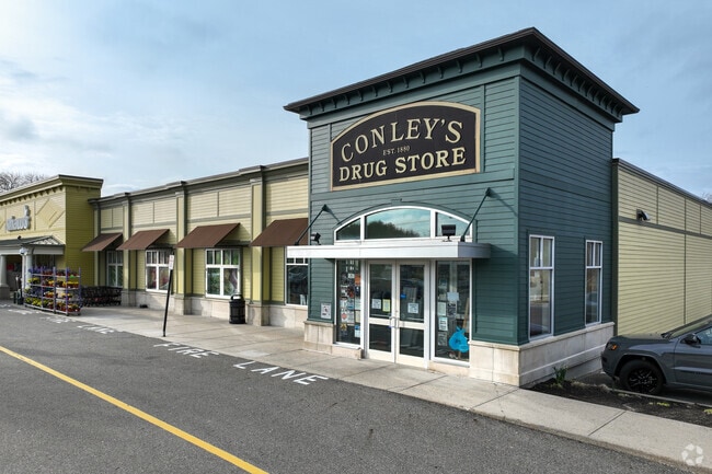
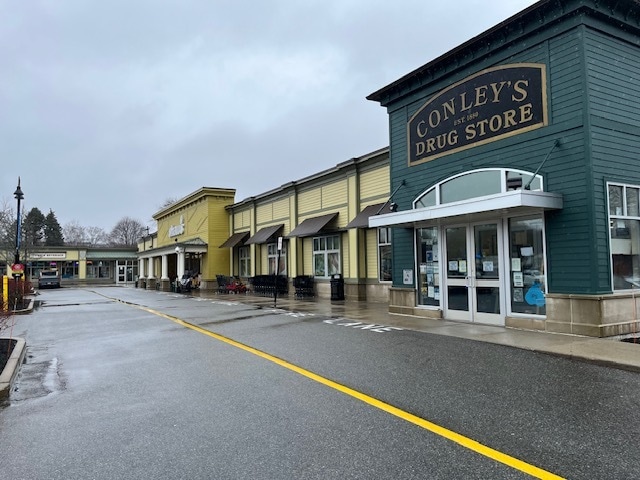
146 High St
Regionalshoppingcenterormallwithanchorstore
Essex
HB
Massachusetts
A Areas with a 1% annual chance of flooding and a 26% chance of flooding over the life of a 30-year mortgage.
6.30 AC
2025
Amesbury/Ipswich
2025
Boston
223300
Boston-Cambridge-Newton, MA-NH
32,166 SF
IPSW-000030A-000003
NEARBY LISTINGS FOR SALE OR LEASE
DEMOGRAPHICS near 146 High St
1 mile
3 mile
5 mile
2025 Total Population
4,498
15,586
27,206
2030 Population
4,639
16,130
28,227
Pop Growth 2025-2030
+ 3.13%
+ 3.49%
+ 3.75%
Average Age
44
46
45
2025 Total Households
1,867
6,604
10,899
HH Growth 2025-2030
+ 3.00%
+ 3.45%
+ 3.72%
Median Household Inc
$115,940
$118,655
$129,184
Avg Household Size
2.40
2.30
2.50
2025 Avg HH Vehicles
2.00
2.00
2.00
Median Home Value
$748,551
$758,883
$769,309
Median Year Built
1965
1971
1971
Nearby Places
Map Layers
Map Styles
 Street
 Aerial
Layers
 Traffic
 Biking
Places
Listings with unknown addresses are not visible on the map
- Restaurants
- Banks
- Shops
- Fitness
- Groceries
PUBLIC TRANSPORTATION
COMMUTER RAIL
Ipswich (Newburyport/Rockport Line - Massachusetts Bay Transportation Authority Commuter Rail (Purple Line))
Drive
Walk
Distance
Ipswich (Newburyport/Rockport Line - Massachusetts Bay Transportation Authority Commuter Rail (Purple Line))
5 min
1.7 mi
Rowley (Newburyport/Rockport Line - Massachusetts Bay Transportation Authority Commuter Rail (Purple Line))
Drive
Walk
Distance
Rowley (Newburyport/Rockport Line - Massachusetts Bay Transportation Authority Commuter Rail (Purple Line))
9 min
4.1 mi
AIRPORT
General Edward Lawrence Logan International
Drive
Walk
Distance
General Edward Lawrence Logan International
50 min
29.9 mi
Portsmouth International at Pease
Drive
Walk
Distance
Portsmouth International at Pease
48 min
32.9 mi
Manchester Boston Regional
Drive
Walk
Distance
Manchester Boston Regional
77 min
46.4 mi
Freight Ports
Port of Boston
Drive
Walk
Distance
Port of Boston
53 min
32.9 mi
SALE & LEASE HISTORY
LISTING DATE
SALE/LEASE

Oct 09, 2020
For Lease
May 09, 2024
For Lease
Jun 23, 2020
For Lease
Nearby Properties
Address
Land Use
TOTAL SIZE
Lot Size
Zoning
Address
Land Use
TOTAL SIZE
Lot Size
Zoning
126.58 AC
RRA
Address
Land Use
TOTAL SIZE
Lot Size
Zoning
171.85 AC
RRA
Address
Land Use
TOTAL SIZE
Lot Size
Zoning
1,520 AC
RRA
Address
Land Use
TOTAL SIZE
Lot Size
Zoning
22.90 AC
HB
Address
Land Use
TOTAL SIZE
Lot Size
Zoning
106,342 SF
22.38 AC
Address
Land Use
TOTAL SIZE
Lot Size
Zoning
284.17 AC
RRA
Address
Land Use
TOTAL SIZE
Lot Size
Zoning
49,530 SF
12.18 AC
RRA
Address
Land Use
TOTAL SIZE
Lot Size
Zoning
96,136 SF
13.40 AC
IR
Address
Land Use
TOTAL SIZE
Lot Size
Zoning
475 AC
RRA
Address
Land Use
TOTAL SIZE
Lot Size
Zoning
4 AC
CB
Address
Land Use
TOTAL SIZE
Lot Size
Zoning
36,838 SF
13.93 AC
HB
Address
Land Use
TOTAL SIZE
Lot Size
Zoning
4.41 AC
RRA
Address
Land Use
TOTAL SIZE
Lot Size
Zoning
1,863 SF
9.67 AC
RRA
Address
Land Use
TOTAL SIZE
Lot Size
Zoning
52,392 SF
9.98 AC
1R
Address
Land Use
TOTAL SIZE
Lot Size
Zoning
90,855 SF
16.19 AC
Address
Land Use
TOTAL SIZE
Lot Size
Zoning
3.70 AC
HB
Address
Land Use
TOTAL SIZE
Lot Size
Zoning
6.80 AC
1R
Address
Land Use
TOTAL SIZE
Lot Size
Zoning
264 SF
232.27 AC
PC
Address
Land Use
TOTAL SIZE
Lot Size
Zoning
42,090 SF
1.94 AC
1R
Address
Land Use
TOTAL SIZE
Lot Size
Zoning
42,090 SF
1.90 AC
1R
Address
Land Use
TOTAL SIZE
Lot Size
Zoning
46,186 SF
9.08 AC
RRA
Address
Land Use
TOTAL SIZE
Lot Size
Zoning
5.40 AC
RRA
Address
Land Use
TOTAL SIZE
Lot Size
Zoning
56,998 SF
17.23 AC
RRA
Address
Land Use
TOTAL SIZE
Lot Size
Zoning
34,944 SF
18.44 AC
HB
Address
Land Use
TOTAL SIZE
Lot Size
Zoning
2,286 SF
3.82 AC
Address
Land Use
TOTAL SIZE
Lot Size
Zoning
194.58 AC
RRC
Address
Land Use
TOTAL SIZE
Lot Size
Zoning
1,500 SF
7.55 AC
RRA
Address
Land Use
TOTAL SIZE
Lot Size
Zoning
16,374 SF
10.20 AC
HB
Address
Land Use
TOTAL SIZE
Lot Size
Zoning
3.21 AC
HB
Address
Land Use
TOTAL SIZE
Lot Size
Zoning
0.96 AC
CB
The World's #1 Commercial Real Estate Marketplace
Connect with us
© 2026 CoStar Group
The information above has been obtained from sources believed reliable. While we do not doubt its accuracy we have not verified it and make no guarantee, warranty or representation about it. It is your responsibility to independently confirm its accuracy and completeness. Any projections, opinions, assumptions, or estimates used are for example only and do not represent the current or future performance of the property. The value of this transaction to you depends on tax and other factors which should be evaluated by your tax, financial, and legal advisors. You and your advisors should conduct a careful, independent investigation of the property to determine to your satisfaction the suitability of the property for your needs.