Property Record
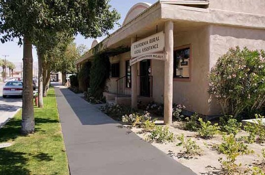
1460 6Th St, Coachella, CA 92236


Property Detail
1460 6Th St
778-092-002
LOT 8 BLK 14 MB 004/052 COACHELLA
Officebuilding
Riverside
CG
California
B and X Area of moderate flood hazard, usually the area between the limits of the 100-year and 500-year floods.
8
2024
0.14 AC
2025
Coachella Valley
045707
Inland Empire (California)
2,635 SF
Riverside-San Bernardino-Ontario, CA
NEARBY LISTINGS FOR SALE OR LEASE
-
-
View all Coachella listings for sale on LoopNet.com
DEMOGRAPHICS near 1460 6Th St
1 mile
3 mile
5 mile
2024 Total Population
21,949
55,315
117,556
2029 Population
22,412
56,814
122,096
Pop Growth 2024-2029
+ 2.11%
+ 2.71%
+ 3.86%
Average Age
33
35
37
2024 Total Households
5,223
13,972
33,889
HH Growth 2024-2029
+ 1.84%
+ 2.91%
+ 4.41%
Median Household Inc
$58,753
$69,603
$72,934
Avg Household Size
4.10
3.80
3.30
2024 Avg HH Vehicles
2.00
2.00
2.00
Median Home Value
$340,479
$406,556
$452,261
Median Year Built
1986
1997
1994
Nearby Places
Map Layers
Map Styles
 Street
 Aerial
Transit
 Traffic
 Biking
Places
Listings with unknown addresses are not visible on the map
- Restaurants
- Banks
- Shops
- Fitness
- Groceries
PUBLIC TRANSPORTATION
AIRPORT
Palm Springs International
Drive
Walk
Distance
Palm Springs International
35 min
26.2 mi
Nearby Properties
Address
Land Use
TOTAL SIZE
Lot Size
Zoning
Address
Land Use
TOTAL SIZE
Lot Size
Zoning
52,901 SF
6 AC
Address
Land Use
TOTAL SIZE
Lot Size
Zoning
133,694 SF
5.83 AC
Address
Land Use
TOTAL SIZE
Lot Size
Zoning
177,392 SF
25.40 AC
MH
Address
Land Use
TOTAL SIZE
Lot Size
Zoning
41,091 SF
4.65 AC
Address
Land Use
TOTAL SIZE
Lot Size
Zoning
105,122 SF
2.23 AC
Address
Land Use
TOTAL SIZE
Lot Size
Zoning
275,931 SF
37.69 AC
Address
Land Use
TOTAL SIZE
Lot Size
Zoning
100,110 SF
4.03 AC
Address
Land Use
TOTAL SIZE
Lot Size
Zoning
86,479 SF
6.46 AC
Address
Land Use
TOTAL SIZE
Lot Size
Zoning
44,511 SF
9.40 AC
CM
Address
Land Use
TOTAL SIZE
Lot Size
Zoning
34,312 SF
3.15 AC
Address
Land Use
TOTAL SIZE
Lot Size
Zoning
40,380 SF
17.55 AC
Address
Land Use
TOTAL SIZE
Lot Size
Zoning
30,000 SF
2.98 AC
Address
Land Use
TOTAL SIZE
Lot Size
Zoning
53,705 SF
5.10 AC
A1
Address
Land Use
TOTAL SIZE
Lot Size
Zoning
31,708 SF
5.07 AC
R3
Address
Land Use
TOTAL SIZE
Lot Size
Zoning
37,282 SF
9.92 AC
CG
Address
Land Use
TOTAL SIZE
Lot Size
Zoning
58,586 SF
6.03 AC
Address
Land Use
TOTAL SIZE
Lot Size
Zoning
13,888 SF
4.36 AC
R3
Address
Land Use
TOTAL SIZE
Lot Size
Zoning
74,437 SF
8.80 AC
R1
Address
Land Use
TOTAL SIZE
Lot Size
Zoning
42,247 SF
8.40 AC
Address
Land Use
TOTAL SIZE
Lot Size
Zoning
76.89 AC
A120
Address
Land Use
TOTAL SIZE
Lot Size
Zoning
140,069 SF
8.37 AC
M
Address
Land Use
TOTAL SIZE
Lot Size
Zoning
1,589 SF
65.71 AC
A110
Address
Land Use
TOTAL SIZE
Lot Size
Zoning
19,059 SF
8.15 AC
Address
Land Use
TOTAL SIZE
Lot Size
Zoning
34,458 SF
4.27 AC
R3
Address
Land Use
TOTAL SIZE
Lot Size
Zoning
21,170 SF
7.27 AC
RM
Address
Land Use
TOTAL SIZE
Lot Size
Zoning
76,880 SF
8.30 AC
Address
Land Use
TOTAL SIZE
Lot Size
Zoning
25,370 SF
6.61 AC
A1050
Address
Land Use
TOTAL SIZE
Lot Size
Zoning
Address
Land Use
TOTAL SIZE
Lot Size
Zoning
42,249 SF
4.97 AC
Address
Land Use
TOTAL SIZE
Lot Size
Zoning
14,820 SF
1.55 AC
CG
The World's #1 Commercial Real Estate Marketplace
Connect with us
© 2026 CoStar Group
The information above has been obtained from sources believed reliable. While we do not doubt its accuracy we have not verified it and make no guarantee, warranty or representation about it. It is your responsibility to independently confirm its accuracy and completeness. Any projections, opinions, assumptions, or estimates used are for example only and do not represent the current or future performance of the property. The value of this transaction to you depends on tax and other factors which should be evaluated by your tax, financial, and legal advisors. You and your advisors should conduct a careful, independent investigation of the property to determine to your satisfaction the suitability of the property for your needs.