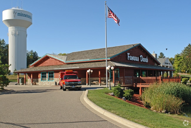
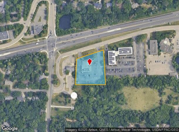
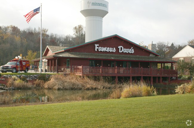
Property Record
14601 Highway 7, Minnetonka, MN 55345
NEARBY LISTINGS FOR SALE OR LEASE
Property Detail
14601 Highway 7
Minneapolis-St. Paul-Bloomington, MN-WI
Tower Hill
21-117-22-44-0029
LOT 002 BLOCK 001 B TOWER HILL LOT 2 BLK 1 TOWER HILL ALSO THE W 45 FT OF LOT 3 SAID BLK 1 N265X320X285X246
Commercialnec
Hennepin
X
Minnesota
27053C0337F
2
2024
1.78 AC
2024
Ridgedale
026206
Minneapolis/St Paul
5,598 SF
DEMOGRAPHICS near 14601 Highway 7
1 Mile
3 Mile
5 Mile
2024 Total Population
5,952
55,506
151,378
2029 Population
5,802
54,643
149,740
Pop Growth 2024-2029
(2.52%)
(1.55%)
(1.08%)
Average Age
45
43
42
2024 Total Households
2,390
23,471
64,857
HH Growth 2024-2029
(2.64%)
(1.64%)
(1.21%)
Median Household Inc
$123,970
$104,452
$101,961
Avg Household Size
2.40
2.30
2.30
2024 Avg HH Vehicles
2.00
2.00
2.00
Median Home Value
$448,456
$409,038
$419,232
Median Year Built
1967
1975
1979
Nearby Places
Map Layers
Map Styles
 Street
 Aerial
- Restaurants
- Banks
- Shops
- Fitness
- Groceries
PUBLIC TRANSPORTATION
AIRPORT
Minneapolis-St Paul International/Wold-Chamberlain
DRIVE
WALK
Distance
Minneapolis-St Paul International/Wold-Chamberlain
25 min
16.9 mi
Nearby Properties
Address
Land Use
TOTAL SIZE
Lot Size
Zoning
Address
Land Use
TOTAL SIZE
Lot Size
Zoning
4.89 AC
Address
Land Use
TOTAL SIZE
Lot Size
Zoning
0.90 AC
Address
Land Use
TOTAL SIZE
Lot Size
Zoning
4.84 AC
Address
Land Use
TOTAL SIZE
Lot Size
Zoning
4.55 AC
Address
Land Use
TOTAL SIZE
Lot Size
Zoning
233,320 SF
17.37 AC
PUD
Address
Land Use
TOTAL SIZE
Lot Size
Zoning
171,900 SF
39.17 AC
B1
Address
Land Use
TOTAL SIZE
Lot Size
Zoning
13.43 AC
Address
Land Use
TOTAL SIZE
Lot Size
Zoning
8.38 AC
PUD
Address
Land Use
TOTAL SIZE
Lot Size
Zoning
46,726 SF
2.65 AC
PUD
Address
Land Use
TOTAL SIZE
Lot Size
Zoning
11.56 AC
Address
Land Use
TOTAL SIZE
Lot Size
Zoning
20.18 AC
RM65
Address
Land Use
TOTAL SIZE
Lot Size
Zoning
2,676 SF
3.17 AC
PUD
Address
Land Use
TOTAL SIZE
Lot Size
Zoning
7.38 AC
Address
Land Use
TOTAL SIZE
Lot Size
Zoning
7.06 AC
PUD
Address
Land Use
TOTAL SIZE
Lot Size
Zoning
49,925 SF
18.37 AC
B1
Address
Land Use
TOTAL SIZE
Lot Size
Zoning
129,168 SF
16.01 AC
PUD
Address
Land Use
TOTAL SIZE
Lot Size
Zoning
7,209 SF
2.53 AC
B1
Address
Land Use
TOTAL SIZE
Lot Size
Zoning
23.66 AC
Address
Land Use
TOTAL SIZE
Lot Size
Zoning
177,644 SF
10.49 AC
I1
Address
Land Use
TOTAL SIZE
Lot Size
Zoning
1.81 AC
Address
Land Use
TOTAL SIZE
Lot Size
Zoning
55,780 SF
9.93 AC
PUD
Address
Land Use
TOTAL SIZE
Lot Size
Zoning
29,091 SF
34.94 AC
PUD
Address
Land Use
TOTAL SIZE
Lot Size
Zoning
7.82 AC
R4
Address
Land Use
TOTAL SIZE
Lot Size
Zoning
7.69 AC
Address
Land Use
TOTAL SIZE
Lot Size
Zoning
4.29 AC
Address
Land Use
TOTAL SIZE
Lot Size
Zoning
17.67 AC
R4
Address
Land Use
TOTAL SIZE
Lot Size
Zoning
111,335 SF
9.71 AC
B2
Address
Land Use
TOTAL SIZE
Lot Size
Zoning
9.29 AC
R4
Address
Land Use
TOTAL SIZE
Lot Size
Zoning
135,240 SF
15.23 AC
PUD
Address
Land Use
TOTAL SIZE
Lot Size
Zoning
88,948 SF
10.14 AC
B2
The World's #1 Commercial Real Estate Marketplace
Connect with us
© 2025 CoStar Group
The information above has been obtained from sources believed reliable. While we do not doubt its accuracy we have not verified it and make no guarantee, warranty or representation about it. It is your responsibility to independently confirm its accuracy and completeness. Any projections, opinions, assumptions, or estimates used are for example only and do not represent the current or future performance of the property. The value of this transaction to you depends on tax and other factors which should be evaluated by your tax, financial, and legal advisors. You and your advisors should conduct a careful, independent investigation of the property to determine to your satisfaction the suitability of the property for your needs.