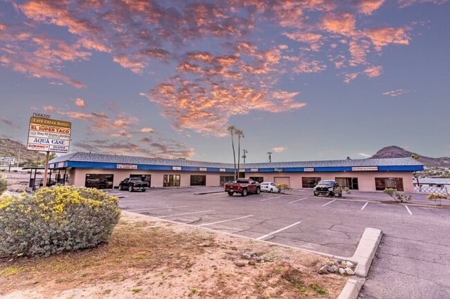
Property Record
14620 N Cave Creek Rd, Phoenix, AZ 85022
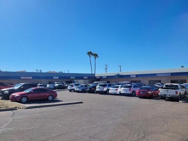

Current Lease Availabilities
NEARBY LISTINGS FOR SALE OR LEASE
Property Detail
14620 N Cave Creek Rd
Phoenix-Mesa-Scottsdale, AZ
Sugarloaf Foothills
214-68-079B
SUGARLOAF FOOTHILLS MCR 95/17
Storebuilding
Maricopa
X
Arizona
04013C1735L
v
2025
0.12 AC
2025
East Phoenix
103607
Phoenix
12,740 SF
DEMOGRAPHICS near 14620 N Cave Creek Rd
1 Mile
3 Mile
5 Mile
2024 Total Population
13,900
133,343
316,963
2029 Population
14,926
143,598
342,504
Pop Growth 2024-2029
+ 7.38%
+ 7.69%
+ 8.06%
Average Age
40
40
40
2024 Total Households
5,156
55,976
129,832
HH Growth 2024-2029
+ 7.35%
+ 7.81%
+ 8.22%
Median Household Inc
$69,748
$70,610
$72,283
Avg Household Size
2.50
2.30
2.40
2024 Avg HH Vehicles
2.00
2.00
2.00
Median Home Value
$366,666
$385,960
$398,537
Median Year Built
1981
1983
1983
Nearby Places
Map Layers
Map Styles
 Street
 Aerial
- Restaurants
- Banks
- Shops
- Fitness
- Groceries
PUBLIC TRANSPORTATION
AIRPORT
Phoenix Sky Harbor International
DRIVE
WALK
Distance
Phoenix Sky Harbor International
27 min
18.3 mi
Freight Ports
Port of San Diego
DRIVE
WALK
Distance
Port of San Diego
415 min
370.7 mi
Nearby Properties
Address
Land Use
TOTAL SIZE
Lot Size
Zoning
Address
Land Use
TOTAL SIZE
Lot Size
Zoning
281,880 SF
14.13 AC
Address
Land Use
TOTAL SIZE
Lot Size
Zoning
128,046 SF
9.97 AC
C2
Address
Land Use
TOTAL SIZE
Lot Size
Zoning
429,168 SF
9.52 AC
R-8
Address
Land Use
TOTAL SIZE
Lot Size
Zoning
342,574 SF
85.69 AC
R-18
Address
Land Use
TOTAL SIZE
Lot Size
Zoning
1,089,213 SF
53.03 AC
R-3
Address
Land Use
TOTAL SIZE
Lot Size
Zoning
359,170 SF
37.47 AC
R-14
Address
Land Use
TOTAL SIZE
Lot Size
Zoning
512,499 SF
23.03 AC
R3A
Address
Land Use
TOTAL SIZE
Lot Size
Zoning
323,288 SF
40.56 AC
R1-10
Address
Land Use
TOTAL SIZE
Lot Size
Zoning
482,581 SF
20.45 AC
C-C
Address
Land Use
TOTAL SIZE
Lot Size
Zoning
452,506 SF
55.11 AC
RH
Address
Land Use
TOTAL SIZE
Lot Size
Zoning
3.27 AC
C-C
Address
Land Use
TOTAL SIZE
Lot Size
Zoning
336,529 SF
11.23 AC
R4A
Address
Land Use
TOTAL SIZE
Lot Size
Zoning
211,239 SF
12.33 AC
M-M
Address
Land Use
TOTAL SIZE
Lot Size
Zoning
28,805 SF
2.67 AC
C-C
Address
Land Use
TOTAL SIZE
Lot Size
Zoning
316,766 SF
13.32 AC
M-H
Address
Land Use
TOTAL SIZE
Lot Size
Zoning
358,670 SF
18.14 AC
M-H
Address
Land Use
TOTAL SIZE
Lot Size
Zoning
127,252 SF
0.89 AC
C-C
Address
Land Use
TOTAL SIZE
Lot Size
Zoning
281,018 SF
9.26 AC
M-H
Address
Land Use
TOTAL SIZE
Lot Size
Zoning
135,939 SF
19.35 AC
R1-8
Address
Land Use
TOTAL SIZE
Lot Size
Zoning
205,996 SF
20.50 AC
PAD-MD
Address
Land Use
TOTAL SIZE
Lot Size
Zoning
113,611 SF
1.43 AC
C-C
Address
Land Use
TOTAL SIZE
Lot Size
Zoning
120,494 SF
11.17 AC
C-C
Address
Land Use
TOTAL SIZE
Lot Size
Zoning
115,983 SF
4.85 AC
R-14
Address
Land Use
TOTAL SIZE
Lot Size
Zoning
362,106 SF
15.60 AC
M-H
Address
Land Use
TOTAL SIZE
Lot Size
Zoning
81,692 SF
8.65 AC
R-10
Address
Land Use
TOTAL SIZE
Lot Size
Zoning
229,447 SF
23.43 AC
Address
Land Use
TOTAL SIZE
Lot Size
Zoning
180,205 SF
11.53 AC
C-C
Address
Land Use
TOTAL SIZE
Lot Size
Zoning
110,623 SF
4.39 AC
R-10
Address
Land Use
TOTAL SIZE
Lot Size
Zoning
313,047 SF
11.87 AC
R4A
Address
Land Use
TOTAL SIZE
Lot Size
Zoning
55,384 SF
78.40 AC
R-18
The World's #1 Commercial Real Estate Marketplace
Connect with us
© 2025 CoStar Group
The information above has been obtained from sources believed reliable. While we do not doubt its accuracy we have not verified it and make no guarantee, warranty or representation about it. It is your responsibility to independently confirm its accuracy and completeness. Any projections, opinions, assumptions, or estimates used are for example only and do not represent the current or future performance of the property. The value of this transaction to you depends on tax and other factors which should be evaluated by your tax, financial, and legal advisors. You and your advisors should conduct a careful, independent investigation of the property to determine to your satisfaction the suitability of the property for your needs.