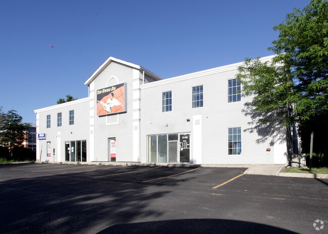
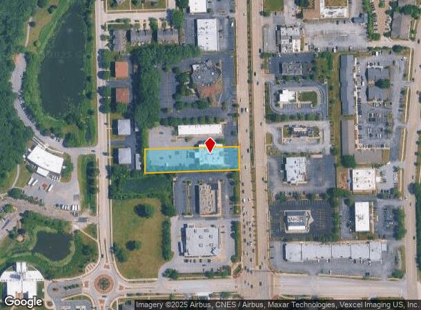
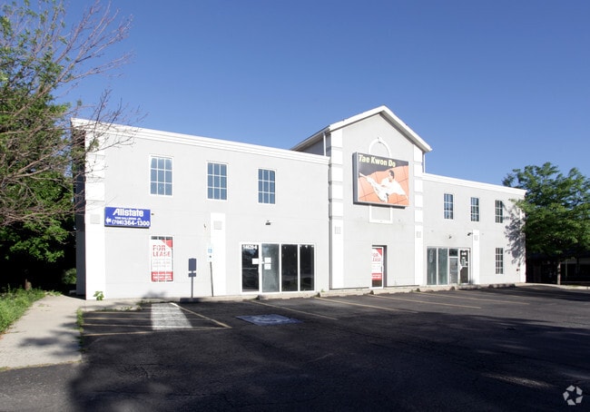
Property Record
14620 S La Grange Rd, Orland Park, IL 60462
This Property Is For Sale
NEARBY LISTINGS FOR SALE OR LEASE
Property Detail
14620 S La Grange Rd
Chicago-Naperville-Elgin, IL-IN-WI
Cottage Home
27-09-220-031-0000
(COTTAGE) (HOME) SUB OF PT EH NE SEC 09-36-12
Storebuilding
Cook
X
Illinois
17031C0701J
7,6
2023
0.95 AC
2024
South Route 45
824116
Chicago
16,802 SF
DEMOGRAPHICS near 14620 S La Grange Rd
1 Mile
3 Mile
5 Mile
2024 Total Population
10,521
63,746
159,975
2029 Population
10,156
61,553
155,303
Pop Growth 2024-2029
(3.47%)
(3.44%)
(2.92%)
Average Age
42
44
44
2024 Total Households
4,057
24,367
60,622
HH Growth 2024-2029
(3.82%)
(3.83%)
(3.27%)
Median Household Inc
$86,831
$93,270
$94,175
Avg Household Size
2.50
2.60
2.60
2024 Avg HH Vehicles
2.00
2.00
2.00
Median Home Value
$276,276
$316,970
$304,836
Median Year Built
1977
1983
1983
Nearby Places
Map Layers
Map Styles
 Street
 Aerial
- Restaurants
- Banks
- Shops
- Fitness
- Groceries
PUBLIC TRANSPORTATION
COMMUTER RAIL
DRIVE
WALK
Distance
2 min
14 min
0.7 mi
Orland Park - 153rd Street Station (SouthWest Service - Northeast Illinois Regional Commuter Railroad (Metra))
DRIVE
WALK
Distance
Orland Park - 153rd Street Station (SouthWest Service - Northeast Illinois Regional Commuter Railroad (Metra))
6 min
2.1 mi
AIRPORT
Chicago Midway International
DRIVE
WALK
Distance
Chicago Midway International
25 min
17.1 mi
Chicago O'Hare International
DRIVE
WALK
Distance
Chicago O'Hare International
45 min
27.5 mi
Nearby Properties
Address
Land Use
TOTAL SIZE
Lot Size
Zoning
Address
Land Use
TOTAL SIZE
Lot Size
Zoning
673,462 SF
41.34 AC
Address
Land Use
TOTAL SIZE
Lot Size
Zoning
298,700 SF
Address
Land Use
TOTAL SIZE
Lot Size
Zoning
8.38 AC
Address
Land Use
TOTAL SIZE
Lot Size
Zoning
535,443 SF
Address
Land Use
TOTAL SIZE
Lot Size
Zoning
188,930 SF
9.40 AC
Address
Land Use
TOTAL SIZE
Lot Size
Zoning
Address
Land Use
TOTAL SIZE
Lot Size
Zoning
216,735 SF
11.33 AC
Address
Land Use
TOTAL SIZE
Lot Size
Zoning
103,110 SF
9.12 AC
Address
Land Use
TOTAL SIZE
Lot Size
Zoning
67,394 SF
6.72 AC
Address
Land Use
TOTAL SIZE
Lot Size
Zoning
3,955 SF
1.82 AC
Address
Land Use
TOTAL SIZE
Lot Size
Zoning
6.16 AC
Address
Land Use
TOTAL SIZE
Lot Size
Zoning
155,657 SF
15.68 AC
Address
Land Use
TOTAL SIZE
Lot Size
Zoning
367,687 SF
6.63 AC
Address
Land Use
TOTAL SIZE
Lot Size
Zoning
104,589 SF
3.41 AC
Address
Land Use
TOTAL SIZE
Lot Size
Zoning
454,002 SF
10.50 AC
Address
Land Use
TOTAL SIZE
Lot Size
Zoning
94,932 SF
8.02 AC
Address
Land Use
TOTAL SIZE
Lot Size
Zoning
160,014 SF
13.04 AC
Address
Land Use
TOTAL SIZE
Lot Size
Zoning
24,600 SF
Address
Land Use
TOTAL SIZE
Lot Size
Zoning
135,849 SF
12.77 AC
Address
Land Use
TOTAL SIZE
Lot Size
Zoning
Address
Land Use
TOTAL SIZE
Lot Size
Zoning
122,846 SF
17.42 AC
Address
Land Use
TOTAL SIZE
Lot Size
Zoning
104,427 SF
10.83 AC
Address
Land Use
TOTAL SIZE
Lot Size
Zoning
253,215 SF
29.36 AC
Address
Land Use
TOTAL SIZE
Lot Size
Zoning
108,890 SF
10.01 AC
Address
Land Use
TOTAL SIZE
Lot Size
Zoning
75,720 SF
7.50 AC
Address
Land Use
TOTAL SIZE
Lot Size
Zoning
176,762 SF
6.43 AC
Address
Land Use
TOTAL SIZE
Lot Size
Zoning
132,808 SF
15.97 AC
Address
Land Use
TOTAL SIZE
Lot Size
Zoning
203,359 SF
12.56 AC
Address
Land Use
TOTAL SIZE
Lot Size
Zoning
74,992 SF
3.62 AC
Address
Land Use
TOTAL SIZE
Lot Size
Zoning
47,125 SF
5.85 AC
The World's #1 Commercial Real Estate Marketplace
Connect with us
© 2025 CoStar Group
The information above has been obtained from sources believed reliable. While we do not doubt its accuracy we have not verified it and make no guarantee, warranty or representation about it. It is your responsibility to independently confirm its accuracy and completeness. Any projections, opinions, assumptions, or estimates used are for example only and do not represent the current or future performance of the property. The value of this transaction to you depends on tax and other factors which should be evaluated by your tax, financial, and legal advisors. You and your advisors should conduct a careful, independent investigation of the property to determine to your satisfaction the suitability of the property for your needs.