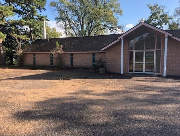
Property Record
440 Mcfarland Rd, Houston, TX 77060

NEARBY LISTINGS FOR SALE OR LEASE
Property Detail
440 Mcfarland Rd
0041800000371
Aldine Gardens Sec 7
Religious
TR 356C ALDINE GARDENS SEC 7
X
Harris
48201C0470L
Texas
0
1.46 AC
2025
Northeast Near
222402
Houston
5,967 SF
Houston-The Woodlands-Sugar Land, TX
DEMOGRAPHICS near 440 Mcfarland Rd
1 Mile
3 Mile
5 Mile
2024 Total Population
11,981
94,345
269,304
2029 Population
12,066
95,664
273,753
Pop Growth 2024-2029
+ 0.71%
+ 1.40%
+ 1.65%
Average Age
34
33
34
2024 Total Households
3,183
29,208
82,306
HH Growth 2024-2029
+ 0.63%
+ 1.49%
+ 1.72%
Median Household Inc
$38,133
$35,830
$38,483
Avg Household Size
3.70
3.20
3.20
2024 Avg HH Vehicles
2.00
2.00
2.00
Median Home Value
$116,176
$132,315
$147,595
Median Year Built
1971
1976
1978
Nearby Places
Map Layers
Map Styles
 Street
 Aerial
- Restaurants
- Banks
- Shops
- Fitness
- Groceries
PUBLIC TRANSPORTATION
AIRPORT
George Bush Intcntl/Houston
DRIVE
WALK
Distance
George Bush Intcntl/Houston
13 min
9.0 mi
William P Hobby
DRIVE
WALK
Distance
William P Hobby
40 min
25.3 mi
Freight Ports
Port of Houston
DRIVE
WALK
Distance
Port of Houston
29 min
18.6 mi
SALE & LEASE HISTORY
LISTING DATE
SALE/LEASE

Jan 16, 2019
For Sale
Nearby Properties
Address
Land Use
TOTAL SIZE
Lot Size
Zoning
Address
Land Use
TOTAL SIZE
Lot Size
Zoning
858,420 SF
60.71 AC
Address
Land Use
TOTAL SIZE
Lot Size
Zoning
145.62 AC
Address
Land Use
TOTAL SIZE
Lot Size
Zoning
739,141 SF
54 AC
Address
Land Use
TOTAL SIZE
Lot Size
Zoning
413,178 SF
21.45 AC
Address
Land Use
TOTAL SIZE
Lot Size
Zoning
704,105 SF
40.72 AC
Address
Land Use
TOTAL SIZE
Lot Size
Zoning
594,105 SF
43.68 AC
Address
Land Use
TOTAL SIZE
Lot Size
Zoning
614,256 SF
31.25 AC
Address
Land Use
TOTAL SIZE
Lot Size
Zoning
608,784 SF
29.08 AC
Address
Land Use
TOTAL SIZE
Lot Size
Zoning
718,600 SF
42.09 AC
Address
Land Use
TOTAL SIZE
Lot Size
Zoning
504,000 SF
32.25 AC
Address
Land Use
TOTAL SIZE
Lot Size
Zoning
241,625 SF
11.10 AC
Address
Land Use
TOTAL SIZE
Lot Size
Zoning
356,900 SF
19.38 AC
Address
Land Use
TOTAL SIZE
Lot Size
Zoning
350,500 SF
17.71 AC
Address
Land Use
TOTAL SIZE
Lot Size
Zoning
353,600 SF
23.45 AC
Address
Land Use
TOTAL SIZE
Lot Size
Zoning
423,730 SF
5.91 AC
Address
Land Use
TOTAL SIZE
Lot Size
Zoning
284,476 SF
20 AC
Address
Land Use
TOTAL SIZE
Lot Size
Zoning
284,687 SF
19.66 AC
Address
Land Use
TOTAL SIZE
Lot Size
Zoning
383,451 SF
15.98 AC
Address
Land Use
TOTAL SIZE
Lot Size
Zoning
240,240 SF
14.35 AC
Address
Land Use
TOTAL SIZE
Lot Size
Zoning
251,812 SF
12.22 AC
Address
Land Use
TOTAL SIZE
Lot Size
Zoning
244,864 SF
12.30 AC
Address
Land Use
TOTAL SIZE
Lot Size
Zoning
208,008 SF
8.32 AC
Address
Land Use
TOTAL SIZE
Lot Size
Zoning
244,760 SF
17.20 AC
Address
Land Use
TOTAL SIZE
Lot Size
Zoning
379,255 SF
22.65 AC
Address
Land Use
TOTAL SIZE
Lot Size
Zoning
293,270 SF
8.29 AC
Address
Land Use
TOTAL SIZE
Lot Size
Zoning
202,362 SF
8.02 AC
Address
Land Use
TOTAL SIZE
Lot Size
Zoning
261,000 SF
13.89 AC
Address
Land Use
TOTAL SIZE
Lot Size
Zoning
250,660 SF
14.22 AC
Address
Land Use
TOTAL SIZE
Lot Size
Zoning
193,972 SF
14.59 AC
Address
Land Use
TOTAL SIZE
Lot Size
Zoning
350,511 SF
15.40 AC
The World's #1 Commercial Real Estate Marketplace
Connect with us
© 2025 CoStar Group
The information above has been obtained from sources believed reliable. While we do not doubt its accuracy we have not verified it and make no guarantee, warranty or representation about it. It is your responsibility to independently confirm its accuracy and completeness. Any projections, opinions, assumptions, or estimates used are for example only and do not represent the current or future performance of the property. The value of this transaction to you depends on tax and other factors which should be evaluated by your tax, financial, and legal advisors. You and your advisors should conduct a careful, independent investigation of the property to determine to your satisfaction the suitability of the property for your needs.