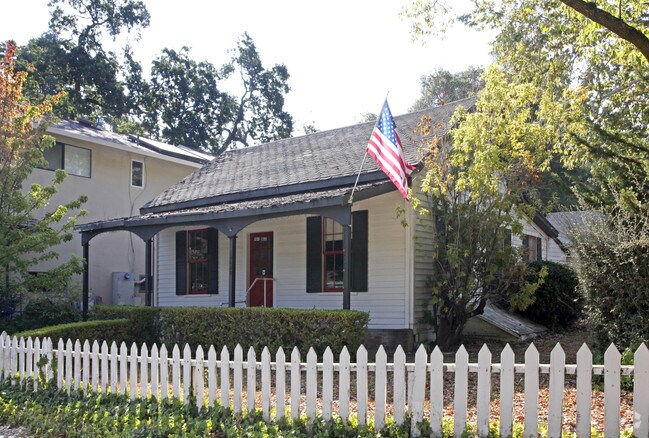
Property Record
14630 Big Basin Way, Saratoga, CA 95070


NEARBY LISTINGS FOR SALE OR LEASE
Property Detail
14630 Big Basin Way
517-08-005
Town Saratoga
Financialbuilding
MAP A PG 43 BLK 11
X
Santa Clara
06087C0050E
California
2024
0.12 AC
2025
Los Gatos/Saratoga
507302
South Bay/San Jose
970 SF
San Jose-Sunnyvale-Santa Clara, CA
DEMOGRAPHICS near 14630 Big Basin Way
1 Mile
3 Mile
5 Mile
2024 Total Population
5,861
38,784
178,134
2029 Population
5,626
37,234
171,038
Pop Growth 2024-2029
(4.01%)
(4.00%)
(3.98%)
Average Age
47
46
43
2024 Total Households
2,020
13,495
62,411
HH Growth 2024-2029
(4.31%)
(4.24%)
(4.26%)
Median Household Inc
$244,136
$229,393
$193,677
Avg Household Size
2.90
2.80
2.80
2024 Avg HH Vehicles
3.00
2.00
2.00
Median Home Value
$1,143,872
$1,143,616
$1,140,549
Median Year Built
1967
1967
1967
Nearby Places
Map Layers
Map Styles
 Street
 Aerial
- Restaurants
- Banks
- Shops
- Fitness
- Groceries
PUBLIC TRANSPORTATION
COMMUTER RAIL
Sunnyvale (Caltrain - Caltrain (Caltrain))
DRIVE
WALK
Distance
Sunnyvale (Caltrain - Caltrain (Caltrain))
20 min
8.9 mi
Santa Clara (Caltrain - Caltrain (Caltrain))
DRIVE
WALK
Distance
Santa Clara (Caltrain - Caltrain (Caltrain))
20 min
9.2 mi
AIRPORT
Norman Y Mineta San Jose International
DRIVE
WALK
Distance
Norman Y Mineta San Jose International
22 min
10.0 mi
San Francisco International
DRIVE
WALK
Distance
San Francisco International
47 min
35.6 mi
Metro Oakland International
DRIVE
WALK
Distance
Metro Oakland International
60 min
44.3 mi
Freight Ports
Port of Redwood City
DRIVE
WALK
Distance
Port of Redwood City
32 min
22.4 mi
Nearby Properties
Address
Land Use
TOTAL SIZE
Lot Size
Zoning
Address
Land Use
TOTAL SIZE
Lot Size
Zoning
153.69 AC
HS
Address
Land Use
TOTAL SIZE
Lot Size
Zoning
195,565 SF
25.03 AC
R140
Address
Land Use
TOTAL SIZE
Lot Size
Zoning
124,360 SF
10.48 AC
R140
Address
Land Use
TOTAL SIZE
Lot Size
Zoning
20,825 SF
5.77 AC
CN
Address
Land Use
TOTAL SIZE
Lot Size
Zoning
89,262 SF
10.25 AC
PA
Address
Land Use
TOTAL SIZE
Lot Size
Zoning
194 AC
HS-D1
Address
Land Use
TOTAL SIZE
Lot Size
Zoning
33,586 SF
0.67 AC
CC
Address
Land Use
TOTAL SIZE
Lot Size
Zoning
2.87 AC
R110
Address
Land Use
TOTAL SIZE
Lot Size
Zoning
43.92 AC
RHSG1
Address
Land Use
TOTAL SIZE
Lot Size
Zoning
4.83 AC
R120
Address
Land Use
TOTAL SIZE
Lot Size
Zoning
104,526 SF
3.26 AC
C
Address
Land Use
TOTAL SIZE
Lot Size
Zoning
38,760 SF
10.65 AC
R140
Address
Land Use
TOTAL SIZE
Lot Size
Zoning
26,596 SF
2.24 AC
C1
Address
Land Use
TOTAL SIZE
Lot Size
Zoning
1,855 SF
3.59 AC
R110
Address
Land Use
TOTAL SIZE
Lot Size
Zoning
30,000 SF
2.70 AC
C1
Address
Land Use
TOTAL SIZE
Lot Size
Zoning
23,673 SF
1.24 AC
C1
Address
Land Use
TOTAL SIZE
Lot Size
Zoning
11.31 AC
R120
Address
Land Use
TOTAL SIZE
Lot Size
Zoning
8,004 SF
45.29 AC
HCRD
Address
Land Use
TOTAL SIZE
Lot Size
Zoning
4.56 AC
R1
Address
Land Use
TOTAL SIZE
Lot Size
Zoning
11,722 SF
0.39 AC
CC
Address
Land Use
TOTAL SIZE
Lot Size
Zoning
10.10 AC
LG
Address
Land Use
TOTAL SIZE
Lot Size
Zoning
37.81 AC
AW
Address
Land Use
TOTAL SIZE
Lot Size
Zoning
1.70 AC
C
Address
Land Use
TOTAL SIZE
Lot Size
Zoning
11,648 SF
1.34 AC
C1H
Address
Land Use
TOTAL SIZE
Lot Size
Zoning
11,026 SF
2.93 AC
CN
Address
Land Use
TOTAL SIZE
Lot Size
Zoning
1.55 AC
SA
Address
Land Use
TOTAL SIZE
Lot Size
Zoning
2,342 SF
0.06 AC
CH1
Address
Land Use
TOTAL SIZE
Lot Size
Zoning
7,979 SF
1.40 AC
R120
Address
Land Use
TOTAL SIZE
Lot Size
Zoning
21,544 SF
0.64 AC
CC
Address
Land Use
TOTAL SIZE
Lot Size
Zoning
12,777 SF
1.33 AC
C
The World's #1 Commercial Real Estate Marketplace
Connect with us
© 2025 CoStar Group
The information above has been obtained from sources believed reliable. While we do not doubt its accuracy we have not verified it and make no guarantee, warranty or representation about it. It is your responsibility to independently confirm its accuracy and completeness. Any projections, opinions, assumptions, or estimates used are for example only and do not represent the current or future performance of the property. The value of this transaction to you depends on tax and other factors which should be evaluated by your tax, financial, and legal advisors. You and your advisors should conduct a careful, independent investigation of the property to determine to your satisfaction the suitability of the property for your needs.