Property Record
1467 Route 31 S, Clinton, NJ 08809

NEARBY LISTINGS FOR SALE OR LEASE
Property Detail
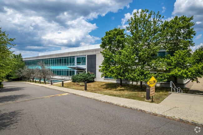
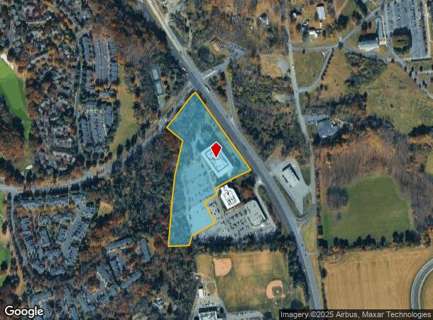
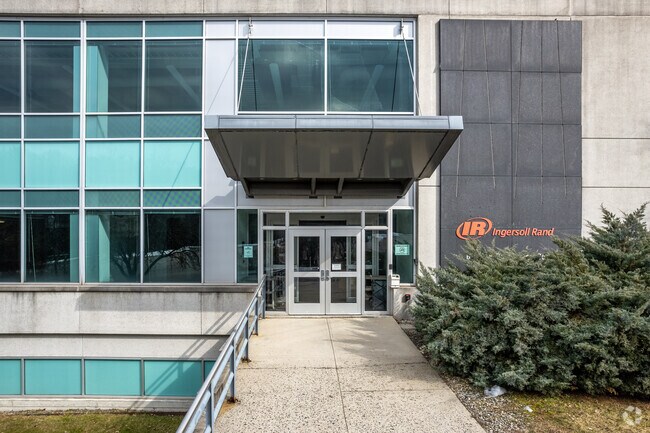
1467 Route 31 S
Newark, NJ
ADDITIONAL LOTS: 106500SF OFFICE
06-00079-02-00007
Hunterdon
Scientificpharmaceuticalmedicalresearchfacility
New Jersey
X
7
34019C0119F
10.44 AC
2024
Hunterdon
2025
Northern New Jersey
010801
DEMOGRAPHICS near 1467 Route 31 S
1 Mile
3 Mile
5 Mile
2024 Total Population
3,562
19,219
31,330
2029 Population
3,631
19,478
31,668
Pop Growth 2024-2029
+ 1.94%
+ 1.35%
+ 1.08%
Average Age
45
43
43
2024 Total Households
1,568
7,450
11,272
HH Growth 2024-2029
+ 1.98%
+ 1.53%
+ 1.37%
Median Household Inc
$116,433
$118,481
$129,104
Avg Household Size
2.20
2.40
2.50
2024 Avg HH Vehicles
2.00
2.00
2.00
Median Home Value
$432,927
$400,582
$449,672
Median Year Built
1989
1979
1978
Nearby Places
Map Layers
Map Styles
 Street
 Aerial
- Restaurants
- Banks
- Shops
- Fitness
- Groceries
PUBLIC TRANSPORTATION
COMMUTER RAIL
Annandale (Raritan Valley Line - NJ Transit Commuter Rail (NJ Transit))
DRIVE
WALK
Distance
Annandale (Raritan Valley Line - NJ Transit Commuter Rail (NJ Transit))
5 min
2.1 mi
Lebanon (Raritan Valley Line - NJ Transit Commuter Rail (NJ Transit))
DRIVE
WALK
Distance
Lebanon (Raritan Valley Line - NJ Transit Commuter Rail (NJ Transit))
8 min
3.7 mi
AIRPORT
Trenton Mercer
DRIVE
WALK
Distance
Trenton Mercer
46 min
29.4 mi
Lehigh Valley International
DRIVE
WALK
Distance
Lehigh Valley International
50 min
33.8 mi
Freight Ports
Maher Terminal
DRIVE
WALK
Distance
Maher Terminal
55 min
43.1 mi
SALE & LEASE HISTORY
LISTING DATE
SALE/LEASE

May 25, 2021
For Lease
Mar 16, 2021
For Lease
Mar 16, 2021
For Sale
Jun 28, 2022
For Sale
Jun 13, 2022
For Lease
Jan 25, 2024
For Lease
Jan 25, 2024
For Sale
Nearby Properties
Address
Land Use
TOTAL SIZE
Lot Size
Zoning
Address
Land Use
TOTAL SIZE
Lot Size
Zoning
84.62 AC
ROM1
Address
Land Use
TOTAL SIZE
Lot Size
Zoning
3,703.19 AC
RC
Address
Land Use
TOTAL SIZE
Lot Size
Zoning
328.35 AC
INS
Address
Land Use
TOTAL SIZE
Lot Size
Zoning
49.26 AC
RR4S
Address
Land Use
TOTAL SIZE
Lot Size
Zoning
3,432 SF
24.17 AC
OB3
Address
Land Use
TOTAL SIZE
Lot Size
Zoning
29,982 SF
7.76 AC
Address
Land Use
TOTAL SIZE
Lot Size
Zoning
76.99 AC
ROM2
Address
Land Use
TOTAL SIZE
Lot Size
Zoning
6 AC
ROM1
Address
Land Use
TOTAL SIZE
Lot Size
Zoning
36.51 AC
C-N
Address
Land Use
TOTAL SIZE
Lot Size
Zoning
2,526 SF
339.93 AC
RC
Address
Land Use
TOTAL SIZE
Lot Size
Zoning
40.13 AC
AH2
Address
Land Use
TOTAL SIZE
Lot Size
Zoning
Address
Land Use
TOTAL SIZE
Lot Size
Zoning
261.91 AC
RC
Address
Land Use
TOTAL SIZE
Lot Size
Zoning
Address
Land Use
TOTAL SIZE
Lot Size
Zoning
9,408 SF
37 AC
ROM1
Address
Land Use
TOTAL SIZE
Lot Size
Zoning
5.36 AC
PUD
Address
Land Use
TOTAL SIZE
Lot Size
Zoning
10.20 AC
OB1
Address
Land Use
TOTAL SIZE
Lot Size
Zoning
Address
Land Use
TOTAL SIZE
Lot Size
Zoning
1.88 AC
OB-2
Address
Land Use
TOTAL SIZE
Lot Size
Zoning
52,594 SF
4.58 AC
GA
Address
Land Use
TOTAL SIZE
Lot Size
Zoning
10.18 AC
OB-4
Address
Land Use
TOTAL SIZE
Lot Size
Zoning
5.24 AC
C-N
Address
Land Use
TOTAL SIZE
Lot Size
Zoning
34.80 AC
ROM
Address
Land Use
TOTAL SIZE
Lot Size
Zoning
Address
Land Use
TOTAL SIZE
Lot Size
Zoning
4.61 AC
Address
Land Use
TOTAL SIZE
Lot Size
Zoning
1,620 SF
15.85 AC
C2
Address
Land Use
TOTAL SIZE
Lot Size
Zoning
1,056 SF
4 AC
Address
Land Use
TOTAL SIZE
Lot Size
Zoning
4.70 AC
Address
Land Use
TOTAL SIZE
Lot Size
Zoning
8.50 AC
Address
Land Use
TOTAL SIZE
Lot Size
Zoning
47,400 SF
15.68 AC
I
The World's #1 Commercial Real Estate Marketplace
Connect with us
© 2026 CoStar Group
The information above has been obtained from sources believed reliable. While we do not doubt its accuracy we have not verified it and make no guarantee, warranty or representation about it. It is your responsibility to independently confirm its accuracy and completeness. Any projections, opinions, assumptions, or estimates used are for example only and do not represent the current or future performance of the property. The value of this transaction to you depends on tax and other factors which should be evaluated by your tax, financial, and legal advisors. You and your advisors should conduct a careful, independent investigation of the property to determine to your satisfaction the suitability of the property for your needs.