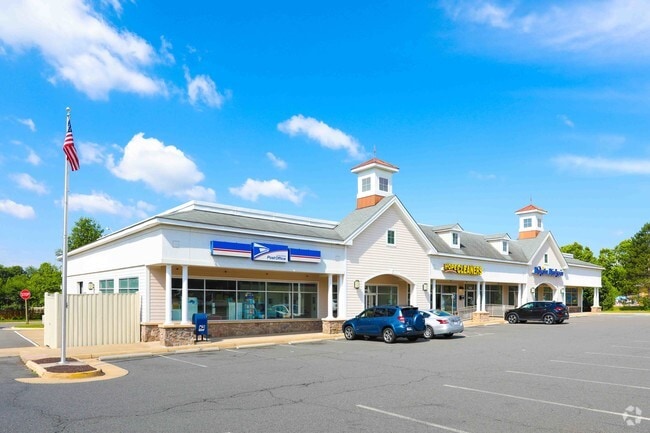
Property Record
14670 Gap Way, Gainesville, VA 20155

Property Detail
14670 Gap Way
7397-18-6524
GREENHILL CROSSING COMMERCIAL CTR PH 1 L-1
Regionalshoppingcenterormallwithanchorstore
Prince William
B1
Virginia
B and X Area of moderate flood hazard, usually the area between the limits of the 100-year and 500-year floods.
1
2024
1.13 AC
2025
Route 29/I-66 Corridor
901507
Washington, DC
12,080 SF
Washington-Arlington-Alexandria, DC-VA-MD-WV
NEARBY LISTINGS FOR SALE OR LEASE
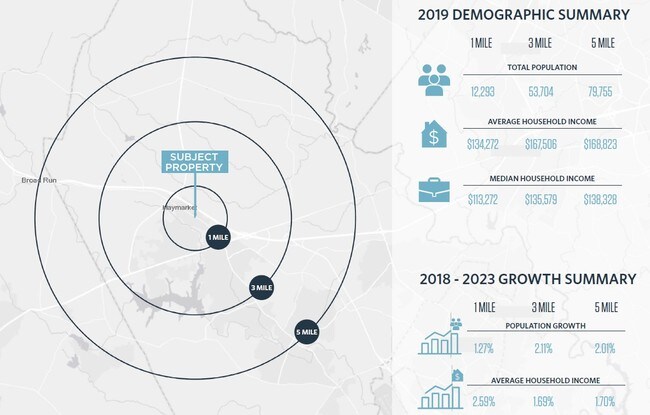
DEMOGRAPHICS near 14670 Gap Way
1 mile
3 mile
5 mile
2025 Total Population
13,487
54,360
84,621
2030 Population
13,924
55,999
87,069
Pop Growth 2025-2030
+ 3.24%
+ 3.02%
+ 2.89%
Average Age
36
41
40
2025 Total Households
4,348
17,825
26,899
HH Growth 2025-2030
+ 3.15%
+ 2.94%
+ 2.84%
Median Household Inc
$152,009
$172,268
$176,825
Avg Household Size
3.00
3.00
3.10
2025 Avg HH Vehicles
2.00
2.00
2.00
Median Home Value
$561,084
$708,337
$716,525
Median Year Built
2004
2005
2004
Nearby Places
Map Layers
Map Styles
 Street
 Aerial
Transit
 Traffic
 Biking
Places
Listings with unknown addresses are not visible on the map
- Restaurants
- Banks
- Shops
- Fitness
- Groceries
PUBLIC TRANSPORTATION
AIRPORT
Washington Dulles International
Drive
Walk
Distance
Washington Dulles International
36 min
23.4 mi
Freight Ports
Port of Baltimore
Drive
Walk
Distance
Port of Baltimore
96 min
73.8 mi
SALE & LEASE HISTORY
LISTING DATE
SALE/LEASE

Aug 21, 2019
For Sale
Nearby Properties
Address
Land Use
TOTAL SIZE
Lot Size
Zoning
Address
Land Use
TOTAL SIZE
Lot Size
Zoning
482,223 SF
28.10 AC
PBD
Address
Land Use
TOTAL SIZE
Lot Size
Zoning
453,174 SF
38.50 AC
PBD
Address
Land Use
TOTAL SIZE
Lot Size
Zoning
560,942 SF
90.90 AC
B1
Address
Land Use
TOTAL SIZE
Lot Size
Zoning
117.22 AC
M1
Address
Land Use
TOTAL SIZE
Lot Size
Zoning
252,966 SF
10.54 AC
PMD
Address
Land Use
TOTAL SIZE
Lot Size
Zoning
258,716 SF
58.54 AC
M1
Address
Land Use
TOTAL SIZE
Lot Size
Zoning
350,906 SF
83.51 AC
M1
Address
Land Use
TOTAL SIZE
Lot Size
Zoning
227,465 SF
31.91 AC
M1
Address
Land Use
TOTAL SIZE
Lot Size
Zoning
58.30 AC
M1
Address
Land Use
TOTAL SIZE
Lot Size
Zoning
482,200 SF
29.18 AC
PBD
Address
Land Use
TOTAL SIZE
Lot Size
Zoning
220,552 SF
30.95 AC
PMD
Address
Land Use
TOTAL SIZE
Lot Size
Zoning
236,082 SF
28.27 AC
M2
Address
Land Use
TOTAL SIZE
Lot Size
Zoning
161.28 AC
PBD
Address
Land Use
TOTAL SIZE
Lot Size
Zoning
298,474 SF
11.60 AC
PMR
Address
Land Use
TOTAL SIZE
Lot Size
Zoning
280,221 SF
78.35 AC
RPC
Address
Land Use
TOTAL SIZE
Lot Size
Zoning
333,737 SF
37.06 AC
RPC
Address
Land Use
TOTAL SIZE
Lot Size
Zoning
28.38 AC
PBD
Address
Land Use
TOTAL SIZE
Lot Size
Zoning
147,877 SF
39.51 AC
MIXED
Address
Land Use
TOTAL SIZE
Lot Size
Zoning
75,317 SF
13.68 AC
R16
Address
Land Use
TOTAL SIZE
Lot Size
Zoning
241,328 SF
8.66 AC
B1
Address
Land Use
TOTAL SIZE
Lot Size
Zoning
23.65 AC
R4
Address
Land Use
TOTAL SIZE
Lot Size
Zoning
39,078 SF
84.24 AC
MIXED
Address
Land Use
TOTAL SIZE
Lot Size
Zoning
92,182 SF
19.90 AC
B1
Address
Land Use
TOTAL SIZE
Lot Size
Zoning
363,220 SF
20.35 AC
PBD
Address
Land Use
TOTAL SIZE
Lot Size
Zoning
18.22 AC
A1
Address
Land Use
TOTAL SIZE
Lot Size
Zoning
Address
Land Use
TOTAL SIZE
Lot Size
Zoning
140,285 SF
20.51 AC
RPC
Address
Land Use
TOTAL SIZE
Lot Size
Zoning
125,157 SF
18.53 AC
B1
Address
Land Use
TOTAL SIZE
Lot Size
Zoning
121,672 SF
11.05 AC
M2
Address
Land Use
TOTAL SIZE
Lot Size
Zoning
285,889 SF
19.61 AC
M1
The World's #1 Commercial Real Estate Marketplace
Connect with us
© 2026 CoStar Group
The information above has been obtained from sources believed reliable. While we do not doubt its accuracy we have not verified it and make no guarantee, warranty or representation about it. It is your responsibility to independently confirm its accuracy and completeness. Any projections, opinions, assumptions, or estimates used are for example only and do not represent the current or future performance of the property. The value of this transaction to you depends on tax and other factors which should be evaluated by your tax, financial, and legal advisors. You and your advisors should conduct a careful, independent investigation of the property to determine to your satisfaction the suitability of the property for your needs.