Property Record
14675 Sw 120Th St, Miami, FL 33186


NEARBY LISTINGS FOR SALE OR LEASE
Property Detail
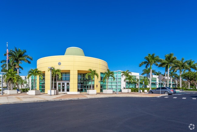
14675 Sw 120Th St
30-5910-048-0010
Sffp South Plat
Officebuilding
SFFP SOUTH PLAT PB 167-089 T-22791 TR A LESS BEG NE COR OF TR A TH S 86 DEG W 211.43FT S 02 DEG E 107FT N 86 DEG E 211.44FT N 02 DEG W 107FT TO POB LOT SIZE 247734 SQ FT
AH
Miami/Dade
12086C0443L
Florida
2024
5.69 AC
2025
Kendall
018700
South Florida
47,596 SF
Miami-Miami Beach-Kendall, FL
DEMOGRAPHICS near 14675 Sw 120Th St
1 Mile
3 Mile
5 Mile
2024 Total Population
12,120
155,816
318,225
2029 Population
11,676
151,394
308,793
Pop Growth 2024-2029
(3.66%)
(2.84%)
(2.96%)
Average Age
41
41
42
2024 Total Households
3,577
50,971
103,398
HH Growth 2024-2029
(4.17%)
(3.21%)
(3.39%)
Median Household Inc
$95,603
$73,902
$73,810
Avg Household Size
3.20
2.90
3.00
2024 Avg HH Vehicles
2.00
2.00
2.00
Median Home Value
$395,479
$369,343
$368,980
Median Year Built
1991
1990
1987
Nearby Places
Map Layers
Map Styles
 Street
 Aerial
- Restaurants
- Banks
- Shops
- Fitness
- Groceries
PUBLIC TRANSPORTATION
COMMUTER RAIL
Dadeland South (Metrorail Green Line - Miami-Dade Transit (Metrorail/Metromover))
DRIVE
WALK
Distance
Dadeland South (Metrorail Green Line - Miami-Dade Transit (Metrorail/Metromover))
18 min
9.6 mi
AIRPORT
Miami International
DRIVE
WALK
Distance
Miami International
32 min
17.6 mi
Fort Lauderdale/Hollywood International
DRIVE
WALK
Distance
Fort Lauderdale/Hollywood International
58 min
43.3 mi
Nearby Properties
Address
Land Use
TOTAL SIZE
Lot Size
Zoning
Address
Land Use
TOTAL SIZE
Lot Size
Zoning
827,208 SF
27.66 AC
6400
Address
Land Use
TOTAL SIZE
Lot Size
Zoning
498,210 SF
17.39 AC
9400
Address
Land Use
TOTAL SIZE
Lot Size
Zoning
686,394 SF
669.92 AC
8000
Address
Land Use
TOTAL SIZE
Lot Size
Zoning
336,145 SF
17.04 AC
3900
Address
Land Use
TOTAL SIZE
Lot Size
Zoning
407,900 SF
18.79 AC
3900
Address
Land Use
TOTAL SIZE
Lot Size
Zoning
299,209 SF
15.83 AC
3800
Address
Land Use
TOTAL SIZE
Lot Size
Zoning
298,178 SF
10.39 AC
3900
Address
Land Use
TOTAL SIZE
Lot Size
Zoning
276,816 SF
9.63 AC
3900
Address
Land Use
TOTAL SIZE
Lot Size
Zoning
546,903 SF
49.47 AC
7700
Address
Land Use
TOTAL SIZE
Lot Size
Zoning
269,546 SF
21.99 AC
6200
Address
Land Use
TOTAL SIZE
Lot Size
Zoning
382,043 SF
14.96 AC
3900
Address
Land Use
TOTAL SIZE
Lot Size
Zoning
287,950 SF
9.81 AC
4100
Address
Land Use
TOTAL SIZE
Lot Size
Zoning
30,297 SF
19.11 AC
6200
Address
Land Use
TOTAL SIZE
Lot Size
Zoning
396,198 SF
17.10 AC
3700
Address
Land Use
TOTAL SIZE
Lot Size
Zoning
266,199 SF
8.74 AC
3900
Address
Land Use
TOTAL SIZE
Lot Size
Zoning
207,583 SF
20.16 AC
6400
Address
Land Use
TOTAL SIZE
Lot Size
Zoning
357,573 SF
33.93 AC
8900
Address
Land Use
TOTAL SIZE
Lot Size
Zoning
318,986 SF
20.95 AC
3800
Address
Land Use
TOTAL SIZE
Lot Size
Zoning
196,490 SF
13.50 AC
0102
Address
Land Use
TOTAL SIZE
Lot Size
Zoning
269,198 SF
9.82 AC
3900
Address
Land Use
TOTAL SIZE
Lot Size
Zoning
192,585 SF
11.66 AC
6400
Address
Land Use
TOTAL SIZE
Lot Size
Zoning
1 SF
304.88 AC
9000
Address
Land Use
TOTAL SIZE
Lot Size
Zoning
254,848 SF
14.41 AC
7100
Address
Land Use
TOTAL SIZE
Lot Size
Zoning
412,188 SF
13.87 AC
3900
Address
Land Use
TOTAL SIZE
Lot Size
Zoning
188,499 SF
13.67 AC
6400
Address
Land Use
TOTAL SIZE
Lot Size
Zoning
172,645 SF
15.49 AC
3800
Address
Land Use
TOTAL SIZE
Lot Size
Zoning
199,308 SF
9.67 AC
3800
Address
Land Use
TOTAL SIZE
Lot Size
Zoning
115,970 SF
9.40 AC
3800
The World's #1 Commercial Real Estate Marketplace
Connect with us
© 2026 CoStar Group
The information above has been obtained from sources believed reliable. While we do not doubt its accuracy we have not verified it and make no guarantee, warranty or representation about it. It is your responsibility to independently confirm its accuracy and completeness. Any projections, opinions, assumptions, or estimates used are for example only and do not represent the current or future performance of the property. The value of this transaction to you depends on tax and other factors which should be evaluated by your tax, financial, and legal advisors. You and your advisors should conduct a careful, independent investigation of the property to determine to your satisfaction the suitability of the property for your needs.