Property Record
14677 E Easter Ave, Centennial, CO 80112


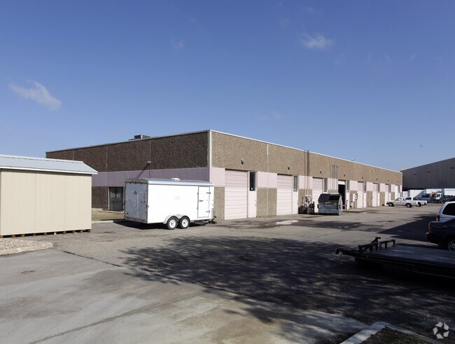

Property Detail
14677 E Easter Ave
Denver-Aurora-Centennial, CO
SUBDIVISIONCD 012055 SUBDIVISIONNAME CHERRY CREEK INDUSTRIAL PARK BLOCK 001 LOT 00C LOT C TOG WITH PRIVATE DR ADJ BLK 1 CHERRY CREEK INDUSTRIAL PARK
2073-30-1-04-009
Arapahoe
Warehouse
Colorado
B and X Area of moderate flood hazard, usually the area between the limits of the 100-year and 500-year floods.
00c,c
2024
1 AC
2025
Centennial
006863
Denver
15,297 SF
NEARBY LISTINGS FOR SALE OR LEASE
DEMOGRAPHICS near 14677 E Easter Ave
1 mile
3 mile
5 mile
2025 Total Population
6,658
60,521
227,401
2030 Population
6,727
62,040
233,710
Pop Growth 2025-2030
+ 1.04%
+ 2.51%
+ 2.77%
Average Age
35
39
39
2025 Total Households
2,643
22,544
87,188
HH Growth 2025-2030
+ 1.06%
+ 2.86%
+ 3.13%
Median Household Inc
$81,417
$120,145
$116,423
Avg Household Size
2.10
2.60
2.50
2025 Avg HH Vehicles
2.00
2.00
2.00
Median Home Value
$447,289
$717,076
$667,560
Median Year Built
2004
2000
1995
Nearby Places
Map Layers
Map Styles
 Street
 Aerial
Transit
 Traffic
 Biking
Places
Listings with unknown addresses are not visible on the map
- Restaurants
- Banks
- Shops
- Fitness
- Groceries
PUBLIC TRANSPORTATION
AIRPORT
Denver International
Drive
Walk
Distance
Denver International
38 min
32.1 mi
Nearby Properties
Address
Land Use
TOTAL SIZE
Lot Size
Zoning
Address
Land Use
TOTAL SIZE
Lot Size
Zoning
234,214 SF
5.23 AC
Address
Land Use
TOTAL SIZE
Lot Size
Zoning
280,586 SF
60.97 AC
RPD
Address
Land Use
TOTAL SIZE
Lot Size
Zoning
29,070 SF
308.89 AC
Address
Land Use
TOTAL SIZE
Lot Size
Zoning
284,862 SF
23.37 AC
PUD
Address
Land Use
TOTAL SIZE
Lot Size
Zoning
525,600 SF
57.90 AC
Address
Land Use
TOTAL SIZE
Lot Size
Zoning
246,768 SF
12.37 AC
PUD
Address
Land Use
TOTAL SIZE
Lot Size
Zoning
134,316 SF
26.52 AC
Address
Land Use
TOTAL SIZE
Lot Size
Zoning
247,689 SF
26.15 AC
AMU
Address
Land Use
TOTAL SIZE
Lot Size
Zoning
216,853 SF
5.42 AC
PUD
Address
Land Use
TOTAL SIZE
Lot Size
Zoning
103,811 SF
6.36 AC
RPD
Address
Land Use
TOTAL SIZE
Lot Size
Zoning
304,620 SF
23.95 AC
AMU
Address
Land Use
TOTAL SIZE
Lot Size
Zoning
231,715 SF
5.58 AC
Address
Land Use
TOTAL SIZE
Lot Size
Zoning
107,760 SF
5.41 AC
AMU
Address
Land Use
TOTAL SIZE
Lot Size
Zoning
279,884 SF
14.72 AC
Address
Land Use
TOTAL SIZE
Lot Size
Zoning
222,000 SF
16.26 AC
AMU
Address
Land Use
TOTAL SIZE
Lot Size
Zoning
355,326 SF
12.27 AC
PUD
Address
Land Use
TOTAL SIZE
Lot Size
Zoning
253,296 SF
16.41 AC
Address
Land Use
TOTAL SIZE
Lot Size
Zoning
441,689 SF
25.31 AC
Address
Land Use
TOTAL SIZE
Lot Size
Zoning
222,931 SF
13 AC
Address
Land Use
TOTAL SIZE
Lot Size
Zoning
217,273 SF
18.28 AC
Address
Land Use
TOTAL SIZE
Lot Size
Zoning
171,600 SF
10.32 AC
AA2
Address
Land Use
TOTAL SIZE
Lot Size
Zoning
195,390 SF
14.78 AC
AI1
Address
Land Use
TOTAL SIZE
Lot Size
Zoning
281,429 SF
22.55 AC
PUD
Address
Land Use
TOTAL SIZE
Lot Size
Zoning
494,489 SF
22.16 AC
Address
Land Use
TOTAL SIZE
Lot Size
Zoning
150,920 SF
12.18 AC
AA1
Address
Land Use
TOTAL SIZE
Lot Size
Zoning
337,765 SF
23.46 AC
Address
Land Use
TOTAL SIZE
Lot Size
Zoning
140,080 SF
15.05 AC
Address
Land Use
TOTAL SIZE
Lot Size
Zoning
91.37 AC
Address
Land Use
TOTAL SIZE
Lot Size
Zoning
190,344 SF
10.77 AC
PDU
Address
Land Use
TOTAL SIZE
Lot Size
Zoning
196,252 SF
17.14 AC
PDU
The World's #1 Commercial Real Estate Marketplace
Connect with us
© 2026 CoStar Group
The information above has been obtained from sources believed reliable. While we do not doubt its accuracy we have not verified it and make no guarantee, warranty or representation about it. It is your responsibility to independently confirm its accuracy and completeness. Any projections, opinions, assumptions, or estimates used are for example only and do not represent the current or future performance of the property. The value of this transaction to you depends on tax and other factors which should be evaluated by your tax, financial, and legal advisors. You and your advisors should conduct a careful, independent investigation of the property to determine to your satisfaction the suitability of the property for your needs.