Property Record
1469 E Front St, Plainfield, NJ 07062
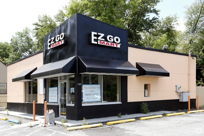


Property Detail
1469 E Front St
12-00442-0000-00007
ADDITIONAL LOTS: 1716 SQ FT
Commercialnec
Union
R-3
New Jersey
AE The base floodplain where base flood elevations are provided. AE Zones are now used on new format FIRMs instead of A1-A30 Zones.
7
2024
0.29 AC
2025
Route 22 East
038800
Northern New Jersey
1,716 SF
Newark, NJ
NEARBY LISTINGS FOR SALE OR LEASE
DEMOGRAPHICS near 1469 E Front St
1 mile
3 mile
5 mile
2024 Total Population
17,114
123,147
289,148
2029 Population
17,945
129,227
303,408
Pop Growth 2024-2029
+ 4.86%
+ 4.94%
+ 4.93%
Average Age
39
39
40
2024 Total Households
5,800
40,090
97,114
HH Growth 2024-2029
+ 4.98%
+ 5.10%
+ 5.07%
Median Household Inc
$107,112
$123,571
$135,409
Avg Household Size
2.90
3.00
2.90
2024 Avg HH Vehicles
2.00
2.00
2.00
Median Home Value
$465,852
$642,230
$671,458
Median Year Built
1953
1956
1959
Nearby Places
Map Layers
Map Styles
 Street
 Aerial
Transit
 Traffic
 Biking
Places
Listings with unknown addresses are not visible on the map
- Restaurants
- Banks
- Shops
- Fitness
- Groceries
PUBLIC TRANSPORTATION
COMMUTER RAIL
Netherwood (Raritan Valley Line - NJ Transit Commuter Rail (NJ Transit))
Drive
Walk
Distance
Netherwood (Raritan Valley Line - NJ Transit Commuter Rail (NJ Transit))
4 min
1.4 mi
Fanwood (Raritan Valley Line - NJ Transit Commuter Rail (NJ Transit))
Drive
Walk
Distance
Fanwood (Raritan Valley Line - NJ Transit Commuter Rail (NJ Transit))
5 min
1.6 mi
AIRPORT
Newark Liberty International
Drive
Walk
Distance
Newark Liberty International
26 min
18.6 mi
LaGuardia
Drive
Walk
Distance
LaGuardia
61 min
37.8 mi
John F Kennedy International
Drive
Walk
Distance
John F Kennedy International
73 min
46.1 mi
Freight Ports
New York Container Terminal
Drive
Walk
Distance
New York Container Terminal
32 min
16.3 mi
SALE & LEASE HISTORY
LISTING DATE
SALE/LEASE

Jul 09, 2018
For Lease
Nearby Properties
Address
Land Use
TOTAL SIZE
Lot Size
Zoning
Address
Land Use
TOTAL SIZE
Lot Size
Zoning
20.08 AC
RML1
Address
Land Use
TOTAL SIZE
Lot Size
Zoning
153.40 AC
OR
Address
Land Use
TOTAL SIZE
Lot Size
Zoning
439.33 AC
Address
Land Use
TOTAL SIZE
Lot Size
Zoning
0.42 AC
R-1
Address
Land Use
TOTAL SIZE
Lot Size
Zoning
26.87 AC
H-D
Address
Land Use
TOTAL SIZE
Lot Size
Zoning
47.69 AC
MU
Address
Land Use
TOTAL SIZE
Lot Size
Zoning
47.80 AC
H-D
Address
Land Use
TOTAL SIZE
Lot Size
Zoning
34.60 AC
MU
Address
Land Use
TOTAL SIZE
Lot Size
Zoning
140,732 SF
42.73 AC
OR
Address
Land Use
TOTAL SIZE
Lot Size
Zoning
15.79 AC
H-D
Address
Land Use
TOTAL SIZE
Lot Size
Zoning
24.92 AC
MU
Address
Land Use
TOTAL SIZE
Lot Size
Zoning
12.47 AC
H-D
Address
Land Use
TOTAL SIZE
Lot Size
Zoning
188,800 SF
5.61 AC
Address
Land Use
TOTAL SIZE
Lot Size
Zoning
19.84 AC
Address
Land Use
TOTAL SIZE
Lot Size
Zoning
4.74 AC
NC
Address
Land Use
TOTAL SIZE
Lot Size
Zoning
19.84 AC
H-D
Address
Land Use
TOTAL SIZE
Lot Size
Zoning
61,912 SF
16 AC
OR
Address
Land Use
TOTAL SIZE
Lot Size
Zoning
19.19 AC
R-3
Address
Land Use
TOTAL SIZE
Lot Size
Zoning
356.94 AC
OL
Address
Land Use
TOTAL SIZE
Lot Size
Zoning
21.53 AC
H-D
Address
Land Use
TOTAL SIZE
Lot Size
Zoning
122,820 SF
14.65 AC
H-D
Address
Land Use
TOTAL SIZE
Lot Size
Zoning
120 SF
9.80 AC
Address
Land Use
TOTAL SIZE
Lot Size
Zoning
600,000 SF
2.72 AC
Address
Land Use
TOTAL SIZE
Lot Size
Zoning
12.52 AC
H-D
Address
Land Use
TOTAL SIZE
Lot Size
Zoning
11.20 AC
Address
Land Use
TOTAL SIZE
Lot Size
Zoning
0.39 AC
R5
Address
Land Use
TOTAL SIZE
Lot Size
Zoning
9.06 AC
Address
Land Use
TOTAL SIZE
Lot Size
Zoning
28.80 AC
Address
Land Use
TOTAL SIZE
Lot Size
Zoning
6.76 AC
MU
Address
Land Use
TOTAL SIZE
Lot Size
Zoning
The World's #1 Commercial Real Estate Marketplace
Connect with us
© 2026 CoStar Group
The information above has been obtained from sources believed reliable. While we do not doubt its accuracy we have not verified it and make no guarantee, warranty or representation about it. It is your responsibility to independently confirm its accuracy and completeness. Any projections, opinions, assumptions, or estimates used are for example only and do not represent the current or future performance of the property. The value of this transaction to you depends on tax and other factors which should be evaluated by your tax, financial, and legal advisors. You and your advisors should conduct a careful, independent investigation of the property to determine to your satisfaction the suitability of the property for your needs.