Property Record
147 147 Dr, Jamaica, NY 11422


NEARBY LISTINGS FOR SALE OR LEASE
Property Detail
147 147 Dr
13640-0001
Queens
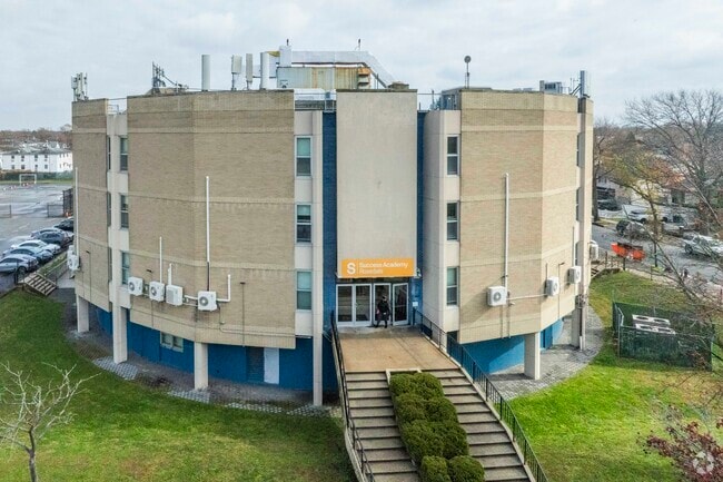
Publicschool
New York
X
1
36059C0213G
2.37 AC
0
South Queens
2025
Long Island (New York)
065600
New York-Jersey City-White Plains, NY-NJ
33,912 SF
DEMOGRAPHICS near 147 147 Dr
1 Mile
3 Mile
5 Mile
2024 Total Population
32,805
248,272
752,968
2029 Population
30,018
234,583
708,485
Pop Growth 2024-2029
(8.50%)
(5.51%)
(5.91%)
Average Age
41
41
41
2024 Total Households
9,778
77,409
234,824
HH Growth 2024-2029
(9.14%)
(5.84%)
(6.10%)
Median Household Inc
$100,645
$98,702
$87,432
Avg Household Size
3.20
3.10
3.00
2024 Avg HH Vehicles
2.00
2.00
1.00
Median Home Value
$674,482
$639,434
$647,607
Median Year Built
1958
1953
1952
Nearby Places
Map Layers
Map Styles
 Street
 Aerial
- Restaurants
- Banks
- Shops
- Fitness
- Groceries
PUBLIC TRANSPORTATION
COMMUTER RAIL
Rosedale Station (Far Rockaway Branch - Long Island Rail Road)
DRIVE
WALK
Distance
Rosedale Station (Far Rockaway Branch - Long Island Rail Road)
3 min
17 min
0.9 mi
Laurelton Station (Far Rockaway Branch - Long Island Rail Road)
DRIVE
WALK
Distance
Laurelton Station (Far Rockaway Branch - Long Island Rail Road)
5 min
1.8 mi
AIRPORT
John F Kennedy International
DRIVE
WALK
Distance
John F Kennedy International
12 min
5.9 mi
LaGuardia
DRIVE
WALK
Distance
LaGuardia
22 min
12.9 mi
Newark Liberty International
DRIVE
WALK
Distance
Newark Liberty International
49 min
32.6 mi
Freight Ports
NY - Red Hook Container Terminal
DRIVE
WALK
Distance
NY - Red Hook Container Terminal
33 min
17.3 mi
Nearby Properties
Address
Land Use
TOTAL SIZE
Lot Size
Zoning
Address
Land Use
TOTAL SIZE
Lot Size
Zoning
14,417,607 SF
4,921.45 AC
M1-1
Address
Land Use
TOTAL SIZE
Lot Size
Zoning
111.98 AC
PARK
Address
Land Use
TOTAL SIZE
Lot Size
Zoning
182.50 AC
M1-1
Address
Land Use
TOTAL SIZE
Lot Size
Zoning
124.60 AC
M1-1
Address
Land Use
TOTAL SIZE
Lot Size
Zoning
294.47 AC
PARK
Address
Land Use
TOTAL SIZE
Lot Size
Zoning
731,247 SF
56.09 AC
R3-2
Address
Land Use
TOTAL SIZE
Lot Size
Zoning
208,952 SF
9.03 AC
M1-1
Address
Land Use
TOTAL SIZE
Lot Size
Zoning
285,170 SF
12.63 AC
R3-1
Address
Land Use
TOTAL SIZE
Lot Size
Zoning
27.23 AC
PARK
Address
Land Use
TOTAL SIZE
Lot Size
Zoning
50,000 SF
52.45 AC
PARK
Address
Land Use
TOTAL SIZE
Lot Size
Zoning
175,040 SF
10.19 AC
R3X
Address
Land Use
TOTAL SIZE
Lot Size
Zoning
129,378 SF
4.86 AC
R2A
Address
Land Use
TOTAL SIZE
Lot Size
Zoning
304,128 SF
3.70 AC
R6
Address
Land Use
TOTAL SIZE
Lot Size
Zoning
160,000 SF
4.02 AC
R3-2
Address
Land Use
TOTAL SIZE
Lot Size
Zoning
64,618 SF
8.04 AC
Address
Land Use
TOTAL SIZE
Lot Size
Zoning
165,600 SF
2.11 AC
R6
Address
Land Use
TOTAL SIZE
Lot Size
Zoning
93.35 AC
PARK
Address
Land Use
TOTAL SIZE
Lot Size
Zoning
178,870 SF
7.60 AC
M1-1
Address
Land Use
TOTAL SIZE
Lot Size
Zoning
122,080 SF
2.81 AC
R2
Address
Land Use
TOTAL SIZE
Lot Size
Zoning
875 SF
21.59 AC
PARK
Address
Land Use
TOTAL SIZE
Lot Size
Zoning
5,296 SF
37.42 AC
PARK
Address
Land Use
TOTAL SIZE
Lot Size
Zoning
138,000 SF
7.06 AC
R3-2
Address
Land Use
TOTAL SIZE
Lot Size
Zoning
213,338 SF
2.91 AC
R3X
Address
Land Use
TOTAL SIZE
Lot Size
Zoning
252,665 SF
7.50 AC
R3-2
Address
Land Use
TOTAL SIZE
Lot Size
Zoning
964 SF
50.20 AC
PARK
Address
Land Use
TOTAL SIZE
Lot Size
Zoning
97,190 SF
1.75 AC
R3X
Address
Land Use
TOTAL SIZE
Lot Size
Zoning
56,385 SF
7.81 AC
R6
Address
Land Use
TOTAL SIZE
Lot Size
Zoning
75,410 SF
5.12 AC
M1-1
Address
Land Use
TOTAL SIZE
Lot Size
Zoning
78,380 SF
0.85 AC
R3-2
Address
Land Use
TOTAL SIZE
Lot Size
Zoning
806 SF
84.15 AC
R2A
The World's #1 Commercial Real Estate Marketplace
Connect with us
© 2025 CoStar Group
The information above has been obtained from sources believed reliable. While we do not doubt its accuracy we have not verified it and make no guarantee, warranty or representation about it. It is your responsibility to independently confirm its accuracy and completeness. Any projections, opinions, assumptions, or estimates used are for example only and do not represent the current or future performance of the property. The value of this transaction to you depends on tax and other factors which should be evaluated by your tax, financial, and legal advisors. You and your advisors should conduct a careful, independent investigation of the property to determine to your satisfaction the suitability of the property for your needs.