Property Record
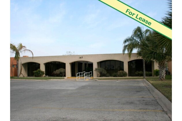
147 E Price Rd, Brownsville, TX 78521

Property Detail
147 E Price Rd
044450-0060-011000
LAND OLAKE SUBDIVISION BLKS 1-11 AMENDED LOT 11 BLK 6
Commercialnec
Cameron
A-C
Texas
B and X Area of moderate flood hazard, usually the area between the limits of the 100-year and 500-year floods.
11
2024
0.38 AC
2025
Greater Brownsville
013102
Brownsville/Harlingen
5,834 SF
Brownsville-Harlingen, TX
NEARBY LISTINGS FOR SALE OR LEASE
DEMOGRAPHICS near 147 E Price Rd
1 mile
3 mile
5 mile
2025 Total Population
13,442
110,073
190,869
2030 Population
13,759
112,199
194,781
Pop Growth 2025-2030
+ 2.36%
+ 1.93%
+ 2.05%
Average Age
36
36
36
2025 Total Households
4,290
35,001
58,625
HH Growth 2025-2030
+ 2.40%
+ 1.99%
+ 2.12%
Median Household Inc
$54,232
$43,951
$49,025
Avg Household Size
3.10
3.10
3.20
2025 Avg HH Vehicles
2.00
2.00
2.00
Median Home Value
$163,170
$127,679
$139,744
Median Year Built
1993
1988
1992
Nearby Places
Map Layers
Map Styles
 Street
 Aerial
Layers
 Traffic
 Biking
Places
Listings with unknown addresses are not visible on the map
- Restaurants
- Banks
- Shops
- Fitness
- Groceries
PUBLIC TRANSPORTATION
AIRPORT
Brownsville/South Padre Island International
Drive
Walk
Distance
Brownsville/South Padre Island International
9 min
4.0 mi
Valley International
Drive
Walk
Distance
Valley International
46 min
28.0 mi
Freight Ports
Port of Brownsville
Drive
Walk
Distance
Port of Brownsville
8 min
4.4 mi
Nearby Properties
Address
Land Use
TOTAL SIZE
Lot Size
Zoning
Address
Land Use
TOTAL SIZE
Lot Size
Zoning
591,279 SF
49.02 AC
Address
Land Use
TOTAL SIZE
Lot Size
Zoning
319,798 SF
46.28 AC
Address
Land Use
TOTAL SIZE
Lot Size
Zoning
452,559 SF
13.79 AC
C
Address
Land Use
TOTAL SIZE
Lot Size
Zoning
302,902 SF
6.61 AC
C
Address
Land Use
TOTAL SIZE
Lot Size
Zoning
286,243 SF
19.21 AC
C
Address
Land Use
TOTAL SIZE
Lot Size
Zoning
72,436 SF
22.08 AC
Address
Land Use
TOTAL SIZE
Lot Size
Zoning
145,240 SF
17.49 AC
Address
Land Use
TOTAL SIZE
Lot Size
Zoning
100,491 SF
14 AC
C
Address
Land Use
TOTAL SIZE
Lot Size
Zoning
167,653 SF
5.10 AC
Address
Land Use
TOTAL SIZE
Lot Size
Zoning
132,197 SF
10.70 AC
Address
Land Use
TOTAL SIZE
Lot Size
Zoning
148,781 SF
10.28 AC
B
Address
Land Use
TOTAL SIZE
Lot Size
Zoning
213,521 SF
38.75 AC
Address
Land Use
TOTAL SIZE
Lot Size
Zoning
131,240 SF
9.94 AC
C
Address
Land Use
TOTAL SIZE
Lot Size
Zoning
188,446 SF
18.42 AC
Address
Land Use
TOTAL SIZE
Lot Size
Zoning
62,344 SF
2.92 AC
Address
Land Use
TOTAL SIZE
Lot Size
Zoning
133,476 SF
8.14 AC
Address
Land Use
TOTAL SIZE
Lot Size
Zoning
107,815 SF
10 AC
Address
Land Use
TOTAL SIZE
Lot Size
Zoning
142,385 SF
0.50 AC
Address
Land Use
TOTAL SIZE
Lot Size
Zoning
120,166 SF
12.33 AC
Address
Land Use
TOTAL SIZE
Lot Size
Zoning
102,042 SF
8.68 AC
C
Address
Land Use
TOTAL SIZE
Lot Size
Zoning
176,990 SF
18.31 AC
C
Address
Land Use
TOTAL SIZE
Lot Size
Zoning
110,431 SF
15 AC
Address
Land Use
TOTAL SIZE
Lot Size
Zoning
87,909 SF
12 AC
Address
Land Use
TOTAL SIZE
Lot Size
Zoning
112,263 SF
9.66 AC
Address
Land Use
TOTAL SIZE
Lot Size
Zoning
80,480 SF
10.68 AC
Address
Land Use
TOTAL SIZE
Lot Size
Zoning
101,569 SF
1.95 AC
Address
Land Use
TOTAL SIZE
Lot Size
Zoning
392,622 SF
55 AC
I
Address
Land Use
TOTAL SIZE
Lot Size
Zoning
86,682 SF
25.76 AC
C
Address
Land Use
TOTAL SIZE
Lot Size
Zoning
241,619 SF
14.68 AC
The World's #1 Commercial Real Estate Marketplace
Connect with us
© 2026 CoStar Group
The information above has been obtained from sources believed reliable. While we do not doubt its accuracy we have not verified it and make no guarantee, warranty or representation about it. It is your responsibility to independently confirm its accuracy and completeness. Any projections, opinions, assumptions, or estimates used are for example only and do not represent the current or future performance of the property. The value of this transaction to you depends on tax and other factors which should be evaluated by your tax, financial, and legal advisors. You and your advisors should conduct a careful, independent investigation of the property to determine to your satisfaction the suitability of the property for your needs.