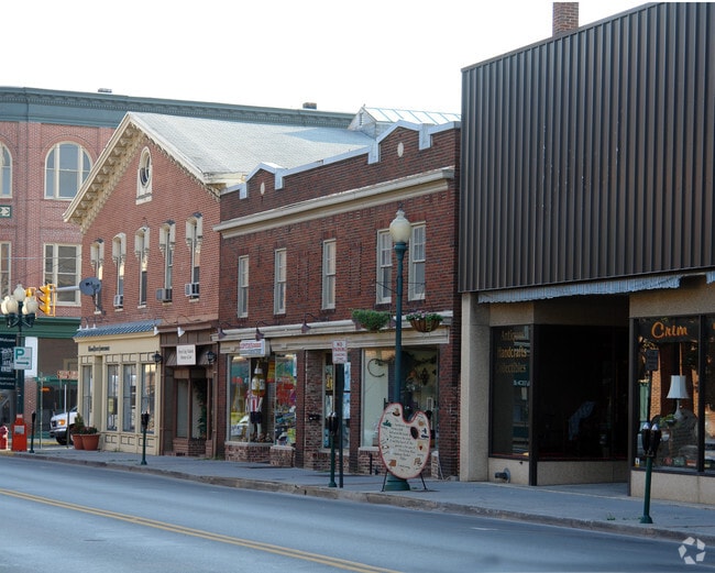
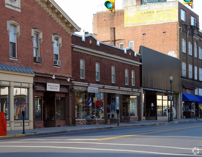
Property Record
147 N Queen St, Martinsburg, WV 25401
NEARBY LISTINGS FOR SALE OR LEASE
Property Detail
147 N Queen St
Hagerstown-Martinsburg, MD-WV
LOT 18 145-149 N QUEEN 51.7X10³
06-14-04770000
Berkeley
Storebuilding
West Virginia
X
18
54037C0005E
0.12 AC
2025
Berkeley County
2025
Washington, DC
971500
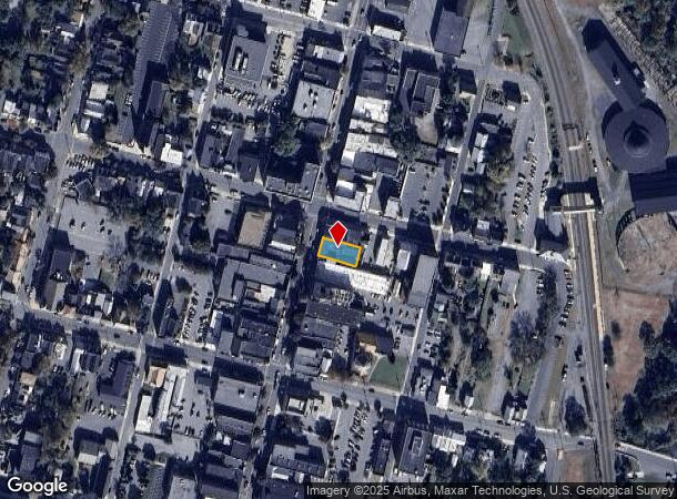
DEMOGRAPHICS near 147 N Queen St
1 Mile
3 Mile
5 Mile
2024 Total Population
12,855
42,412
64,176
2029 Population
14,782
48,622
73,701
Pop Growth 2024-2029
+ 14.99%
+ 14.64%
+ 14.84%
Average Age
40
39
39
2024 Total Households
5,541
17,220
25,408
HH Growth 2024-2029
+ 15.63%
+ 15.27%
+ 15.45%
Median Household Inc
$42,980
$56,226
$65,117
Avg Household Size
2.20
2.40
2.40
2024 Avg HH Vehicles
1.00
2.00
2.00
Median Home Value
$148,734
$194,892
$222,025
Median Year Built
1953
1988
1993
Nearby Places
Map Layers
Map Styles
 Street
 Aerial
- Restaurants
- Banks
- Shops
- Fitness
- Groceries
PUBLIC TRANSPORTATION
TRANSIT/SUBWAY
Martinsburg (Brunswick Line - Maryland Area Regional Commuter Trains (The MARC))
DRIVE
WALK
Distance
Martinsburg (Brunswick Line - Maryland Area Regional Commuter Trains (The MARC))
1 min
3 min
0.1 mi
COMMUTER RAIL
DRIVE
WALK
Distance
1 min
2 min
0.1 mi
Martinsburg (Brunswick Line - Maryland Area Regional Commuter Trains (The MARC))
DRIVE
WALK
Distance
Martinsburg (Brunswick Line - Maryland Area Regional Commuter Trains (The MARC))
1 min
3 min
0.1 mi
AIRPORT
Hagerstown Regional/Richard A Henson Field
DRIVE
WALK
Distance
Hagerstown Regional/Richard A Henson Field
31 min
23.9 mi
SALE & LEASE HISTORY
LISTING DATE
SALE/LEASE

Jan 18, 2017
For Lease
Dec 14, 2016
For Sale
Nearby Properties
Address
Land Use
TOTAL SIZE
Lot Size
Zoning
Address
Land Use
TOTAL SIZE
Lot Size
Zoning
Address
Land Use
TOTAL SIZE
Lot Size
Zoning
18.46 AC
Address
Land Use
TOTAL SIZE
Lot Size
Zoning
849.14 AC
Address
Land Use
TOTAL SIZE
Lot Size
Zoning
Address
Land Use
TOTAL SIZE
Lot Size
Zoning
56.33 AC
Address
Land Use
TOTAL SIZE
Lot Size
Zoning
15.61 AC
Address
Land Use
TOTAL SIZE
Lot Size
Zoning
25.69 AC
Address
Land Use
TOTAL SIZE
Lot Size
Zoning
9.11 AC
Address
Land Use
TOTAL SIZE
Lot Size
Zoning
Address
Land Use
TOTAL SIZE
Lot Size
Zoning
17.02 AC
Address
Land Use
TOTAL SIZE
Lot Size
Zoning
Address
Land Use
TOTAL SIZE
Lot Size
Zoning
18.45 AC
Address
Land Use
TOTAL SIZE
Lot Size
Zoning
8.47 AC
Address
Land Use
TOTAL SIZE
Lot Size
Zoning
4.31 AC
Address
Land Use
TOTAL SIZE
Lot Size
Zoning
Address
Land Use
TOTAL SIZE
Lot Size
Zoning
Address
Land Use
TOTAL SIZE
Lot Size
Zoning
Address
Land Use
TOTAL SIZE
Lot Size
Zoning
5.35 AC
Address
Land Use
TOTAL SIZE
Lot Size
Zoning
Address
Land Use
TOTAL SIZE
Lot Size
Zoning
Address
Land Use
TOTAL SIZE
Lot Size
Zoning
4.40 AC
Address
Land Use
TOTAL SIZE
Lot Size
Zoning
2.46 AC
Address
Land Use
TOTAL SIZE
Lot Size
Zoning
10.74 AC
Address
Land Use
TOTAL SIZE
Lot Size
Zoning
4.40 AC
Address
Land Use
TOTAL SIZE
Lot Size
Zoning
Address
Land Use
TOTAL SIZE
Lot Size
Zoning
0.14 AC
Address
Land Use
TOTAL SIZE
Lot Size
Zoning
6.16 AC
Address
Land Use
TOTAL SIZE
Lot Size
Zoning
2.20 AC
Address
Land Use
TOTAL SIZE
Lot Size
Zoning
16.91 AC
Address
Land Use
TOTAL SIZE
Lot Size
Zoning
The World's #1 Commercial Real Estate Marketplace
Connect with us
© 2025 CoStar Group
The information above has been obtained from sources believed reliable. While we do not doubt its accuracy we have not verified it and make no guarantee, warranty or representation about it. It is your responsibility to independently confirm its accuracy and completeness. Any projections, opinions, assumptions, or estimates used are for example only and do not represent the current or future performance of the property. The value of this transaction to you depends on tax and other factors which should be evaluated by your tax, financial, and legal advisors. You and your advisors should conduct a careful, independent investigation of the property to determine to your satisfaction the suitability of the property for your needs.