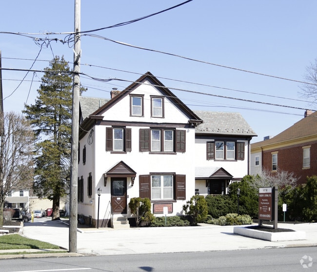
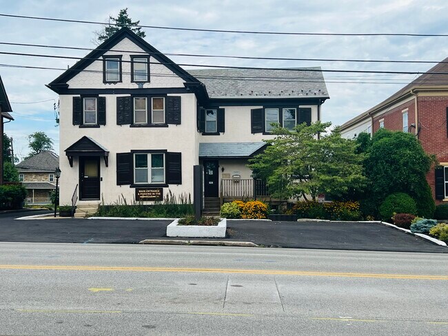
Property Record
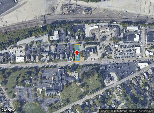
147 W Lancaster Ave, Paoli, PA 19301
NEARBY LISTINGS FOR SALE OR LEASE
Property Detail
147 W Lancaster Ave
54-01L-0070.0000
LOT OFFICE & APT
Officebuilding
Chester
X
Pennsylvania
42029C0165G
0.28 AC
2024
Upper Main Line
2025
Philadelphia
300303
Philadelphia-Camden-Wilmington, PA-NJ-DE-MD
4,952 SF
DEMOGRAPHICS near 147 W Lancaster Ave
1 Mile
3 Mile
5 Mile
2024 Total Population
7,580
38,693
91,635
2029 Population
7,940
40,526
95,761
Pop Growth 2024-2029
+ 4.75%
+ 4.74%
+ 4.50%
Average Age
43
42
43
2024 Total Households
3,113
15,228
34,977
HH Growth 2024-2029
+ 4.98%
+ 4.91%
+ 4.65%
Median Household Inc
$106,742
$138,786
$138,163
Avg Household Size
2.40
2.50
2.50
2024 Avg HH Vehicles
2.00
2.00
2.00
Median Home Value
$482,572
$622,298
$654,240
Median Year Built
1966
1975
1977
Nearby Places
Map Layers
Map Styles
 Street
 Aerial
- Restaurants
- Banks
- Shops
- Fitness
- Groceries
PUBLIC TRANSPORTATION
TRANSIT/SUBWAY
Paoli (R5 - Southeastern Pennsylvania Transportation Authority Regional Rail (SEPTA Regional Rail))
DRIVE
WALK
Distance
Paoli (R5 - Southeastern Pennsylvania Transportation Authority Regional Rail (SEPTA Regional Rail))
2 min
8 min
0.4 mi
COMMUTER RAIL
Paoli (R5 - Southeastern Pennsylvania Transportation Authority Regional Rail (SEPTA Regional Rail))
DRIVE
WALK
Distance
Paoli (R5 - Southeastern Pennsylvania Transportation Authority Regional Rail (SEPTA Regional Rail))
2 min
10 min
0.4 mi
Malvern (R5 - Southeastern Pennsylvania Transportation Authority Regional Rail (SEPTA Regional Rail))
DRIVE
WALK
Distance
Malvern (R5 - Southeastern Pennsylvania Transportation Authority Regional Rail (SEPTA Regional Rail))
4 min
1.5 mi
AIRPORT
Philadelphia International
DRIVE
WALK
Distance
Philadelphia International
40 min
22.4 mi
Freight Ports
South Jersey Port
DRIVE
WALK
Distance
South Jersey Port
44 min
28.2 mi
SALE & LEASE HISTORY
LISTING DATE
SALE/LEASE

Sep 25, 2017
For Lease
Nearby Properties
Address
Land Use
TOTAL SIZE
Lot Size
Zoning
Address
Land Use
TOTAL SIZE
Lot Size
Zoning
887,909 SF
22.50 AC
I
Address
Land Use
TOTAL SIZE
Lot Size
Zoning
691,182 SF
84.22 AC
GI
Address
Land Use
TOTAL SIZE
Lot Size
Zoning
1,173,683 SF
56.30 AC
LI
Address
Land Use
TOTAL SIZE
Lot Size
Zoning
615,910 SF
24.84 AC
C1
Address
Land Use
TOTAL SIZE
Lot Size
Zoning
921,976 SF
111 AC
PO1
Address
Land Use
TOTAL SIZE
Lot Size
Zoning
451,865 SF
19.90 AC
R2
Address
Land Use
TOTAL SIZE
Lot Size
Zoning
447,886 SF
13.17 AC
C1
Address
Land Use
TOTAL SIZE
Lot Size
Zoning
268,392 SF
13.73 AC
RIC
Address
Land Use
TOTAL SIZE
Lot Size
Zoning
63,648 SF
8.60 AC
C2
Address
Land Use
TOTAL SIZE
Lot Size
Zoning
377,378 SF
33.20 AC
LI
Address
Land Use
TOTAL SIZE
Lot Size
Zoning
395,031 SF
17.96 AC
PIP
Address
Land Use
TOTAL SIZE
Lot Size
Zoning
412,888 SF
44.75 AC
LI
Address
Land Use
TOTAL SIZE
Lot Size
Zoning
338,507 SF
2.08 AC
R2
Address
Land Use
TOTAL SIZE
Lot Size
Zoning
351,149 SF
12.73 AC
OA
Address
Land Use
TOTAL SIZE
Lot Size
Zoning
238,137 SF
6.29 AC
C1
Address
Land Use
TOTAL SIZE
Lot Size
Zoning
214,675 SF
22.50 AC
PO2
Address
Land Use
TOTAL SIZE
Lot Size
Zoning
413,028 SF
3.92 AC
C2
Address
Land Use
TOTAL SIZE
Lot Size
Zoning
163,400 SF
16.90 AC
R2
Address
Land Use
TOTAL SIZE
Lot Size
Zoning
224,421 SF
97.34 AC
R1
Address
Land Use
TOTAL SIZE
Lot Size
Zoning
154,066 SF
18.10 AC
O
Address
Land Use
TOTAL SIZE
Lot Size
Zoning
124,849 SF
22.09 AC
RIC
Address
Land Use
TOTAL SIZE
Lot Size
Zoning
223,303 SF
15.80 AC
LI
Address
Land Use
TOTAL SIZE
Lot Size
Zoning
129,207 SF
13.24 AC
R2
Address
Land Use
TOTAL SIZE
Lot Size
Zoning
299,258 SF
11.90 AC
OA
Address
Land Use
TOTAL SIZE
Lot Size
Zoning
162,799 SF
44.40 AC
O
Address
Land Use
TOTAL SIZE
Lot Size
Zoning
144,024 SF
10 AC
RIC
Address
Land Use
TOTAL SIZE
Lot Size
Zoning
141,810 SF
20 AC
LI
Address
Land Use
TOTAL SIZE
Lot Size
Zoning
93,484 SF
18.30 AC
R1
Address
Land Use
TOTAL SIZE
Lot Size
Zoning
184,309 SF
24.70 AC
C1
Address
Land Use
TOTAL SIZE
Lot Size
Zoning
125,700 SF
11.50 AC
R2
The World's #1 Commercial Real Estate Marketplace
Connect with us
© 2025 CoStar Group
The information above has been obtained from sources believed reliable. While we do not doubt its accuracy we have not verified it and make no guarantee, warranty or representation about it. It is your responsibility to independently confirm its accuracy and completeness. Any projections, opinions, assumptions, or estimates used are for example only and do not represent the current or future performance of the property. The value of this transaction to you depends on tax and other factors which should be evaluated by your tax, financial, and legal advisors. You and your advisors should conduct a careful, independent investigation of the property to determine to your satisfaction the suitability of the property for your needs.