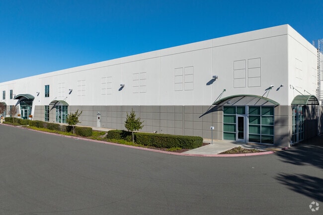
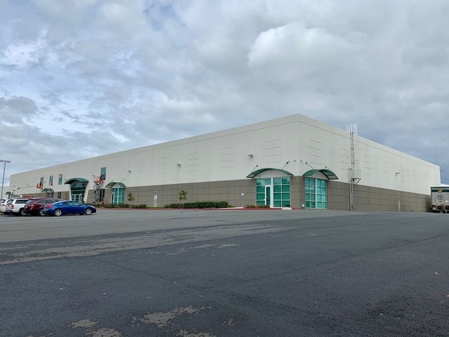
Property Record
1470 Cader Ln, Petaluma, CA 94954

Current Lease Availabilities
Property Detail
1470 Cader Ln
005-040-071
2018 FM PTN 005-040-057, PER PM 401, PCL B
Lightindustrial
Sonoma
B and X Area of moderate flood hazard, usually the area between the limits of the 100-year and 500-year floods.
California
2025
3.73 AC
2025
Petaluma/Cotati/Rohnert
150612
North Bay/Santa Rosa
80,000 SF
Santa Rosa-Petaluma, CA
NEARBY LISTINGS FOR SALE OR LEASE
DEMOGRAPHICS near 1470 Cader Ln
1 mile
3 mile
5 mile
2025 Total Population
7,210
45,777
64,150
2030 Population
7,189
45,914
63,994
Pop Growth 2025-2030
(0.29%)
+ 0.30%
(0.24%)
Average Age
41
43
44
2025 Total Households
2,671
17,657
24,950
HH Growth 2025-2030
(0.19%)
+ 0.39%
(0.20%)
Median Household Inc
$116,911
$109,543
$112,608
Avg Household Size
2.60
2.50
2.50
2025 Avg HH Vehicles
2.00
2.00
2.00
Median Home Value
$805,229
$827,683
$838,013
Median Year Built
1985
1977
1980
Nearby Places
Map Layers
Map Styles
 Street
 Aerial
Layers
 Traffic
 Biking
Places
Listings with unknown addresses are not visible on the map
- Restaurants
- Banks
- Shops
- Fitness
- Groceries
PUBLIC TRANSPORTATION
COMMUTER RAIL
Smart Petaluma Downtown (Main Line - Sonoma Marin Area Rail Transit)
Drive
Walk
Distance
Smart Petaluma Downtown (Main Line - Sonoma Marin Area Rail Transit)
5 min
2.5 mi
Smart Petaluma North (Main Line - Sonoma Marin Area Rail Transit)
Drive
Walk
Distance
Smart Petaluma North (Main Line - Sonoma Marin Area Rail Transit)
10 min
4.5 mi
AIRPORT
Charles M Schulz - Sonoma County
Drive
Walk
Distance
Charles M Schulz - Sonoma County
34 min
26.0 mi
Freight Ports
Port of Richmond
Drive
Walk
Distance
Port of Richmond
46 min
33.6 mi
Nearby Properties
Address
Land Use
TOTAL SIZE
Lot Size
Zoning
Address
Land Use
TOTAL SIZE
Lot Size
Zoning
456,584 SF
32.23 AC
CITYPE
Address
Land Use
TOTAL SIZE
Lot Size
Zoning
0.76 AC
ML
Address
Land Use
TOTAL SIZE
Lot Size
Zoning
226,772 SF
8.05 AC
Address
Land Use
TOTAL SIZE
Lot Size
Zoning
38,083 SF
16.14 AC
Address
Land Use
TOTAL SIZE
Lot Size
Zoning
3,967 SF
5.03 AC
CITYPE
Address
Land Use
TOTAL SIZE
Lot Size
Zoning
150,025 SF
1.48 AC
Address
Land Use
TOTAL SIZE
Lot Size
Zoning
39,000 SF
11.06 AC
CITYPE
Address
Land Use
TOTAL SIZE
Lot Size
Zoning
134,732 SF
2.05 AC
Address
Land Use
TOTAL SIZE
Lot Size
Zoning
165,541 SF
12.61 AC
Address
Land Use
TOTAL SIZE
Lot Size
Zoning
63,000 SF
5.40 AC
CITYPE
Address
Land Use
TOTAL SIZE
Lot Size
Zoning
137,270 SF
10.04 AC
Address
Land Use
TOTAL SIZE
Lot Size
Zoning
35,408 SF
2.66 AC
Address
Land Use
TOTAL SIZE
Lot Size
Zoning
82,704 SF
14.63 AC
CITYPE
Address
Land Use
TOTAL SIZE
Lot Size
Zoning
59,351 SF
14.53 AC
Address
Land Use
TOTAL SIZE
Lot Size
Zoning
32,000 SF
5.89 AC
PCD
Address
Land Use
TOTAL SIZE
Lot Size
Zoning
98,382 SF
6.83 AC
SP
Address
Land Use
TOTAL SIZE
Lot Size
Zoning
23,979 SF
5.85 AC
Address
Land Use
TOTAL SIZE
Lot Size
Zoning
120,480 SF
6.87 AC
CITYPE
Address
Land Use
TOTAL SIZE
Lot Size
Zoning
72,576 SF
8.39 AC
Address
Land Use
TOTAL SIZE
Lot Size
Zoning
109,993 SF
2.31 AC
Address
Land Use
TOTAL SIZE
Lot Size
Zoning
85,582 SF
2.61 AC
CITYPE
Address
Land Use
TOTAL SIZE
Lot Size
Zoning
83,109 SF
9.56 AC
Address
Land Use
TOTAL SIZE
Lot Size
Zoning
165,000 SF
9.99 AC
Address
Land Use
TOTAL SIZE
Lot Size
Zoning
5,640 SF
7.31 AC
CITYPE
Address
Land Use
TOTAL SIZE
Lot Size
Zoning
73,279 SF
0.96 AC
MG
Address
Land Use
TOTAL SIZE
Lot Size
Zoning
70,110 SF
1.11 AC
CITYPE
Address
Land Use
TOTAL SIZE
Lot Size
Zoning
10,000 SF
16.50 AC
Address
Land Use
TOTAL SIZE
Lot Size
Zoning
94,000 SF
4.87 AC
Address
Land Use
TOTAL SIZE
Lot Size
Zoning
71,600 SF
9.78 AC
CITYPE
The World's #1 Commercial Real Estate Marketplace
Connect with us
© 2026 CoStar Group
The information above has been obtained from sources believed reliable. While we do not doubt its accuracy we have not verified it and make no guarantee, warranty or representation about it. It is your responsibility to independently confirm its accuracy and completeness. Any projections, opinions, assumptions, or estimates used are for example only and do not represent the current or future performance of the property. The value of this transaction to you depends on tax and other factors which should be evaluated by your tax, financial, and legal advisors. You and your advisors should conduct a careful, independent investigation of the property to determine to your satisfaction the suitability of the property for your needs.