Property Record
1471 Greg St, Sparks, NV 89431
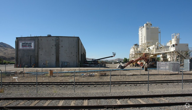

Property Detail
1471 Greg St
034-161-08
FR SEC 14 & 15 TWP 19 RGE 20
Multipleuses
Washoe
I
Nevada
AE The base floodplain where base flood elevations are provided. AE Zones are now used on new format FIRMs instead of A1-A30 Zones.
7.68 AC
0
Sparks
2026
Reno/Sparks
003111
Reno, NV
20,351 SF
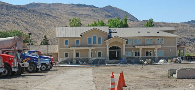
NEARBY LISTINGS FOR SALE OR LEASE
DEMOGRAPHICS near 1471 Greg St
1 mile
3 mile
5 mile
2025 Total Population
261
50,333
160,716
2030 Population
270
51,392
164,579
Pop Growth 2025-2030
+ 3.45%
+ 2.10%
+ 2.40%
Average Age
38
41
39
2025 Total Households
48
20,492
64,055
HH Growth 2025-2030
+ 2.08%
+ 2.39%
+ 2.59%
Median Household Inc
$65,000
$82,263
$69,082
Avg Household Size
2.10
2.40
2.40
2025 Avg HH Vehicles
2.00
2.00
2.00
Median Home Value
$62,499
$452,269
$434,791
Median Year Built
1976
1982
1982
Nearby Places
Map Layers
Map Styles
 Street
 Aerial
Transit
 Traffic
 Biking
Places
Listings with unknown addresses are not visible on the map
- Restaurants
- Banks
- Shops
- Fitness
- Groceries
PUBLIC TRANSPORTATION
COMMUTER RAIL
Reno (California Zephyr - Amtrak)
Drive
Walk
Distance
Reno (California Zephyr - Amtrak)
8 min
3.2 mi
AIRPORT
Reno/Tahoe International
Drive
Walk
Distance
Reno/Tahoe International
23 min
5.1 mi
Freight Ports
Port of Stockton
Drive
Walk
Distance
Port of Stockton
212 min
182.3 mi
Nearby Properties
Address
Land Use
TOTAL SIZE
Lot Size
Zoning
Address
Land Use
TOTAL SIZE
Lot Size
Zoning
2,041,608 SF
28.47 AC
MU
Address
Land Use
TOTAL SIZE
Lot Size
Zoning
1,638,272 SF
17.11 AC
MU
Address
Land Use
TOTAL SIZE
Lot Size
Zoning
762,384 SF
1,131.28 AC
MA
Address
Land Use
TOTAL SIZE
Lot Size
Zoning
1,103,124 SF
138.61 AC
MU
Address
Land Use
TOTAL SIZE
Lot Size
Zoning
799,762 SF
13.30 AC
MU
Address
Land Use
TOTAL SIZE
Lot Size
Zoning
1,865,345 SF
2.75 AC
MD-ED
Address
Land Use
TOTAL SIZE
Lot Size
Zoning
1.47 AC
MD-UD
Address
Land Use
TOTAL SIZE
Lot Size
Zoning
1,048,514 SF
1.30 AC
MU
Address
Land Use
TOTAL SIZE
Lot Size
Zoning
759,161 SF
37.37 AC
MU
Address
Land Use
TOTAL SIZE
Lot Size
Zoning
385,812 SF
16.47 AC
NUD
Address
Land Use
TOTAL SIZE
Lot Size
Zoning
991,800 SF
51.03 AC
PD
Address
Land Use
TOTAL SIZE
Lot Size
Zoning
497,928 SF
3.52 AC
MU
Address
Land Use
TOTAL SIZE
Lot Size
Zoning
645,699 SF
4.53 AC
MU
Address
Land Use
TOTAL SIZE
Lot Size
Zoning
501,541 SF
2.89 AC
MD-ED
Address
Land Use
TOTAL SIZE
Lot Size
Zoning
294,872 SF
69.02 AC
PF
Address
Land Use
TOTAL SIZE
Lot Size
Zoning
296,048 SF
93.65 AC
PF
Address
Land Use
TOTAL SIZE
Lot Size
Zoning
460,367 SF
1.52 AC
MD-ED
Address
Land Use
TOTAL SIZE
Lot Size
Zoning
356,160 SF
12.05 AC
MUD
Address
Land Use
TOTAL SIZE
Lot Size
Zoning
347,564 SF
10.23 AC
MUD
Address
Land Use
TOTAL SIZE
Lot Size
Zoning
232,156 SF
1.76 AC
MU
Address
Land Use
TOTAL SIZE
Lot Size
Zoning
460,688 SF
62.55 AC
PF
Address
Land Use
TOTAL SIZE
Lot Size
Zoning
234,478 SF
2.93 AC
MD-ED
Address
Land Use
TOTAL SIZE
Lot Size
Zoning
342,947 SF
8.95 AC
MF30
Address
Land Use
TOTAL SIZE
Lot Size
Zoning
587,380 SF
2.59 AC
MD-ED
Address
Land Use
TOTAL SIZE
Lot Size
Zoning
257,400 SF
2.71 AC
MD-ED
Address
Land Use
TOTAL SIZE
Lot Size
Zoning
194,000 SF
2.24 AC
MD-RD
Address
Land Use
TOTAL SIZE
Lot Size
Zoning
283,243 SF
2.02 AC
MD-UD
Address
Land Use
TOTAL SIZE
Lot Size
Zoning
365,962 SF
3.54 AC
PD
Address
Land Use
TOTAL SIZE
Lot Size
Zoning
617,081 SF
2.62 AC
MUD
Address
Land Use
TOTAL SIZE
Lot Size
Zoning
109,936 SF
1.80 AC
MD-RD
The World's #1 Commercial Real Estate Marketplace
Connect with us
© 2026 CoStar Group
The information above has been obtained from sources believed reliable. While we do not doubt its accuracy we have not verified it and make no guarantee, warranty or representation about it. It is your responsibility to independently confirm its accuracy and completeness. Any projections, opinions, assumptions, or estimates used are for example only and do not represent the current or future performance of the property. The value of this transaction to you depends on tax and other factors which should be evaluated by your tax, financial, and legal advisors. You and your advisors should conduct a careful, independent investigation of the property to determine to your satisfaction the suitability of the property for your needs.