Property Record
1471 Straight Path, Wyandanch, NY 11798


NEARBY LISTINGS FOR SALE OR LEASE
-
-
View all Wyandanch listings for sale on LoopNet.com
Property Detail
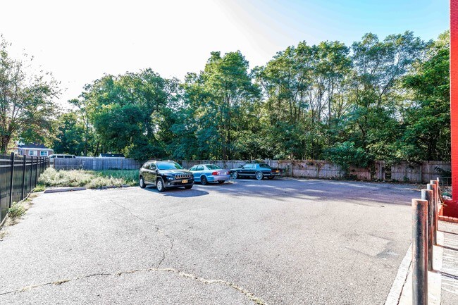
1471 Straight Path
Nassau County-Suffolk County, NY
N-OLSEN E- OLSEN S-HAGERMAN BROS W- STRAIGHT PH
0100-055-00-03-00-005-000
Suffolk
Commercialcondominium
New York
X
5
36103C0855H
0.32 AC
2024
Wyandanch
2024
Long Island (New York)
123401
DEMOGRAPHICS near 1471 Straight Path
1 Mile
3 Mile
5 Mile
2024 Total Population
17,569
102,074
270,965
2029 Population
17,184
99,693
265,265
Pop Growth 2024-2029
(2.19%)
(2.33%)
(2.10%)
Average Age
36
40
41
2024 Total Households
4,474
31,893
87,974
HH Growth 2024-2029
(2.30%)
(2.58%)
(2.27%)
Median Household Inc
$94,699
$114,710
$117,892
Avg Household Size
3.60
3.10
2.90
2024 Avg HH Vehicles
2.00
2.00
2.00
Median Home Value
$415,472
$456,516
$476,120
Median Year Built
1972
1963
1962
Nearby Places
Map Layers
Map Styles
 Street
 Aerial
- Restaurants
- Banks
- Shops
- Fitness
- Groceries
PUBLIC TRANSPORTATION
TRANSIT/SUBWAY
Wyandanch Station (Ronkonkoma Branch - Long Island Rail Road)
DRIVE
WALK
Distance
Wyandanch Station (Ronkonkoma Branch - Long Island Rail Road)
1 min
12 min
0.6 mi
COMMUTER RAIL
Wyandanch Station (Ronkonkoma Branch - Long Island Rail Road)
DRIVE
WALK
Distance
Wyandanch Station (Ronkonkoma Branch - Long Island Rail Road)
1 min
12 min
0.6 mi
Pinelawn Station (Ronkonkoma Branch - Long Island Rail Road)
DRIVE
WALK
Distance
Pinelawn Station (Ronkonkoma Branch - Long Island Rail Road)
6 min
2.2 mi
AIRPORT
Long Island MacArthur
DRIVE
WALK
Distance
Long Island MacArthur
28 min
17.7 mi
John F Kennedy International
DRIVE
WALK
Distance
John F Kennedy International
39 min
28.0 mi
LaGuardia
DRIVE
WALK
Distance
LaGuardia
50 min
35.0 mi
Freight Ports
NY - Red Hook Container Terminal
DRIVE
WALK
Distance
NY - Red Hook Container Terminal
60 min
39.4 mi
SALE & LEASE HISTORY
LISTING DATE
SALE/LEASE

Sep 24, 2016
For Sale
Oct 21, 2019
For Sale
Nov 14, 2017
For Sale
Jul 10, 2017
For Sale
Aug 18, 2017
For Sale
Nearby Properties
Address
Land Use
TOTAL SIZE
Lot Size
Zoning
Address
Land Use
TOTAL SIZE
Lot Size
Zoning
756 SF
0.36 AC
B1
Address
Land Use
TOTAL SIZE
Lot Size
Zoning
3.31 AC
R40
Address
Land Use
TOTAL SIZE
Lot Size
Zoning
336,442 SF
43.50 AC
G
Address
Land Use
TOTAL SIZE
Lot Size
Zoning
2,388 SF
0.36 AC
B1
Address
Land Use
TOTAL SIZE
Lot Size
Zoning
400 AC
A
Address
Land Use
TOTAL SIZE
Lot Size
Zoning
24.75 AC
R40
Address
Land Use
TOTAL SIZE
Lot Size
Zoning
1,680 SF
0.15 AC
B1
Address
Land Use
TOTAL SIZE
Lot Size
Zoning
5.95 AC
C
Address
Land Use
TOTAL SIZE
Lot Size
Zoning
0.55 AC
VILLA
Address
Land Use
TOTAL SIZE
Lot Size
Zoning
16.90 AC
EA
Address
Land Use
TOTAL SIZE
Lot Size
Zoning
3.80 AC
BUS1
Address
Land Use
TOTAL SIZE
Lot Size
Zoning
11.10 AC
SC
Address
Land Use
TOTAL SIZE
Lot Size
Zoning
114.70 AC
A
Address
Land Use
TOTAL SIZE
Lot Size
Zoning
292.40 AC
A
Address
Land Use
TOTAL SIZE
Lot Size
Zoning
0.26 AC
R20
Address
Land Use
TOTAL SIZE
Lot Size
Zoning
32.60 AC
I1
Address
Land Use
TOTAL SIZE
Lot Size
Zoning
52.20 AC
R40
Address
Land Use
TOTAL SIZE
Lot Size
Zoning
16.81 AC
Address
Land Use
TOTAL SIZE
Lot Size
Zoning
248.60 AC
A
Address
Land Use
TOTAL SIZE
Lot Size
Zoning
200,065 SF
16.60 AC
GA
Address
Land Use
TOTAL SIZE
Lot Size
Zoning
33 AC
R40
Address
Land Use
TOTAL SIZE
Lot Size
Zoning
260,092 SF
7.07 AC
GA
Address
Land Use
TOTAL SIZE
Lot Size
Zoning
15.20 AC
Address
Land Use
TOTAL SIZE
Lot Size
Zoning
232.90 AC
A
Address
Land Use
TOTAL SIZE
Lot Size
Zoning
11 AC
R40
Address
Land Use
TOTAL SIZE
Lot Size
Zoning
10.10 AC
SC
Address
Land Use
TOTAL SIZE
Lot Size
Zoning
128,999 SF
7.43 AC
G
Address
Land Use
TOTAL SIZE
Lot Size
Zoning
49.49 AC
B
Address
Land Use
TOTAL SIZE
Lot Size
Zoning
14.23 AC
I1
Address
Land Use
TOTAL SIZE
Lot Size
Zoning
236 AC
A
The World's #1 Commercial Real Estate Marketplace
Connect with us
© 2026 CoStar Group
The information above has been obtained from sources believed reliable. While we do not doubt its accuracy we have not verified it and make no guarantee, warranty or representation about it. It is your responsibility to independently confirm its accuracy and completeness. Any projections, opinions, assumptions, or estimates used are for example only and do not represent the current or future performance of the property. The value of this transaction to you depends on tax and other factors which should be evaluated by your tax, financial, and legal advisors. You and your advisors should conduct a careful, independent investigation of the property to determine to your satisfaction the suitability of the property for your needs.