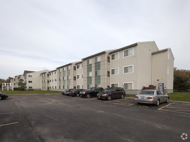
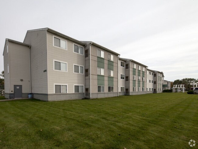
Property Record
14725 Vine Ave, Harvey, IL 60426

NEARBY LISTINGS FOR SALE OR LEASE
Property Detail
14725 Vine Ave
Chicago-Naperville-Elgin, IL-IN-WI
Chases Sub
29-08-301-057-0000
(CHASES) SUB OF BLK 11 OF SOUTH LAWN SUB IN SEC 17 & PT SEC 8 SH SEC 08-36-14
Taxexempt
Cook
X
Illinois
17031C0732J
11-14
2023
1.28 AC
2025
Southern Cook County
827100
Chicago
68,208 SF
DEMOGRAPHICS near 14725 Vine Ave
1 Mile
3 Mile
5 Mile
2024 Total Population
14,443
104,304
284,202
2029 Population
14,657
103,726
279,042
Pop Growth 2024-2029
+ 1.48%
(0.55%)
(1.82%)
Average Age
39
39
40
2024 Total Households
5,161
36,923
105,075
HH Growth 2024-2029
+ 1.20%
(0.78%)
(2.15%)
Median Household Inc
$32,418
$43,660
$51,686
Avg Household Size
2.70
2.70
2.60
2024 Avg HH Vehicles
1.00
2.00
2.00
Median Home Value
$79,300
$107,184
$143,164
Median Year Built
1961
1961
1963
Nearby Places
Map Layers
Map Styles
 Street
 Aerial
- Restaurants
- Banks
- Shops
- Fitness
- Groceries
PUBLIC TRANSPORTATION
COMMUTER RAIL
147Th St. (Metra Electric - Metra)
DRIVE
WALK
Distance
147Th St. (Metra Electric - Metra)
2 min
19 min
1.0 mi
Harvey Station (Metra Electric Line - Northeast Illinois Regional Commuter Railroad (Metra))
DRIVE
WALK
Distance
Harvey Station (Metra Electric Line - Northeast Illinois Regional Commuter Railroad (Metra))
4 min
1.7 mi
AIRPORT
Chicago Midway International
DRIVE
WALK
Distance
Chicago Midway International
26 min
15.6 mi
Chicago O'Hare International
DRIVE
WALK
Distance
Chicago O'Hare International
51 min
37.4 mi
Freight Ports
Port Milwaukee
DRIVE
WALK
Distance
Port Milwaukee
132 min
109.1 mi
Nearby Properties
Address
Land Use
TOTAL SIZE
Lot Size
Zoning
Address
Land Use
TOTAL SIZE
Lot Size
Zoning
1.45 AC
Address
Land Use
TOTAL SIZE
Lot Size
Zoning
88,008 SF
3.96 AC
Address
Land Use
TOTAL SIZE
Lot Size
Zoning
83,005 SF
3.11 AC
Address
Land Use
TOTAL SIZE
Lot Size
Zoning
4.85 AC
Address
Land Use
TOTAL SIZE
Lot Size
Zoning
380,924 SF
19.13 AC
Address
Land Use
TOTAL SIZE
Lot Size
Zoning
44,184 SF
5 AC
Address
Land Use
TOTAL SIZE
Lot Size
Zoning
60,864 SF
5.55 AC
Address
Land Use
TOTAL SIZE
Lot Size
Zoning
Address
Land Use
TOTAL SIZE
Lot Size
Zoning
Address
Land Use
TOTAL SIZE
Lot Size
Zoning
2.86 AC
Address
Land Use
TOTAL SIZE
Lot Size
Zoning
Address
Land Use
TOTAL SIZE
Lot Size
Zoning
Address
Land Use
TOTAL SIZE
Lot Size
Zoning
67,314 SF
1.19 AC
Address
Land Use
TOTAL SIZE
Lot Size
Zoning
44,189 SF
3.09 AC
Address
Land Use
TOTAL SIZE
Lot Size
Zoning
49,229 SF
1.31 AC
Address
Land Use
TOTAL SIZE
Lot Size
Zoning
132,322 SF
2 AC
Address
Land Use
TOTAL SIZE
Lot Size
Zoning
Address
Land Use
TOTAL SIZE
Lot Size
Zoning
38,111 SF
6.70 AC
Address
Land Use
TOTAL SIZE
Lot Size
Zoning
25,290 SF
1.05 AC
Address
Land Use
TOTAL SIZE
Lot Size
Zoning
Address
Land Use
TOTAL SIZE
Lot Size
Zoning
233,490 SF
10.19 AC
Address
Land Use
TOTAL SIZE
Lot Size
Zoning
9,992 SF
1.40 AC
Address
Land Use
TOTAL SIZE
Lot Size
Zoning
6.34 AC
Address
Land Use
TOTAL SIZE
Lot Size
Zoning
170,680 SF
15.28 AC
M3-3
Address
Land Use
TOTAL SIZE
Lot Size
Zoning
Address
Land Use
TOTAL SIZE
Lot Size
Zoning
180,139 SF
18.78 AC
Address
Land Use
TOTAL SIZE
Lot Size
Zoning
20,579 SF
1.14 AC
Address
Land Use
TOTAL SIZE
Lot Size
Zoning
225,800 SF
22.52 AC
M3-2,M1-2
Address
Land Use
TOTAL SIZE
Lot Size
Zoning
49,896 SF
0.87 AC
The World's #1 Commercial Real Estate Marketplace
Connect with us
© 2026 CoStar Group
The information above has been obtained from sources believed reliable. While we do not doubt its accuracy we have not verified it and make no guarantee, warranty or representation about it. It is your responsibility to independently confirm its accuracy and completeness. Any projections, opinions, assumptions, or estimates used are for example only and do not represent the current or future performance of the property. The value of this transaction to you depends on tax and other factors which should be evaluated by your tax, financial, and legal advisors. You and your advisors should conduct a careful, independent investigation of the property to determine to your satisfaction the suitability of the property for your needs.