Property Record
1475 Western Ave, Albany, NY 12203


NEARBY LISTINGS FOR SALE OR LEASE
Property Detail
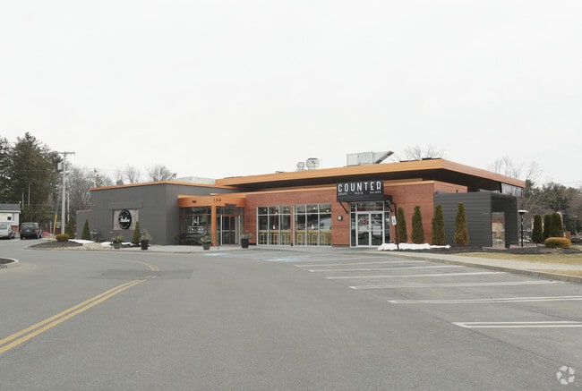
1475 Western Ave
013089-052-004-0002-008-000-0000
SHOPPING CENTER
Regionalshoppingcenterormallwithanchorstore
Albany
X
New York
36001C0187D
8.000
2025
20.14 AC
2024
W Outer Albany County
014608
Albany/Schenectady/Troy
175,587 SF
Albany-Schenectady-Troy, NY
DEMOGRAPHICS near 1475 Western Ave
1 Mile
3 Mile
5 Mile
2024 Total Population
13,568
70,637
175,991
2029 Population
13,599
70,014
174,239
Pop Growth 2024-2029
+ 0.23%
(0.88%)
(1.00%)
Average Age
31
40
40
2024 Total Households
3,062
28,750
73,957
HH Growth 2024-2029
+ 1.24%
(0.89%)
(1.00%)
Median Household Inc
$80,567
$78,380
$72,291
Avg Household Size
2.10
2.10
2.10
2024 Avg HH Vehicles
2.00
2.00
1.00
Median Home Value
$241,131
$245,313
$257,607
Median Year Built
1971
1965
1960
Nearby Places
Map Layers
Map Styles
 Street
 Aerial
- Restaurants
- Banks
- Shops
- Fitness
- Groceries
PUBLIC TRANSPORTATION
COMMUTER RAIL
DRIVE
WALK
Distance
18 min
9.6 mi
AIRPORT
Albany International
DRIVE
WALK
Distance
Albany International
15 min
7.6 mi
Nearby Properties
Address
Land Use
TOTAL SIZE
Lot Size
Zoning
Address
Land Use
TOTAL SIZE
Lot Size
Zoning
111,628 SF
303.87 AC
CO
Address
Land Use
TOTAL SIZE
Lot Size
Zoning
72,000 SF
279.23 AC
CO
Address
Land Use
TOTAL SIZE
Lot Size
Zoning
5.04 AC
CM
Address
Land Use
TOTAL SIZE
Lot Size
Zoning
Address
Land Use
TOTAL SIZE
Lot Size
Zoning
502,950 SF
12.50 AC
CO
Address
Land Use
TOTAL SIZE
Lot Size
Zoning
812,458 SF
38.74 AC
F
Address
Land Use
TOTAL SIZE
Lot Size
Zoning
561,128 SF
33.58 AC
GB
Address
Land Use
TOTAL SIZE
Lot Size
Zoning
9,208 SF
290.80 AC
LC
Address
Land Use
TOTAL SIZE
Lot Size
Zoning
190 AC
LC
Address
Land Use
TOTAL SIZE
Lot Size
Zoning
10,216 SF
48.37 AC
16
Address
Land Use
TOTAL SIZE
Lot Size
Zoning
595,472 SF
6.06 AC
CO
Address
Land Use
TOTAL SIZE
Lot Size
Zoning
12,096 SF
73.12 AC
CM
Address
Land Use
TOTAL SIZE
Lot Size
Zoning
373,296 SF
11.70 AC
46
Address
Land Use
TOTAL SIZE
Lot Size
Zoning
441,152 SF
3.32 AC
CO
Address
Land Use
TOTAL SIZE
Lot Size
Zoning
3,760 SF
28.30 AC
MR
Address
Land Use
TOTAL SIZE
Lot Size
Zoning
213,860 SF
28.20 AC
C2
Address
Land Use
TOTAL SIZE
Lot Size
Zoning
65,219 SF
35 AC
R1B
Address
Land Use
TOTAL SIZE
Lot Size
Zoning
135,000 SF
14.64 AC
R1B
Address
Land Use
TOTAL SIZE
Lot Size
Zoning
59,442 SF
69.20 AC
R1LL
Address
Land Use
TOTAL SIZE
Lot Size
Zoning
80.10 AC
LC
Address
Land Use
TOTAL SIZE
Lot Size
Zoning
279,150 SF
21.10 AC
CO
Address
Land Use
TOTAL SIZE
Lot Size
Zoning
78.70 AC
LC
Address
Land Use
TOTAL SIZE
Lot Size
Zoning
64,685 SF
6.79 AC
R2A
Address
Land Use
TOTAL SIZE
Lot Size
Zoning
31,080 SF
13.60 AC
LB
Address
Land Use
TOTAL SIZE
Lot Size
Zoning
8,600 SF
14.80 AC
MR
Address
Land Use
TOTAL SIZE
Lot Size
Zoning
66,419 SF
2 AC
CPB
Address
Land Use
TOTAL SIZE
Lot Size
Zoning
87.50 AC
CO
Address
Land Use
TOTAL SIZE
Lot Size
Zoning
10,500 SF
40.10 AC
CO
Address
Land Use
TOTAL SIZE
Lot Size
Zoning
18,240 SF
26.70 AC
MR
The World's #1 Commercial Real Estate Marketplace
Connect with us
© 2026 CoStar Group
The information above has been obtained from sources believed reliable. While we do not doubt its accuracy we have not verified it and make no guarantee, warranty or representation about it. It is your responsibility to independently confirm its accuracy and completeness. Any projections, opinions, assumptions, or estimates used are for example only and do not represent the current or future performance of the property. The value of this transaction to you depends on tax and other factors which should be evaluated by your tax, financial, and legal advisors. You and your advisors should conduct a careful, independent investigation of the property to determine to your satisfaction the suitability of the property for your needs.