Property Record
1477 Highway 74, Senoia, GA 30276
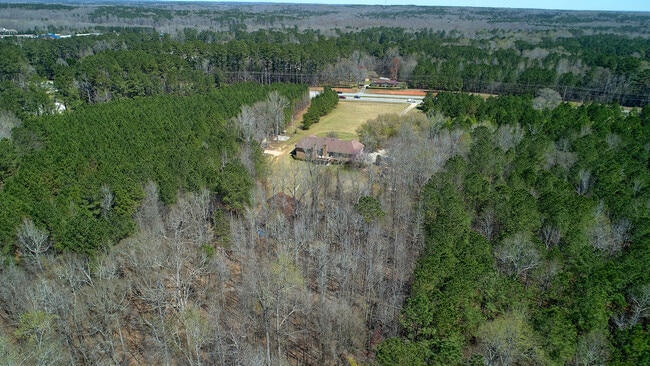

This Property Is For Sale
NEARBY LISTINGS FOR SALE OR LEASE
Property Detail
1477 Highway 74
Atlanta-Sandy Springs-Roswell, GA
Fayette
06-04-00-037
Georgia
Duplex
13.38 AC
X
Fayette/Coweta County
13077C0285D
Atlanta
3,653 SF
DEMOGRAPHICS near 1477 Highway 74
1 Mile
3 Mile
5 Mile
2024 Total Population
1,905
16,927
36,193
2029 Population
2,034
18,251
38,932
Pop Growth 2024-2029
+ 6.77%
+ 7.82%
+ 7.57%
Average Age
37
41
41
2024 Total Households
560
5,750
12,739
HH Growth 2024-2029
+ 6.79%
+ 7.90%
+ 7.65%
Median Household Inc
$201,767
$119,534
$104,365
Avg Household Size
3.30
2.90
2.80
2024 Avg HH Vehicles
2.00
2.00
2.00
Median Home Value
$493,477
$393,487
$376,219
Median Year Built
1999
1996
1994
Nearby Places
Map Layers
Map Styles
 Street
 Aerial
- Restaurants
- Banks
- Shops
- Fitness
- Groceries
PUBLIC TRANSPORTATION
AIRPORT
Hartsfield - Jackson Atlanta International
DRIVE
WALK
Distance
Hartsfield - Jackson Atlanta International
41 min
25.6 mi
Freight Ports
Georgia Ports - Savannah
DRIVE
WALK
Distance
Georgia Ports - Savannah
275 min
239.1 mi
Nearby Properties
Address
Land Use
TOTAL SIZE
Lot Size
Zoning
Address
Land Use
TOTAL SIZE
Lot Size
Zoning
384,330 SF
228 AC
I GI
Address
Land Use
TOTAL SIZE
Lot Size
Zoning
Address
Land Use
TOTAL SIZE
Lot Size
Zoning
74,557 SF
43.31 AC
I GI
Address
Land Use
TOTAL SIZE
Lot Size
Zoning
115,988 SF
16.67 AC
C LUC
Address
Land Use
TOTAL SIZE
Lot Size
Zoning
87,848 SF
33.20 AC
C GI
Address
Land Use
TOTAL SIZE
Lot Size
Zoning
82,744 SF
19.94 AC
Address
Land Use
TOTAL SIZE
Lot Size
Zoning
78,075 SF
11.38 AC
C GC
Address
Land Use
TOTAL SIZE
Lot Size
Zoning
46,582 SF
4.51 AC
C LUC
Address
Land Use
TOTAL SIZE
Lot Size
Zoning
184,564 SF
19.13 AC
I GI
Address
Land Use
TOTAL SIZE
Lot Size
Zoning
51,916 SF
15.62 AC
I GI
Address
Land Use
TOTAL SIZE
Lot Size
Zoning
115,980 SF
17.53 AC
I GI
Address
Land Use
TOTAL SIZE
Lot Size
Zoning
76,703 SF
14.19 AC
I GI
Address
Land Use
TOTAL SIZE
Lot Size
Zoning
50,010 SF
12.48 AC
I GI
Address
Land Use
TOTAL SIZE
Lot Size
Zoning
78,124 SF
6.58 AC
I GI
Address
Land Use
TOTAL SIZE
Lot Size
Zoning
76,630 SF
7.28 AC
I GI
Address
Land Use
TOTAL SIZE
Lot Size
Zoning
115,981 SF
8.01 AC
I GI
Address
Land Use
TOTAL SIZE
Lot Size
Zoning
13,829 SF
52.55 AC
I MI
Address
Land Use
TOTAL SIZE
Lot Size
Zoning
35,914 SF
64.50 AC
Address
Land Use
TOTAL SIZE
Lot Size
Zoning
99,160 SF
6.13 AC
I GI
Address
Land Use
TOTAL SIZE
Lot Size
Zoning
93,465 SF
11.28 AC
I GI
Address
Land Use
TOTAL SIZE
Lot Size
Zoning
19,900 SF
3.29 AC
C GC
Address
Land Use
TOTAL SIZE
Lot Size
Zoning
127,742 SF
40.89 AC
I GI
Address
Land Use
TOTAL SIZE
Lot Size
Zoning
32,860 SF
103.01 AC
Address
Land Use
TOTAL SIZE
Lot Size
Zoning
64,873 SF
76.15 AC
Address
Land Use
TOTAL SIZE
Lot Size
Zoning
35,942 SF
4.17 AC
I GI
Address
Land Use
TOTAL SIZE
Lot Size
Zoning
86.78 AC
Address
Land Use
TOTAL SIZE
Lot Size
Zoning
34,936 SF
4.54 AC
I GI
Address
Land Use
TOTAL SIZE
Lot Size
Zoning
16,710 SF
196.41 AC
AR
Address
Land Use
TOTAL SIZE
Lot Size
Zoning
42,546 SF
21.34 AC
I GI
Address
Land Use
TOTAL SIZE
Lot Size
Zoning
6,356 SF
28.46 AC
I M1
The World's #1 Commercial Real Estate Marketplace
Connect with us
© 2026 CoStar Group
The information above has been obtained from sources believed reliable. While we do not doubt its accuracy we have not verified it and make no guarantee, warranty or representation about it. It is your responsibility to independently confirm its accuracy and completeness. Any projections, opinions, assumptions, or estimates used are for example only and do not represent the current or future performance of the property. The value of this transaction to you depends on tax and other factors which should be evaluated by your tax, financial, and legal advisors. You and your advisors should conduct a careful, independent investigation of the property to determine to your satisfaction the suitability of the property for your needs.