Property Record
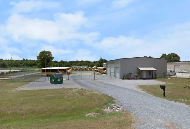
1477 Ohio Ferro Rd, Montgomery, AL 36117
Property Detail
1477 Ohio Ferro Rd
08-03-08-0-000-003.003
SEC 8 T16N R20E 1.5 AC IN NE1/4 SEE 501 FOR ADDITIONAL VALUE 0803080000003000
Autorepair
MONTGOMERY
B and X Area of moderate flood hazard, usually the area between the limits of the 100-year and 500-year floods.
Alabama
2025
1.20 AC
2025
Outlying Montgomery Cnty
005407
Montgomery
2,269 SF
Montgomery, AL
NEARBY LISTINGS FOR SALE OR LEASE
DEMOGRAPHICS near 1477 Ohio Ferro Rd
1 mile
3 mile
5 mile
2025 Total Population
503
7,960
23,803
2030 Population
505
7,961
23,618
Pop Growth 2025-2030
+ 0.40%
+ 0.01%
(0.78%)
Average Age
42
38
40
2025 Total Households
28
2,313
8,644
HH Growth 2025-2030
0.00%
0.00%
(0.99%)
Median Household Inc
$67,500
$95,698
$104,232
Avg Household Size
2.50
2.70
2.50
2025 Avg HH Vehicles
2.00
2.00
2.00
Median Home Value
$245,454
$291,718
$323,771
Median Year Built
1992
2007
2003
Nearby Places
Map Layers
Map Styles
 Street
 Aerial
Layers
 Traffic
 Biking
Places
Listings with unknown addresses are not visible on the map
- Restaurants
- Banks
- Shops
- Fitness
- Groceries
PUBLIC TRANSPORTATION
AIRPORT
Montgomery Regional (Dannelly Field)
Drive
Walk
Distance
Montgomery Regional (Dannelly Field)
36 min
23.9 mi
SALE & LEASE HISTORY
LISTING DATE
SALE/LEASE

Feb 21, 2023
For Sale
Nearby Properties
Address
Land Use
TOTAL SIZE
Lot Size
Zoning
Address
Land Use
TOTAL SIZE
Lot Size
Zoning
25,762 SF
35.04 AC
PUD
Address
Land Use
TOTAL SIZE
Lot Size
Zoning
344,095 SF
30.02 AC
Address
Land Use
TOTAL SIZE
Lot Size
Zoning
170,644 SF
12.34 AC
Address
Land Use
TOTAL SIZE
Lot Size
Zoning
52,600 SF
11.63 AC
Address
Land Use
TOTAL SIZE
Lot Size
Zoning
9,792 SF
160 AC
Address
Land Use
TOTAL SIZE
Lot Size
Zoning
117,633 SF
52.48 AC
Address
Land Use
TOTAL SIZE
Lot Size
Zoning
228,855 SF
15.70 AC
M-1
Address
Land Use
TOTAL SIZE
Lot Size
Zoning
96,764 SF
13.64 AC
M-1
Address
Land Use
TOTAL SIZE
Lot Size
Zoning
168,209 SF
21.62 AC
Address
Land Use
TOTAL SIZE
Lot Size
Zoning
168,209 SF
21.62 AC
Address
Land Use
TOTAL SIZE
Lot Size
Zoning
115,292 SF
49.50 AC
M-1
Address
Land Use
TOTAL SIZE
Lot Size
Zoning
123,376 SF
23 AC
Address
Land Use
TOTAL SIZE
Lot Size
Zoning
9,806 SF
119.29 AC
Address
Land Use
TOTAL SIZE
Lot Size
Zoning
11,100 SF
10.50 AC
Address
Land Use
TOTAL SIZE
Lot Size
Zoning
139,221 SF
11.77 AC
M-1
Address
Land Use
TOTAL SIZE
Lot Size
Zoning
9,615 SF
4.16 AC
Address
Land Use
TOTAL SIZE
Lot Size
Zoning
49,843 SF
11.99 AC
M-1
Address
Land Use
TOTAL SIZE
Lot Size
Zoning
14,596 SF
4.55 AC
PUD
Address
Land Use
TOTAL SIZE
Lot Size
Zoning
5,000 SF
114.60 AC
Address
Land Use
TOTAL SIZE
Lot Size
Zoning
1,192 SF
5 AC
M-1
Address
Land Use
TOTAL SIZE
Lot Size
Zoning
43,260 SF
6.27 AC
M-1
Address
Land Use
TOTAL SIZE
Lot Size
Zoning
102,941 SF
6.68 AC
M-1
Address
Land Use
TOTAL SIZE
Lot Size
Zoning
44,267 SF
9.99 AC
M-1
Address
Land Use
TOTAL SIZE
Lot Size
Zoning
20,637 SF
9.68 AC
M-1
Address
Land Use
TOTAL SIZE
Lot Size
Zoning
21,977 SF
7.50 AC
PUD
Address
Land Use
TOTAL SIZE
Lot Size
Zoning
13,446 SF
2.09 AC
Address
Land Use
TOTAL SIZE
Lot Size
Zoning
17,265 SF
17.30 AC
Address
Land Use
TOTAL SIZE
Lot Size
Zoning
10,530 SF
159.90 AC
Address
Land Use
TOTAL SIZE
Lot Size
Zoning
18,546 SF
80.40 AC
Address
Land Use
TOTAL SIZE
Lot Size
Zoning
46,440 SF
10.80 AC
M-3
The World's #1 Commercial Real Estate Marketplace
Connect with us
© 2026 CoStar Group
The information above has been obtained from sources believed reliable. While we do not doubt its accuracy we have not verified it and make no guarantee, warranty or representation about it. It is your responsibility to independently confirm its accuracy and completeness. Any projections, opinions, assumptions, or estimates used are for example only and do not represent the current or future performance of the property. The value of this transaction to you depends on tax and other factors which should be evaluated by your tax, financial, and legal advisors. You and your advisors should conduct a careful, independent investigation of the property to determine to your satisfaction the suitability of the property for your needs.