Property Record
14770 Imboden Rd, Hudson, CO 80642
Property Detail
14770 Imboden Rd
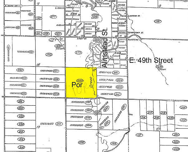
1565-17-3-00-001
SECT,TWN,RNG:17-1-64 DESC: PARC OF LAND IN THE SW4 OF SEC 17 DESC AS BEG AT THE S4 OF SD SEC 17 WHENCE THE SW COR OF SD SEC 17 BRS N 89D 13M 53S 2642/44 FT TH ALG THE E LN OF THE SD SW4 OF SEC 17 N 00D 21M 53S W 30/1 FT TH ALG SD N ROW LN OF 144TH AV
Farms
Adams
A3
Colorado
B and X Area of moderate flood hazard, usually the area between the limits of the 100-year and 500-year floods.
38.56 AC
2024
Northeast Denver
2025
Denver
002502
Denver-Aurora-Centennial, CO
5,669 SF
NEARBY LISTINGS FOR SALE OR LEASE
-
-
View all Hudson listings for sale on LoopNet.com
DEMOGRAPHICS near 14770 Imboden Rd
1 mile
3 mile
5 mile
2024 Total Population
258
1,828
4,197
2029 Population
269
1,915
4,400
Pop Growth 2024-2029
+ 4.26%
+ 4.76%
+ 4.84%
Average Age
40
41
42
2024 Total Households
84
602
1,412
HH Growth 2024-2029
+ 4.76%
+ 4.98%
+ 5.10%
Median Household Inc
$126,136
$132,500
$144,672
Avg Household Size
3.10
3.10
3.00
2024 Avg HH Vehicles
3.00
3.00
3.00
Median Home Value
$854,999
$814,494
$766,834
Median Year Built
2003
2003
2001
Nearby Places
Map Layers
Map Styles
 Street
 Aerial
Transit
 Traffic
 Biking
Places
Listings with unknown addresses are not visible on the map
- Restaurants
- Banks
- Shops
- Fitness
- Groceries
PUBLIC TRANSPORTATION
AIRPORT
Denver International
Drive
Walk
Distance
Denver International
37 min
22.1 mi
Freight Ports
Tulsa Port Of Catoosa
Drive
Walk
Distance
Tulsa Port Of Catoosa
728 min
702.8 mi
Nearby Properties
Address
Land Use
TOTAL SIZE
Lot Size
Zoning
Address
Land Use
TOTAL SIZE
Lot Size
Zoning
1,344 SF
92.59 AC
PUD
Address
Land Use
TOTAL SIZE
Lot Size
Zoning
3,512 SF
44.57 AC
A3
Address
Land Use
TOTAL SIZE
Lot Size
Zoning
3,840 SF
1.63 AC
A3
Address
Land Use
TOTAL SIZE
Lot Size
Zoning
5,040 SF
1.47 AC
PUD
Address
Land Use
TOTAL SIZE
Lot Size
Zoning
4,060 SF
86.33 AC
PUD
Address
Land Use
TOTAL SIZE
Lot Size
Zoning
837 SF
5.44 AC
A3
Address
Land Use
TOTAL SIZE
Lot Size
Zoning
15,224 SF
35.55 AC
A3
Address
Land Use
TOTAL SIZE
Lot Size
Zoning
6,468 SF
9.21 AC
PUD
Address
Land Use
TOTAL SIZE
Lot Size
Zoning
10,589 SF
36.02 AC
Address
Land Use
TOTAL SIZE
Lot Size
Zoning
9,298 SF
35.01 AC
Address
Land Use
TOTAL SIZE
Lot Size
Zoning
9,298 SF
35.05 AC
Address
Land Use
TOTAL SIZE
Lot Size
Zoning
13,335 SF
53.72 AC
Address
Land Use
TOTAL SIZE
Lot Size
Zoning
5,055 SF
40.64 AC
A3
Address
Land Use
TOTAL SIZE
Lot Size
Zoning
5,788 SF
39.55 AC
A3
Address
Land Use
TOTAL SIZE
Lot Size
Zoning
4,000 SF
1.26 AC
A3
Address
Land Use
TOTAL SIZE
Lot Size
Zoning
8,193 SF
40.30 AC
A3
Address
Land Use
TOTAL SIZE
Lot Size
Zoning
9,162 SF
34.64 AC
A3
Address
Land Use
TOTAL SIZE
Lot Size
Zoning
4,982 SF
40.24 AC
A3
Address
Land Use
TOTAL SIZE
Lot Size
Zoning
4,887 SF
35.93 AC
Address
Land Use
TOTAL SIZE
Lot Size
Zoning
8,700 SF
35.01 AC
Address
Land Use
TOTAL SIZE
Lot Size
Zoning
8,700 SF
35.02 AC
Address
Land Use
TOTAL SIZE
Lot Size
Zoning
9,277 SF
35.01 AC
Address
Land Use
TOTAL SIZE
Lot Size
Zoning
10,544 SF
40.30 AC
Address
Land Use
TOTAL SIZE
Lot Size
Zoning
10,544 SF
35.03 AC
Address
Land Use
TOTAL SIZE
Lot Size
Zoning
8,403 SF
35.93 AC
Address
Land Use
TOTAL SIZE
Lot Size
Zoning
7,188 SF
97.03 AC
A3
Address
Land Use
TOTAL SIZE
Lot Size
Zoning
3,974 SF
7.55 AC
A1
Address
Land Use
TOTAL SIZE
Lot Size
Zoning
2.30 AC
PUD
Address
Land Use
TOTAL SIZE
Lot Size
Zoning
7,214 SF
35.02 AC
PUDP
Address
Land Use
TOTAL SIZE
Lot Size
Zoning
8.09 AC
The World's #1 Commercial Real Estate Marketplace
Connect with us
© 2026 CoStar Group
The information above has been obtained from sources believed reliable. While we do not doubt its accuracy we have not verified it and make no guarantee, warranty or representation about it. It is your responsibility to independently confirm its accuracy and completeness. Any projections, opinions, assumptions, or estimates used are for example only and do not represent the current or future performance of the property. The value of this transaction to you depends on tax and other factors which should be evaluated by your tax, financial, and legal advisors. You and your advisors should conduct a careful, independent investigation of the property to determine to your satisfaction the suitability of the property for your needs.