Property Record
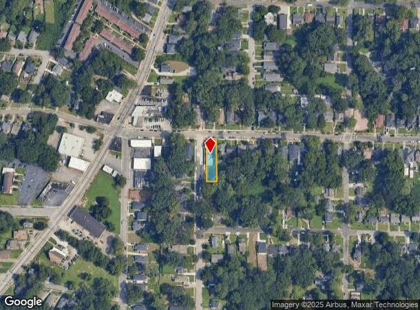
1478 Beecher St Sw, Atlanta, GA 30310
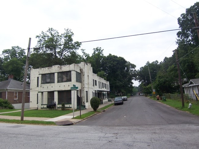
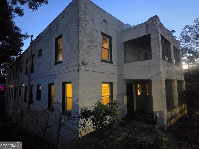

This Property Is For Sale
NEARBY LISTINGS FOR SALE OR LEASE
Property Detail
1478 Beecher St Sw
14-0139-0005-093-5
KA APARTMENTS
Apartment
Fulton
X
Georgia
13121C0356F
71
2024
0.22 AC
2025
Oakland City
006100
Atlanta
9,096 SF
Atlanta-Sandy Springs-Roswell, GA
DEMOGRAPHICS near 1478 Beecher St Sw
1 Mile
3 Mile
5 Mile
2024 Total Population
12,680
108,927
332,345
2029 Population
13,247
114,665
347,160
Pop Growth 2024-2029
+ 4.47%
+ 5.27%
+ 4.46%
Average Age
40
38
37
2024 Total Households
5,386
44,889
146,963
HH Growth 2024-2029
+ 4.49%
+ 5.48%
+ 4.72%
Median Household Inc
$48,117
$36,807
$59,671
Avg Household Size
2.30
2.20
2.00
2024 Avg HH Vehicles
1.00
1.00
1.00
Median Home Value
$339,473
$263,100
$309,207
Median Year Built
1949
1967
1985
Nearby Places
- Restaurants
- Banks
- Shops
- Fitness
- Groceries
PUBLIC TRANSPORTATION
COMMUTER RAIL
Atlanta (Crescent - Amtrak)
DRIVE
WALK
Distance
Atlanta (Crescent - Amtrak)
14 min
7.2 mi
AIRPORT
Hartsfield - Jackson Atlanta International
DRIVE
WALK
Distance
Hartsfield - Jackson Atlanta International
18 min
10.1 mi
Freight Ports
Georgia Ports - Savannah
DRIVE
WALK
Distance
Georgia Ports - Savannah
281 min
249.4 mi
Nearby Properties
Address
Land Use
TOTAL SIZE
Lot Size
Zoning
Address
Land Use
TOTAL SIZE
Lot Size
Zoning
19.94 AC
SPI1
Address
Land Use
TOTAL SIZE
Lot Size
Zoning
11.74 AC
I1
Address
Land Use
TOTAL SIZE
Lot Size
Zoning
9.80 AC
C5
Address
Land Use
TOTAL SIZE
Lot Size
Zoning
10.27 AC
C5
Address
Land Use
TOTAL SIZE
Lot Size
Zoning
61.57 AC
C5
Address
Land Use
TOTAL SIZE
Lot Size
Zoning
1.55 AC
SPI1
Address
Land Use
TOTAL SIZE
Lot Size
Zoning
7 AC
C3
Address
Land Use
TOTAL SIZE
Lot Size
Zoning
3.62 AC
SPI1
Address
Land Use
TOTAL SIZE
Lot Size
Zoning
631,858 SF
1.33 AC
C5C
Address
Land Use
TOTAL SIZE
Lot Size
Zoning
34 AC
OI
Address
Land Use
TOTAL SIZE
Lot Size
Zoning
498,515 SF
3.41 AC
C1
Address
Land Use
TOTAL SIZE
Lot Size
Zoning
979,670 SF
0.82 AC
SPI1
Address
Land Use
TOTAL SIZE
Lot Size
Zoning
1,146,402 SF
4.74 AC
SPI1
Address
Land Use
TOTAL SIZE
Lot Size
Zoning
469,344 SF
3.62 AC
C3
Address
Land Use
TOTAL SIZE
Lot Size
Zoning
9.85 AC
SPI1
Address
Land Use
TOTAL SIZE
Lot Size
Zoning
357,153 SF
0.60 AC
SPI1
Address
Land Use
TOTAL SIZE
Lot Size
Zoning
0.08 AC
SPI1
Address
Land Use
TOTAL SIZE
Lot Size
Zoning
541,508 SF
110.88 AC
I1
Address
Land Use
TOTAL SIZE
Lot Size
Zoning
283,235 SF
5 AC
RG4
Address
Land Use
TOTAL SIZE
Lot Size
Zoning
3.65 AC
SPI1
Address
Land Use
TOTAL SIZE
Lot Size
Zoning
5.34 AC
SPI1
Address
Land Use
TOTAL SIZE
Lot Size
Zoning
857,294 SF
101.10 AC
I1
Address
Land Use
TOTAL SIZE
Lot Size
Zoning
293,935 SF
8.47 AC
I2
Address
Land Use
TOTAL SIZE
Lot Size
Zoning
0.40 AC
SPI1
Address
Land Use
TOTAL SIZE
Lot Size
Zoning
1.05 AC
SPI1
Address
Land Use
TOTAL SIZE
Lot Size
Zoning
3,411,710 SF
25.97 AC
RG3
Address
Land Use
TOTAL SIZE
Lot Size
Zoning
0.49 AC
SPI1
Address
Land Use
TOTAL SIZE
Lot Size
Zoning
479,441 SF
0.36 AC
SPI1
Address
Land Use
TOTAL SIZE
Lot Size
Zoning
687,121 SF
0.07 AC
C1
Address
Land Use
TOTAL SIZE
Lot Size
Zoning
425,270 SF
201.84 AC
I1
The World's #1 Commercial Real Estate Marketplace
Connect with us
© 2025 CoStar Group
The information above has been obtained from sources believed reliable. While we do not doubt its accuracy we have not verified it and make no guarantee, warranty or representation about it. It is your responsibility to independently confirm its accuracy and completeness. Any projections, opinions, assumptions, or estimates used are for example only and do not represent the current or future performance of the property. The value of this transaction to you depends on tax and other factors which should be evaluated by your tax, financial, and legal advisors. You and your advisors should conduct a careful, independent investigation of the property to determine to your satisfaction the suitability of the property for your needs.