Property Record
148 Kathy Ellen Dr, Vallejo, CA 94591
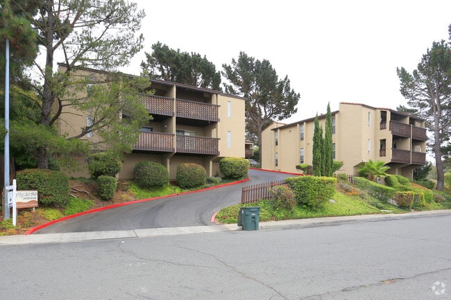


Property Detail
148 Kathy Ellen Dr
Vallejo, CA
STARLITE HILLS SUB LOT 39
0069-043-010
Solano
Multifamilydwelling
California
B and X Area of moderate flood hazard, usually the area between the limits of the 100-year and 500-year floods.
39
2024
0.24 AC
2025
East Vallejo
250103
North Bay/Santa Rosa
8,320 SF
NEARBY LISTINGS FOR SALE OR LEASE
DEMOGRAPHICS near 148 Kathy Ellen Dr
1 mile
3 mile
5 mile
2025 Total Population
20,386
117,955
167,466
2030 Population
20,523
118,681
168,149
Pop Growth 2025-2030
+ 0.67%
+ 0.62%
+ 0.41%
Average Age
42
41
41
2025 Total Households
7,208
40,757
57,451
HH Growth 2025-2030
+ 0.71%
+ 0.73%
+ 0.52%
Median Household Inc
$93,517
$85,561
$97,070
Avg Household Size
2.70
2.80
2.80
2025 Avg HH Vehicles
2.00
2.00
2.00
Median Home Value
$686,313
$642,210
$683,016
Median Year Built
1962
1971
1976
Nearby Places
Map Layers
Map Styles
 Street
 Aerial
Transit
 Traffic
 Biking
Places
Listings with unknown addresses are not visible on the map
- Restaurants
- Banks
- Shops
- Fitness
- Groceries
PUBLIC TRANSPORTATION
AIRPORT
Metro Oakland International
Drive
Walk
Distance
Metro Oakland International
47 min
36.0 mi
Freight Ports
Port of Richmond
Drive
Walk
Distance
Port of Richmond
32 min
21.7 mi
SALE & LEASE HISTORY
LISTING DATE
SALE/LEASE

Jun 22, 2017
For Sale
Jul 09, 2023
For Sale
Jul 01, 2022
For Sale
Feb 27, 2024
For Sale
Dec 06, 2018
For Sale
Apr 12, 2018
For Sale
Nearby Properties
Address
Land Use
TOTAL SIZE
Lot Size
Zoning
Address
Land Use
TOTAL SIZE
Lot Size
Zoning
432,550 SF
29.70 AC
Address
Land Use
TOTAL SIZE
Lot Size
Zoning
108.37 AC
Address
Land Use
TOTAL SIZE
Lot Size
Zoning
349.61 AC
Address
Land Use
TOTAL SIZE
Lot Size
Zoning
197,656 SF
18.63 AC
Address
Land Use
TOTAL SIZE
Lot Size
Zoning
92,043 SF
8.99 AC
Address
Land Use
TOTAL SIZE
Lot Size
Zoning
123,566 SF
7.17 AC
Address
Land Use
TOTAL SIZE
Lot Size
Zoning
176,119 SF
6.80 AC
CHANGE-MUL
Address
Land Use
TOTAL SIZE
Lot Size
Zoning
266,792 SF
26.29 AC
Address
Land Use
TOTAL SIZE
Lot Size
Zoning
17.66 AC
Address
Land Use
TOTAL SIZE
Lot Size
Zoning
80,512 SF
6.88 AC
Address
Land Use
TOTAL SIZE
Lot Size
Zoning
4.23 AC
COMM
Address
Land Use
TOTAL SIZE
Lot Size
Zoning
43.81 AC
Address
Land Use
TOTAL SIZE
Lot Size
Zoning
7.86 AC
Address
Land Use
TOTAL SIZE
Lot Size
Zoning
128,544 SF
5.92 AC
Address
Land Use
TOTAL SIZE
Lot Size
Zoning
175,831 SF
8.63 AC
Address
Land Use
TOTAL SIZE
Lot Size
Zoning
151,720 SF
8 AC
HDR
Address
Land Use
TOTAL SIZE
Lot Size
Zoning
240,905 SF
19.12 AC
Address
Land Use
TOTAL SIZE
Lot Size
Zoning
108,316 SF
5.31 AC
MULTI RES
Address
Land Use
TOTAL SIZE
Lot Size
Zoning
121,070 SF
11.12 AC
Address
Land Use
TOTAL SIZE
Lot Size
Zoning
27,653 SF
3.85 AC
Address
Land Use
TOTAL SIZE
Lot Size
Zoning
73,819 SF
5.64 AC
Address
Land Use
TOTAL SIZE
Lot Size
Zoning
178,265 SF
10.87 AC
Address
Land Use
TOTAL SIZE
Lot Size
Zoning
266,792 SF
3.32 AC
Address
Land Use
TOTAL SIZE
Lot Size
Zoning
4.99 AC
Address
Land Use
TOTAL SIZE
Lot Size
Zoning
46,912 SF
9.36 AC
Address
Land Use
TOTAL SIZE
Lot Size
Zoning
119,746 SF
0.64 AC
Address
Land Use
TOTAL SIZE
Lot Size
Zoning
83,768 SF
4.08 AC
Address
Land Use
TOTAL SIZE
Lot Size
Zoning
125,720 SF
11.72 AC
Address
Land Use
TOTAL SIZE
Lot Size
Zoning
140,712 SF
9.54 AC
Address
Land Use
TOTAL SIZE
Lot Size
Zoning
126,000 SF
12.60 AC
GENERAL RE
The World's #1 Commercial Real Estate Marketplace
Connect with us
© 2026 CoStar Group
The information above has been obtained from sources believed reliable. While we do not doubt its accuracy we have not verified it and make no guarantee, warranty or representation about it. It is your responsibility to independently confirm its accuracy and completeness. Any projections, opinions, assumptions, or estimates used are for example only and do not represent the current or future performance of the property. The value of this transaction to you depends on tax and other factors which should be evaluated by your tax, financial, and legal advisors. You and your advisors should conduct a careful, independent investigation of the property to determine to your satisfaction the suitability of the property for your needs.