Property Record
148 Wildwood Pky, Birmingham, AL 35209


NEARBY LISTINGS FOR SALE OR LEASE
Property Detail
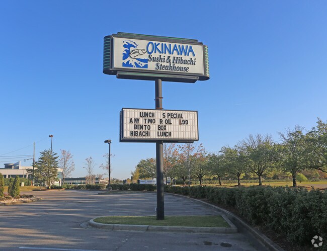
148 Wildwood Pky
Birmingham-Hoover, AL
Wildwood North 29-23-3
29-00-23-3-001-001.011
LOT 2 WILDWOOD NORTH PB 177 PG 87
Restaurantbuilding
Jefferson
X
Alabama
01073C0554J
2
2023
0.89 AC
2024
Vulcan/Oxmoor
010706
Birmingham
3,810 SF
DEMOGRAPHICS near 148 Wildwood Pky
1 Mile
3 Mile
5 Mile
2024 Total Population
5,532
68,028
181,815
2029 Population
5,294
66,759
179,646
Pop Growth 2024-2029
(4.30%)
(1.87%)
(1.19%)
Average Age
36
37
39
2024 Total Households
2,236
28,888
78,702
HH Growth 2024-2029
(4.43%)
(1.95%)
(1.09%)
Median Household Inc
$89,806
$59,120
$53,416
Avg Household Size
2.40
2.20
2.10
2024 Avg HH Vehicles
2.00
2.00
2.00
Median Home Value
$342,872
$330,280
$289,524
Median Year Built
1972
1974
1971
Nearby Places
Map Layers
Map Styles
 Street
 Aerial
- Restaurants
- Banks
- Shops
- Fitness
- Groceries
PUBLIC TRANSPORTATION
COMMUTER RAIL
Birmingham (Crescent - Amtrak)
DRIVE
WALK
Distance
Birmingham (Crescent - Amtrak)
9 min
6.3 mi
AIRPORT
Birmingham-Shuttlesworth International
DRIVE
WALK
Distance
Birmingham-Shuttlesworth International
18 min
11.4 mi
Freight Ports
Port of Mobile
DRIVE
WALK
Distance
Port of Mobile
274 min
251.4 mi
Nearby Properties
Address
Land Use
TOTAL SIZE
Lot Size
Zoning
Address
Land Use
TOTAL SIZE
Lot Size
Zoning
978,879 SF
43.50 AC
I3
Address
Land Use
TOTAL SIZE
Lot Size
Zoning
31,980 SF
99.92 AC
I3/P
Address
Land Use
TOTAL SIZE
Lot Size
Zoning
242,746 SF
20.96 AC
MXDE
Address
Land Use
TOTAL SIZE
Lot Size
Zoning
334,805 SF
32.50 AC
MXD/
Address
Land Use
TOTAL SIZE
Lot Size
Zoning
200,927 SF
19 AC
PMUD
Address
Land Use
TOTAL SIZE
Lot Size
Zoning
209,765 SF
19.20 AC
I-3
Address
Land Use
TOTAL SIZE
Lot Size
Zoning
186,070 SF
16.60 AC
QB2
Address
Land Use
TOTAL SIZE
Lot Size
Zoning
311,982 SF
30 AC
R6
Address
Land Use
TOTAL SIZE
Lot Size
Zoning
33,209 SF
3.11 AC
C4B
Address
Land Use
TOTAL SIZE
Lot Size
Zoning
282,421 SF
24.33 AC
R7
Address
Land Use
TOTAL SIZE
Lot Size
Zoning
92,332 SF
8.40 AC
Address
Land Use
TOTAL SIZE
Lot Size
Zoning
331,413 SF
14.46 AC
R6
Address
Land Use
TOTAL SIZE
Lot Size
Zoning
265,418 SF
26.55 AC
R2
Address
Land Use
TOTAL SIZE
Lot Size
Zoning
62,516 SF
1.37 AC
I3
Address
Land Use
TOTAL SIZE
Lot Size
Zoning
133,396 SF
19 AC
QR6
Address
Land Use
TOTAL SIZE
Lot Size
Zoning
38,963 SF
0.24 AC
C4B
Address
Land Use
TOTAL SIZE
Lot Size
Zoning
403,758 SF
22.36 AC
R3
Address
Land Use
TOTAL SIZE
Lot Size
Zoning
97,764 SF
14.20 AC
C1
Address
Land Use
TOTAL SIZE
Lot Size
Zoning
141,583 SF
18 AC
I3
Address
Land Use
TOTAL SIZE
Lot Size
Zoning
66,829 SF
3.44 AC
R-5
Address
Land Use
TOTAL SIZE
Lot Size
Zoning
285,719 SF
18 AC
R-4
Address
Land Use
TOTAL SIZE
Lot Size
Zoning
180,412 SF
14.89 AC
R6
Address
Land Use
TOTAL SIZE
Lot Size
Zoning
313,404 SF
19 AC
PMUD
Address
Land Use
TOTAL SIZE
Lot Size
Zoning
218,354 SF
15.23 AC
R4
Address
Land Use
TOTAL SIZE
Lot Size
Zoning
195,150 SF
11 AC
R-5
Address
Land Use
TOTAL SIZE
Lot Size
Zoning
165,328 SF
12 AC
R6C
Address
Land Use
TOTAL SIZE
Lot Size
Zoning
52,239 SF
9 AC
PMUD
The World's #1 Commercial Real Estate Marketplace
Connect with us
© 2025 CoStar Group
The information above has been obtained from sources believed reliable. While we do not doubt its accuracy we have not verified it and make no guarantee, warranty or representation about it. It is your responsibility to independently confirm its accuracy and completeness. Any projections, opinions, assumptions, or estimates used are for example only and do not represent the current or future performance of the property. The value of this transaction to you depends on tax and other factors which should be evaluated by your tax, financial, and legal advisors. You and your advisors should conduct a careful, independent investigation of the property to determine to your satisfaction the suitability of the property for your needs.