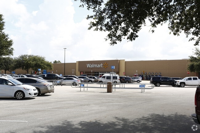
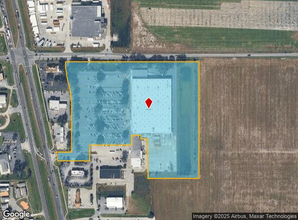
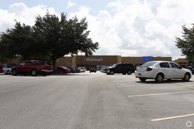
Property Record
1480 Us Highway 17 N, Wauchula, FL 33873
NEARBY LISTINGS FOR SALE OR LEASE
Property Detail
1480 Us Highway 17 N
Wauchula, FL
Subdivision
3333-25-0200-00001-0001
LOT 1 WAL-MART STORES EAST INC & WAUCHULA SQUARE PROPERTIES INC MINOR SUBDIVISION PLAT PB-B5 P3 33 33S 25E LESS LEASE AREA OR608P763 610P408 610P411(EASE 615P1218(UTIL EASE) 622P733- EASE 629P901-EASE 720P1031-EASE PB-B53P2-REPLAT 200825000451 599P30
Regionalshoppingcenterormallwithanchorstore
Hardee
A
Florida
12049C0179D
1
2025
14.32 AC
2025
Florida Central South Area
970301
Other Market Areas
107,610 SF
DEMOGRAPHICS near 1480 Us Highway 17 N
1 Mile
3 Mile
5 Mile
2024 Total Population
1,170
10,916
16,532
2029 Population
1,217
11,177
17,063
Pop Growth 2024-2029
+ 4.02%
+ 2.39%
+ 3.21%
Average Age
37
37
37
2024 Total Households
398
3,659
5,516
HH Growth 2024-2029
+ 4.27%
+ 2.54%
+ 3.34%
Median Household Inc
$45,185
$34,680
$41,054
Avg Household Size
3.00
2.90
2.90
2024 Avg HH Vehicles
2.00
2.00
2.00
Median Home Value
$226,470
$145,104
$125,574
Median Year Built
1977
1978
1979
Nearby Places
Map Layers
Map Styles
 Street
 Aerial
- Restaurants
- Banks
- Shops
- Fitness
- Groceries
Nearby Properties
Address
Land Use
TOTAL SIZE
Lot Size
Zoning
Address
Land Use
TOTAL SIZE
Lot Size
Zoning
60.50 AC
F-R
Address
Land Use
TOTAL SIZE
Lot Size
Zoning
22.21 AC
P-SP
Address
Land Use
TOTAL SIZE
Lot Size
Zoning
47,399 SF
55.51 AC
C-2
Address
Land Use
TOTAL SIZE
Lot Size
Zoning
50,071 SF
9.78 AC
C-2
Address
Land Use
TOTAL SIZE
Lot Size
Zoning
59,117 SF
70 AC
A-1
Address
Land Use
TOTAL SIZE
Lot Size
Zoning
122,608 SF
10.32 AC
R-3
Address
Land Use
TOTAL SIZE
Lot Size
Zoning
45,018 SF
17.48 AC
P-SP
Address
Land Use
TOTAL SIZE
Lot Size
Zoning
40,161 SF
4.48 AC
C-1
Address
Land Use
TOTAL SIZE
Lot Size
Zoning
1,260 SF
39.68 AC
P-I
Address
Land Use
TOTAL SIZE
Lot Size
Zoning
104,690 SF
9.96 AC
F-R
Address
Land Use
TOTAL SIZE
Lot Size
Zoning
89,500 SF
6.80 AC
C-2
Address
Land Use
TOTAL SIZE
Lot Size
Zoning
54,007 SF
9 AC
P-SP
Address
Land Use
TOTAL SIZE
Lot Size
Zoning
13.28 AC
F-R
Address
Land Use
TOTAL SIZE
Lot Size
Zoning
31,216 SF
5.16 AC
C-2
Address
Land Use
TOTAL SIZE
Lot Size
Zoning
1,224 SF
47.28 AC
A-1
Address
Land Use
TOTAL SIZE
Lot Size
Zoning
47,374 SF
1.79 AC
P-SP
Address
Land Use
TOTAL SIZE
Lot Size
Zoning
28.95 AC
P-SP
Address
Land Use
TOTAL SIZE
Lot Size
Zoning
432 SF
9.75 AC
P-SP
Address
Land Use
TOTAL SIZE
Lot Size
Zoning
581.63 AC
A-1
Address
Land Use
TOTAL SIZE
Lot Size
Zoning
2,708 SF
225.32 AC
A-1
Address
Land Use
TOTAL SIZE
Lot Size
Zoning
60,546 SF
14.57 AC
R-3
Address
Land Use
TOTAL SIZE
Lot Size
Zoning
80,858 SF
8.63 AC
C/IBC
Address
Land Use
TOTAL SIZE
Lot Size
Zoning
35,140 SF
2.02 AC
P-SP
Address
Land Use
TOTAL SIZE
Lot Size
Zoning
65,778 SF
7.46 AC
F-R
Address
Land Use
TOTAL SIZE
Lot Size
Zoning
330.48 AC
A-1
Address
Land Use
TOTAL SIZE
Lot Size
Zoning
53,214 SF
12.50 AC
R-1A
Address
Land Use
TOTAL SIZE
Lot Size
Zoning
68,254 SF
11 AC
R-3
Address
Land Use
TOTAL SIZE
Lot Size
Zoning
288.71 AC
A-1
Address
Land Use
TOTAL SIZE
Lot Size
Zoning
41,794 SF
4.07 AC
C/IBC
The World's #1 Commercial Real Estate Marketplace
Connect with us
© 2026 CoStar Group
The information above has been obtained from sources believed reliable. While we do not doubt its accuracy we have not verified it and make no guarantee, warranty or representation about it. It is your responsibility to independently confirm its accuracy and completeness. Any projections, opinions, assumptions, or estimates used are for example only and do not represent the current or future performance of the property. The value of this transaction to you depends on tax and other factors which should be evaluated by your tax, financial, and legal advisors. You and your advisors should conduct a careful, independent investigation of the property to determine to your satisfaction the suitability of the property for your needs.