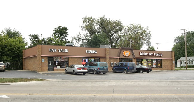
Property Record
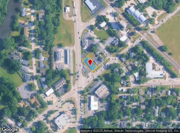
14807 S Route 59, Plainfield, IL 60544

NEARBY LISTINGS FOR SALE OR LEASE
Property Detail
14807 S Route 59
Chicago-Naperville-Elgin, IL-IN-WI
East Plainfield
06-03-10-304-004
LOT 21 THE W1/2 OF VAC ALLEY LYG BETWEEN ADJ LOTS 21 22 IN E PLAINFIELD, A SUB PRT OF THE W1/2 SW1/4 SEC 10, T36N-R9E. (EX
Commercialnec
Will
X
Illinois
17197C0127G
21
2024
0.21 AC
2024
Joliet/Central Will
880411
Chicago
DEMOGRAPHICS near 14807 S Route 59
1 Mile
3 Mile
5 Mile
2024 Total Population
5,123
49,460
155,851
2029 Population
5,164
49,402
156,287
Pop Growth 2024-2029
+ 0.80%
(0.12%)
+ 0.28%
Average Age
41
37
38
2024 Total Households
1,847
15,541
50,678
HH Growth 2024-2029
+ 0.76%
(0.14%)
+ 0.25%
Median Household Inc
$101,809
$117,080
$108,176
Avg Household Size
2.60
3.10
3.00
2024 Avg HH Vehicles
2.00
2.00
2.00
Median Home Value
$327,749
$306,891
$274,073
Median Year Built
1992
1999
2000
Nearby Places
Map Layers
Map Styles
 Street
 Aerial
- Restaurants
- Banks
- Shops
- Fitness
- Groceries
PUBLIC TRANSPORTATION
COMMUTER RAIL
Lockport Station (Heritage Corridor Line - Northeast Illinois Regional Commuter Railroad (Metra))
DRIVE
WALK
Distance
Lockport Station (Heritage Corridor Line - Northeast Illinois Regional Commuter Railroad (Metra))
20 min
9.3 mi
AIRPORT
Chicago Midway International
DRIVE
WALK
Distance
Chicago Midway International
37 min
27.5 mi
Chicago O'Hare International
DRIVE
WALK
Distance
Chicago O'Hare International
55 min
38.9 mi
Freight Ports
Port Milwaukee
DRIVE
WALK
Distance
Port Milwaukee
136 min
110.6 mi
SALE & LEASE HISTORY
LISTING DATE
SALE/LEASE

Mar 13, 2025
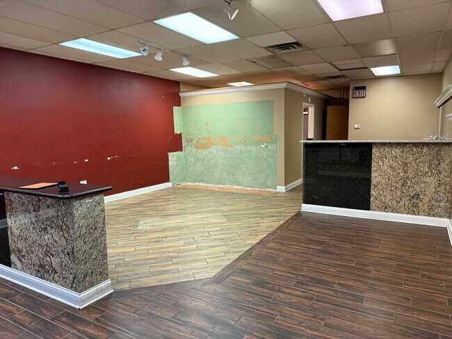
For Lease
Nearby Properties
Address
Land Use
TOTAL SIZE
Lot Size
Zoning
Address
Land Use
TOTAL SIZE
Lot Size
Zoning
135.28 AC
Address
Land Use
TOTAL SIZE
Lot Size
Zoning
952,135 SF
21.86 AC
Address
Land Use
TOTAL SIZE
Lot Size
Zoning
20.75 AC
Address
Land Use
TOTAL SIZE
Lot Size
Zoning
14.67 AC
Address
Land Use
TOTAL SIZE
Lot Size
Zoning
12.47 AC
Address
Land Use
TOTAL SIZE
Lot Size
Zoning
14.59 AC
Address
Land Use
TOTAL SIZE
Lot Size
Zoning
10.47 AC
Address
Land Use
TOTAL SIZE
Lot Size
Zoning
33.04 AC
Address
Land Use
TOTAL SIZE
Lot Size
Zoning
448,352 SF
15.67 AC
Address
Land Use
TOTAL SIZE
Lot Size
Zoning
30.80 AC
Address
Land Use
TOTAL SIZE
Lot Size
Zoning
23.79 AC
Address
Land Use
TOTAL SIZE
Lot Size
Zoning
24.91 AC
Address
Land Use
TOTAL SIZE
Lot Size
Zoning
29.03 AC
Address
Land Use
TOTAL SIZE
Lot Size
Zoning
232,964 SF
28.66 AC
Address
Land Use
TOTAL SIZE
Lot Size
Zoning
36.79 AC
Address
Land Use
TOTAL SIZE
Lot Size
Zoning
1.66 AC
Address
Land Use
TOTAL SIZE
Lot Size
Zoning
643,468 SF
14.77 AC
Address
Land Use
TOTAL SIZE
Lot Size
Zoning
521,457 SF
11.97 AC
Address
Land Use
TOTAL SIZE
Lot Size
Zoning
42.16 AC
Address
Land Use
TOTAL SIZE
Lot Size
Zoning
Address
Land Use
TOTAL SIZE
Lot Size
Zoning
8.10 AC
Address
Land Use
TOTAL SIZE
Lot Size
Zoning
345,727 SF
7.94 AC
Address
Land Use
TOTAL SIZE
Lot Size
Zoning
7.08 AC
Address
Land Use
TOTAL SIZE
Lot Size
Zoning
8.85 AC
Address
Land Use
TOTAL SIZE
Lot Size
Zoning
7.23 AC
Address
Land Use
TOTAL SIZE
Lot Size
Zoning
Address
Land Use
TOTAL SIZE
Lot Size
Zoning
4.89 AC
Address
Land Use
TOTAL SIZE
Lot Size
Zoning
12.66 AC
Address
Land Use
TOTAL SIZE
Lot Size
Zoning
48.21 AC
Address
Land Use
TOTAL SIZE
Lot Size
Zoning
20.40 AC
The World's #1 Commercial Real Estate Marketplace
Connect with us
© 2025 CoStar Group
The information above has been obtained from sources believed reliable. While we do not doubt its accuracy we have not verified it and make no guarantee, warranty or representation about it. It is your responsibility to independently confirm its accuracy and completeness. Any projections, opinions, assumptions, or estimates used are for example only and do not represent the current or future performance of the property. The value of this transaction to you depends on tax and other factors which should be evaluated by your tax, financial, and legal advisors. You and your advisors should conduct a careful, independent investigation of the property to determine to your satisfaction the suitability of the property for your needs.