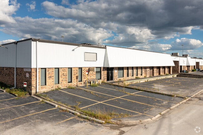
Property Record
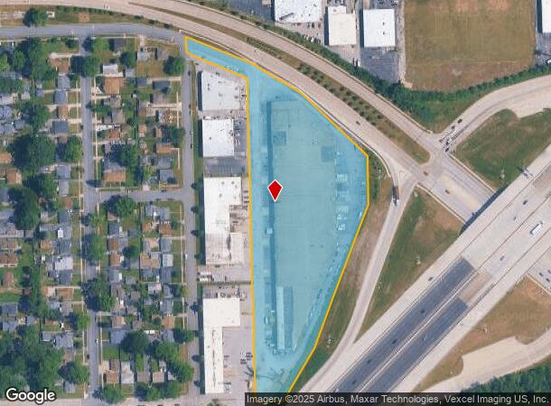
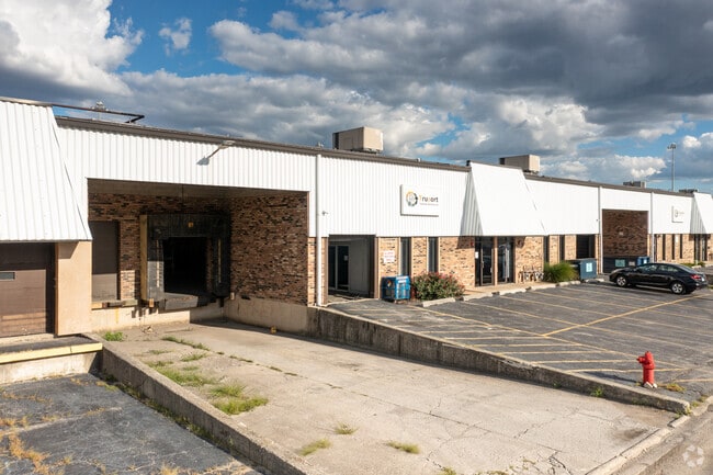
14836 S Campbell Ave, Posen, IL 60469
Current Lease Availabilities
NEARBY LISTINGS FOR SALE OR LEASE
Property Detail
14836 S Campbell Ave
Industrialgeneral
Cook
A
Illinois
17031C0731J
7.51 AC
2023
Near South Cook
2024
Chicago
824800
Chicago-Naperville-Elgin, IL-IN-WI
129,000 SF
28-12-401-055-0000
DEMOGRAPHICS near 14836 S Campbell Ave
1 Mile
3 Mile
5 Mile
2024 Total Population
12,374
99,402
293,674
2029 Population
12,252
98,909
288,795
Pop Growth 2024-2029
(0.99%)
(0.50%)
(1.66%)
Average Age
37
39
40
2024 Total Households
3,997
35,098
108,519
HH Growth 2024-2029
(1.10%)
(0.69%)
(1.93%)
Median Household Inc
$49,818
$44,599
$55,652
Avg Household Size
3.00
2.70
2.60
2024 Avg HH Vehicles
2.00
2.00
2.00
Median Home Value
$126,409
$127,679
$157,409
Median Year Built
1968
1962
1964
Nearby Places
- Restaurants
- Banks
- Shops
- Fitness
- Groceries
PUBLIC TRANSPORTATION
COMMUTER RAIL
Midlothian Station (Rock Island District Line - Northeast Illinois Regional Commuter Railroad (Metra))
DRIVE
WALK
Distance
Midlothian Station (Rock Island District Line - Northeast Illinois Regional Commuter Railroad (Metra))
3 min
1.6 mi
Robbins Station (Rock Island District Line - Northeast Illinois Regional Commuter Railroad (Metra))
DRIVE
WALK
Distance
Robbins Station (Rock Island District Line - Northeast Illinois Regional Commuter Railroad (Metra))
5 min
2.2 mi
AIRPORT
Chicago Midway International
DRIVE
WALK
Distance
Chicago Midway International
23 min
14.0 mi
Chicago O'Hare International
DRIVE
WALK
Distance
Chicago O'Hare International
48 min
35.7 mi
Freight Ports
Port Milwaukee
DRIVE
WALK
Distance
Port Milwaukee
129 min
107.5 mi
Nearby Properties
Address
Land Use
TOTAL SIZE
Lot Size
Zoning
Address
Land Use
TOTAL SIZE
Lot Size
Zoning
1.45 AC
Address
Land Use
TOTAL SIZE
Lot Size
Zoning
Address
Land Use
TOTAL SIZE
Lot Size
Zoning
83,005 SF
3.11 AC
Address
Land Use
TOTAL SIZE
Lot Size
Zoning
380,924 SF
19.13 AC
Address
Land Use
TOTAL SIZE
Lot Size
Zoning
405,045 SF
14.49 AC
Address
Land Use
TOTAL SIZE
Lot Size
Zoning
Address
Land Use
TOTAL SIZE
Lot Size
Zoning
Address
Land Use
TOTAL SIZE
Lot Size
Zoning
162,379 SF
10.59 AC
Address
Land Use
TOTAL SIZE
Lot Size
Zoning
Address
Land Use
TOTAL SIZE
Lot Size
Zoning
8,800 SF
8.83 AC
Address
Land Use
TOTAL SIZE
Lot Size
Zoning
9.38 AC
Address
Land Use
TOTAL SIZE
Lot Size
Zoning
49,229 SF
1.31 AC
Address
Land Use
TOTAL SIZE
Lot Size
Zoning
0.98 AC
Address
Land Use
TOTAL SIZE
Lot Size
Zoning
132,322 SF
2 AC
Address
Land Use
TOTAL SIZE
Lot Size
Zoning
Address
Land Use
TOTAL SIZE
Lot Size
Zoning
370,258 SF
5.12 AC
Address
Land Use
TOTAL SIZE
Lot Size
Zoning
13,327 SF
64.93 AC
Address
Land Use
TOTAL SIZE
Lot Size
Zoning
513,843 SF
23.76 AC
Address
Land Use
TOTAL SIZE
Lot Size
Zoning
15,150 SF
1.64 AC
Address
Land Use
TOTAL SIZE
Lot Size
Zoning
20,579 SF
1.14 AC
Address
Land Use
TOTAL SIZE
Lot Size
Zoning
59,497 SF
5.10 AC
Address
Land Use
TOTAL SIZE
Lot Size
Zoning
80,025 SF
0.70 AC
Address
Land Use
TOTAL SIZE
Lot Size
Zoning
Address
Land Use
TOTAL SIZE
Lot Size
Zoning
Address
Land Use
TOTAL SIZE
Lot Size
Zoning
54,345 SF
23.03 AC
Address
Land Use
TOTAL SIZE
Lot Size
Zoning
90,184 SF
0.65 AC
Address
Land Use
TOTAL SIZE
Lot Size
Zoning
36,920 SF
14.86 AC
Address
Land Use
TOTAL SIZE
Lot Size
Zoning
4,506 SF
2.27 AC
Address
Land Use
TOTAL SIZE
Lot Size
Zoning
456 SF
0.39 AC
The World's #1 Commercial Real Estate Marketplace
Connect with us
© 2025 CoStar Group
The information above has been obtained from sources believed reliable. While we do not doubt its accuracy we have not verified it and make no guarantee, warranty or representation about it. It is your responsibility to independently confirm its accuracy and completeness. Any projections, opinions, assumptions, or estimates used are for example only and do not represent the current or future performance of the property. The value of this transaction to you depends on tax and other factors which should be evaluated by your tax, financial, and legal advisors. You and your advisors should conduct a careful, independent investigation of the property to determine to your satisfaction the suitability of the property for your needs.