Property Record
14819 Thut Rd, Middlefield, OH 44062


Save to a Folder
{{folder.Name}}
{{folder.ListingIds.length}} Properties
{{folder.ListingIds.length}} Property
Create a New Folder
Property Detail
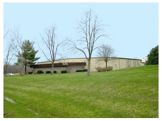
14819 Thut Rd
04-132922
S/L 12 BURTON INDUSTRIAL PARK
Manufacturinglight
GEAUGA
IC
Ohio
B and X Area of moderate flood hazard, usually the area between the limits of the 100-year and 500-year floods.
50
2025
3.12 AC
2025
Geauga County
311300
Cleveland
26,533 SF
Cleveland-Elyria, OH
NEARBY LISTINGS FOR SALE OR LEASE
-
-
View all Middlefield listings for sale on LoopNet.com
DEMOGRAPHICS near 14819 Thut Rd
1 mile
3 mile
5 mile
2025 Total Population
1,501
7,699
14,979
2030 Population
1,498
7,619
14,846
Pop Growth 2025-2030
(0.20%)
(1.04%)
(0.89%)
Average Age
40
40
38
2025 Total Households
578
2,872
5,056
HH Growth 2025-2030
(0.17%)
(1.11%)
(0.97%)
Median Household Inc
$65,983
$67,638
$75,092
Avg Household Size
2.50
2.60
2.80
2025 Avg HH Vehicles
1.00
2.00
2.00
Median Home Value
$219,503
$228,401
$234,675
Median Year Built
1976
1972
1972
Nearby Places
Map Layers
Map Styles
 Street
 Aerial
Layers
 Traffic
 Biking
Places
Listings with unknown addresses are not visible on the map
- Restaurants
- Banks
- Shops
- Fitness
- Groceries
Nearby Properties
Address
Land Use
TOTAL SIZE
Lot Size
Zoning
Address
Land Use
TOTAL SIZE
Lot Size
Zoning
35,614 SF
87.48 AC
R5
Address
Land Use
TOTAL SIZE
Lot Size
Zoning
69,844 SF
7.88 AC
Address
Land Use
TOTAL SIZE
Lot Size
Zoning
225,200 SF
135.47 AC
I
Address
Land Use
TOTAL SIZE
Lot Size
Zoning
74,620 SF
28 AC
R1
Address
Land Use
TOTAL SIZE
Lot Size
Zoning
196,414 SF
10.93 AC
I
Address
Land Use
TOTAL SIZE
Lot Size
Zoning
1,274 SF
4.48 AC
GC
Address
Land Use
TOTAL SIZE
Lot Size
Zoning
317,183 SF
19.75 AC
I
Address
Land Use
TOTAL SIZE
Lot Size
Zoning
156,678 SF
17.23 AC
GC
Address
Land Use
TOTAL SIZE
Lot Size
Zoning
111,000 SF
12.38 AC
Address
Land Use
TOTAL SIZE
Lot Size
Zoning
35,600 SF
11.06 AC
IPUD
Address
Land Use
TOTAL SIZE
Lot Size
Zoning
4,664 SF
13.24 AC
Address
Land Use
TOTAL SIZE
Lot Size
Zoning
36,908 SF
15 AC
Address
Land Use
TOTAL SIZE
Lot Size
Zoning
68,900 SF
18.18 AC
IC
Address
Land Use
TOTAL SIZE
Lot Size
Zoning
1,978 SF
19.31 AC
Address
Land Use
TOTAL SIZE
Lot Size
Zoning
28,789 SF
2.69 AC
S1
Address
Land Use
TOTAL SIZE
Lot Size
Zoning
116,416 SF
6.11 AC
IPUD
Address
Land Use
TOTAL SIZE
Lot Size
Zoning
99,421 SF
6.01 AC
IPUD
Address
Land Use
TOTAL SIZE
Lot Size
Zoning
172,802 SF
10.09 AC
I
Address
Land Use
TOTAL SIZE
Lot Size
Zoning
29,100 SF
8.68 AC
Address
Land Use
TOTAL SIZE
Lot Size
Zoning
6,148 SF
9.12 AC
R3
Address
Land Use
TOTAL SIZE
Lot Size
Zoning
105,640 SF
6.57 AC
IPUD
Address
Land Use
TOTAL SIZE
Lot Size
Zoning
9,636 SF
14 AC
IC
Address
Land Use
TOTAL SIZE
Lot Size
Zoning
107,541 SF
7.24 AC
Address
Land Use
TOTAL SIZE
Lot Size
Zoning
4,640 SF
4.72 AC
R3
Address
Land Use
TOTAL SIZE
Lot Size
Zoning
31,826 SF
19.11 AC
IC
Address
Land Use
TOTAL SIZE
Lot Size
Zoning
8,286 SF
13.12 AC
I
Address
Land Use
TOTAL SIZE
Lot Size
Zoning
3,696 SF
12.51 AC
R3
Address
Land Use
TOTAL SIZE
Lot Size
Zoning
84,808 SF
24 AC
R2
Address
Land Use
TOTAL SIZE
Lot Size
Zoning
38,445 SF
3.26 AC
R1
Address
Land Use
TOTAL SIZE
Lot Size
Zoning
21,093 SF
9.56 AC
R3
The World's #1 Commercial Real Estate Marketplace
Connect with us
© 2026 CoStar Group
The information above has been obtained from sources believed reliable. While we do not doubt its accuracy we have not verified it and make no guarantee, warranty or representation about it. It is your responsibility to independently confirm its accuracy and completeness. Any projections, opinions, assumptions, or estimates used are for example only and do not represent the current or future performance of the property. The value of this transaction to you depends on tax and other factors which should be evaluated by your tax, financial, and legal advisors. You and your advisors should conduct a careful, independent investigation of the property to determine to your satisfaction the suitability of the property for your needs.