Property Record
1483 W Anderson St, Stockton, CA 95206


NEARBY LISTINGS FOR SALE OR LEASE
Property Detail
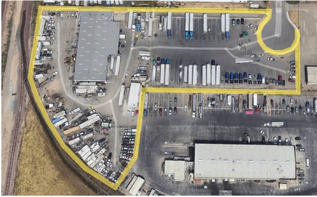
1483 W Anderson St
163-300-25
15-FM PT 163-300-22/PT TO 24/ ROAD PER 14051629/PM
Truckterminal
San Joaquin
X
California
06077C0460F
4.46 AC
2025
West Stockton
2025
Stockton/Modesto
000803
Stockton-Lodi, CA
DEMOGRAPHICS near 1483 W Anderson St
1 Mile
3 Mile
5 Mile
2024 Total Population
9,714
128,834
254,172
2029 Population
10,244
135,840
267,903
Pop Growth 2024-2029
+ 5.46%
+ 5.44%
+ 5.40%
Average Age
35
35
36
2024 Total Households
2,338
38,616
77,744
HH Growth 2024-2029
+ 5.90%
+ 5.67%
+ 5.54%
Median Household Inc
$66,085
$57,570
$61,701
Avg Household Size
3.60
3.10
3.10
2024 Avg HH Vehicles
2.00
2.00
2.00
Median Home Value
$368,701
$337,611
$349,059
Median Year Built
1987
1963
1972
Nearby Places
Map Layers
Map Styles
 Street
 Aerial
- Restaurants
- Banks
- Shops
- Fitness
- Groceries
PUBLIC TRANSPORTATION
COMMUTER RAIL
Stockton (San Joaquins - Amtrak)
DRIVE
WALK
Distance
Stockton (San Joaquins - Amtrak)
6 min
2.1 mi
Stockton (ACE Train - Altamont Commuter Express (ACE), Altamont Corridor Express - Altamont Commuter Express (ACE))
DRIVE
WALK
Distance
Stockton (ACE Train - Altamont Commuter Express (ACE), Altamont Corridor Express - Altamont Commuter Express (ACE))
8 min
3.3 mi
AIRPORT
Stockton Metro
DRIVE
WALK
Distance
Stockton Metro
12 min
6.5 mi
Freight Ports
Port of Stockton
DRIVE
WALK
Distance
Port of Stockton
8 min
4.0 mi
SALE & LEASE HISTORY
LISTING DATE
SALE/LEASE

Nov 15, 2023
For Sale
Nearby Properties
Address
Land Use
TOTAL SIZE
Lot Size
Zoning
Address
Land Use
TOTAL SIZE
Lot Size
Zoning
530,700 SF
8.35 AC
Address
Land Use
TOTAL SIZE
Lot Size
Zoning
152,000 SF
1.31 AC
Address
Land Use
TOTAL SIZE
Lot Size
Zoning
4.78 AC
Address
Land Use
TOTAL SIZE
Lot Size
Zoning
656,200 SF
24.07 AC
IG
Address
Land Use
TOTAL SIZE
Lot Size
Zoning
10,208 SF
47.57 AC
Address
Land Use
TOTAL SIZE
Lot Size
Zoning
502,000 SF
19.76 AC
Address
Land Use
TOTAL SIZE
Lot Size
Zoning
69,954 SF
24.92 AC
Address
Land Use
TOTAL SIZE
Lot Size
Zoning
586,610 SF
27.36 AC
Address
Land Use
TOTAL SIZE
Lot Size
Zoning
328,500 SF
12.27 AC
Address
Land Use
TOTAL SIZE
Lot Size
Zoning
295,680 SF
37.65 AC
Address
Land Use
TOTAL SIZE
Lot Size
Zoning
277,300 SF
13.32 AC
Address
Land Use
TOTAL SIZE
Lot Size
Zoning
82,512 SF
4.14 AC
Address
Land Use
TOTAL SIZE
Lot Size
Zoning
247,850 SF
9.48 AC
Address
Land Use
TOTAL SIZE
Lot Size
Zoning
63,975 SF
6.60 AC
Address
Land Use
TOTAL SIZE
Lot Size
Zoning
23.30 AC
Address
Land Use
TOTAL SIZE
Lot Size
Zoning
8,000 SF
0.67 AC
Address
Land Use
TOTAL SIZE
Lot Size
Zoning
0.79 AC
Address
Land Use
TOTAL SIZE
Lot Size
Zoning
46.75 AC
Address
Land Use
TOTAL SIZE
Lot Size
Zoning
37,846 SF
2.94 AC
Address
Land Use
TOTAL SIZE
Lot Size
Zoning
17,573 SF
3.17 AC
Address
Land Use
TOTAL SIZE
Lot Size
Zoning
Address
Land Use
TOTAL SIZE
Lot Size
Zoning
39,210 SF
10.30 AC
IL
Address
Land Use
TOTAL SIZE
Lot Size
Zoning
2,880 SF
36.83 AC
Address
Land Use
TOTAL SIZE
Lot Size
Zoning
39,840 SF
30 AC
Address
Land Use
TOTAL SIZE
Lot Size
Zoning
84,895 SF
2.21 AC
Address
Land Use
TOTAL SIZE
Lot Size
Zoning
55,228 SF
4.04 AC
Address
Land Use
TOTAL SIZE
Lot Size
Zoning
76,500 SF
7.03 AC
Address
Land Use
TOTAL SIZE
Lot Size
Zoning
65,516 SF
10.56 AC
RM
The World's #1 Commercial Real Estate Marketplace
Connect with us
© 2026 CoStar Group
The information above has been obtained from sources believed reliable. While we do not doubt its accuracy we have not verified it and make no guarantee, warranty or representation about it. It is your responsibility to independently confirm its accuracy and completeness. Any projections, opinions, assumptions, or estimates used are for example only and do not represent the current or future performance of the property. The value of this transaction to you depends on tax and other factors which should be evaluated by your tax, financial, and legal advisors. You and your advisors should conduct a careful, independent investigation of the property to determine to your satisfaction the suitability of the property for your needs.