Property Record
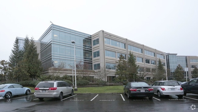
14850 Ne 31St Cir, Redmond, WA 98052


NEARBY LISTINGS FOR SALE OR LEASE
Property Detail
14850 Ne 31St Cir
Seattle-Tacoma-Bellevue, WA
Overlake Industrial Park Add
644820-0010
OVERLAKE INDUSTRIAL PARK PORTION OF LOT S CITY OF REDMOND LOT LINE REVISION NO LLR00-001 RECORDING NO 20001219900009 (BEING A PORTION OF NW QTR SW QTR STR 23-25-05); EXC PORTION THEREOF DAF: BEGINNING AT NE CORNER THEREOF BEING ALSO POINT ON W MARGIN
Industrialpark
King
X
Washington
53033C0369G
1-3
2025
9.18 AC
2024
520 Corridor
022803
Seattle/Puget Sound
339,672 SF
DEMOGRAPHICS near 14850 Ne 31St Cir
1 Mile
3 Mile
5 Mile
2024 Total Population
18,624
130,875
270,623
2029 Population
19,056
133,027
274,172
Pop Growth 2024-2029
+ 2.32%
+ 1.64%
+ 1.31%
Average Age
35
37
38
2024 Total Households
8,377
54,931
109,914
HH Growth 2024-2029
+ 2.63%
+ 1.77%
+ 1.40%
Median Household Inc
$123,927
$145,583
$156,823
Avg Household Size
2.20
2.30
2.40
2024 Avg HH Vehicles
1.00
2.00
2.00
Median Home Value
$1,022,405
$1,013,780
$1,047,109
Median Year Built
1988
1986
1987
Nearby Places
Map Layers
Map Styles
 Street
 Aerial
- Restaurants
- Banks
- Shops
- Fitness
- Groceries
PUBLIC TRANSPORTATION
AIRPORT
Seattle-Tacoma International
DRIVE
WALK
Distance
Seattle-Tacoma International
32 min
20.9 mi
Seattle Paine Field International
DRIVE
WALK
Distance
Seattle Paine Field International
35 min
24.3 mi
Freight Ports
Port of Seattle
DRIVE
WALK
Distance
Port of Seattle
27 min
16.7 mi
Nearby Properties
Address
Land Use
TOTAL SIZE
Lot Size
Zoning
Address
Land Use
TOTAL SIZE
Lot Size
Zoning
223,745 SF
98.45 AC
OBAT
Address
Land Use
TOTAL SIZE
Lot Size
Zoning
6,575 SF
2.03 AC
DNTNO-1
Address
Land Use
TOTAL SIZE
Lot Size
Zoning
629,600 SF
2.62 AC
DNTN-MU
Address
Land Use
TOTAL SIZE
Lot Size
Zoning
482,658 SF
5.78 AC
BR-CR
Address
Land Use
TOTAL SIZE
Lot Size
Zoning
300,118 SF
29.12 AC
OBAT
Address
Land Use
TOTAL SIZE
Lot Size
Zoning
521,058 SF
2.46 AC
DT-O-2-S
Address
Land Use
TOTAL SIZE
Lot Size
Zoning
5,500 SF
1.77 AC
DT-O-2-N
Address
Land Use
TOTAL SIZE
Lot Size
Zoning
786,424 SF
1.54 AC
DT-O-2-N
Address
Land Use
TOTAL SIZE
Lot Size
Zoning
574,970 SF
1.72 AC
DNTNO-1
Address
Land Use
TOTAL SIZE
Lot Size
Zoning
215,279 SF
14.92 AC
OBAT
Address
Land Use
TOTAL SIZE
Lot Size
Zoning
723,028 SF
1.73 AC
DNTNO-1
Address
Land Use
TOTAL SIZE
Lot Size
Zoning
134,200 SF
4.04 AC
DT-OLB-N
Address
Land Use
TOTAL SIZE
Lot Size
Zoning
146,798 SF
19.63 AC
OBAT
Address
Land Use
TOTAL SIZE
Lot Size
Zoning
171,186 SF
16.45 AC
OBAT
Address
Land Use
TOTAL SIZE
Lot Size
Zoning
783,546 SF
0.92 AC
DNTNO-1
Address
Land Use
TOTAL SIZE
Lot Size
Zoning
353,024 SF
3.19 AC
OV
Address
Land Use
TOTAL SIZE
Lot Size
Zoning
424,532 SF
30.49 AC
OUMF
Address
Land Use
TOTAL SIZE
Lot Size
Zoning
672,713 SF
1.31 AC
DNTNO-1
Address
Land Use
TOTAL SIZE
Lot Size
Zoning
18,398 SF
1.45 AC
DNTNO-1
Address
Land Use
TOTAL SIZE
Lot Size
Zoning
695,328 SF
4.81 AC
DT-O-2-E
Address
Land Use
TOTAL SIZE
Lot Size
Zoning
10,500 SF
2.33 AC
BR-RC-2
Address
Land Use
TOTAL SIZE
Lot Size
Zoning
210,846 SF
9.09 AC
OBAT
Address
Land Use
TOTAL SIZE
Lot Size
Zoning
726,000 SF
1.66 AC
DNTNO-1
Address
Land Use
TOTAL SIZE
Lot Size
Zoning
113,412 SF
10.26 AC
OBAT
Address
Land Use
TOTAL SIZE
Lot Size
Zoning
120,444 SF
25.29 AC
OBAT
Address
Land Use
TOTAL SIZE
Lot Size
Zoning
188,062 SF
0.91 AC
DNTN-MU
Address
Land Use
TOTAL SIZE
Lot Size
Zoning
2.25 AC
DNTNO-1
Address
Land Use
TOTAL SIZE
Lot Size
Zoning
27,900 SF
4.02 AC
DNTNO-1
Address
Land Use
TOTAL SIZE
Lot Size
Zoning
337,096 SF
0.94 AC
DNTN-MU
Address
Land Use
TOTAL SIZE
Lot Size
Zoning
274,912 SF
3.25 AC
BR-RC-3
The World's #1 Commercial Real Estate Marketplace
Connect with us
© 2026 CoStar Group
The information above has been obtained from sources believed reliable. While we do not doubt its accuracy we have not verified it and make no guarantee, warranty or representation about it. It is your responsibility to independently confirm its accuracy and completeness. Any projections, opinions, assumptions, or estimates used are for example only and do not represent the current or future performance of the property. The value of this transaction to you depends on tax and other factors which should be evaluated by your tax, financial, and legal advisors. You and your advisors should conduct a careful, independent investigation of the property to determine to your satisfaction the suitability of the property for your needs.