Property Record
1486 Buck Rd, Feasterville Trevose, PA 19053


NEARBY LISTINGS FOR SALE OR LEASE
-
-
View all Feasterville Trevose listings for sale on LoopNet.com
Property Detail
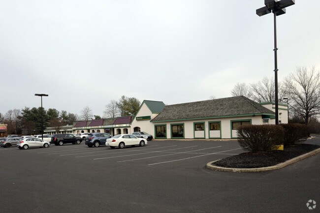
1486 Buck Rd
31-082-002-001
Beacon Hill
Regionalshoppingcenterormallwithanchorstore
5.12A BEACON HILL COMMERCIAL AREA
X
Bucks
42017C0429K
Pennsylvania
2024
5.12 AC
2025
Lower Bucks County
101405
Philadelphia
37,140 SF
Philadelphia-Camden-Wilmington, PA-NJ-DE-MD
DEMOGRAPHICS near 1486 Buck Rd
1 Mile
3 Mile
5 Mile
2024 Total Population
10,046
53,823
153,524
2029 Population
10,028
53,579
152,775
Pop Growth 2024-2029
(0.18%)
(0.45%)
(0.49%)
Average Age
44
45
44
2024 Total Households
3,922
19,967
57,521
HH Growth 2024-2029
(0.38%)
(0.56%)
(0.53%)
Median Household Inc
$118,858
$125,325
$115,590
Avg Household Size
2.50
2.60
2.60
2024 Avg HH Vehicles
2.00
2.00
2.00
Median Home Value
$457,031
$452,493
$420,027
Median Year Built
1983
1980
1979
Nearby Places
Map Layers
Map Styles
 Street
 Aerial
- Restaurants
- Banks
- Shops
- Fitness
- Groceries
PUBLIC TRANSPORTATION
COMMUTER RAIL
Neshaminy Falls (R3 - Southeastern Pennsylvania Transportation Authority Regional Rail (SEPTA Regional Rail))
DRIVE
WALK
Distance
Neshaminy Falls (R3 - Southeastern Pennsylvania Transportation Authority Regional Rail (SEPTA Regional Rail))
12 min
5.5 mi
Langhorne (R3 - Southeastern Pennsylvania Transportation Authority Regional Rail (SEPTA Regional Rail))
DRIVE
WALK
Distance
Langhorne (R3 - Southeastern Pennsylvania Transportation Authority Regional Rail (SEPTA Regional Rail))
12 min
6.2 mi
AIRPORT
Trenton Mercer
DRIVE
WALK
Distance
Trenton Mercer
19 min
11.2 mi
Philadelphia International
DRIVE
WALK
Distance
Philadelphia International
56 min
35.9 mi
Lehigh Valley International
DRIVE
WALK
Distance
Lehigh Valley International
81 min
48.5 mi
Freight Ports
Port of Philadelphia
DRIVE
WALK
Distance
Port of Philadelphia
36 min
19.0 mi
Nearby Properties
Address
Land Use
TOTAL SIZE
Lot Size
Zoning
Address
Land Use
TOTAL SIZE
Lot Size
Zoning
170,342 SF
28.26 AC
PC
Address
Land Use
TOTAL SIZE
Lot Size
Zoning
113,929 SF
10.43 AC
VRI
Address
Land Use
TOTAL SIZE
Lot Size
Zoning
78,743 SF
44.63 AC
IP
Address
Land Use
TOTAL SIZE
Lot Size
Zoning
57,804 SF
20.69 AC
AO
Address
Land Use
TOTAL SIZE
Lot Size
Zoning
102,348 SF
0.60 AC
RA
Address
Land Use
TOTAL SIZE
Lot Size
Zoning
104,204 SF
12.99 AC
RA3
Address
Land Use
TOTAL SIZE
Lot Size
Zoning
162,990 SF
10.75 AC
LI
Address
Land Use
TOTAL SIZE
Lot Size
Zoning
37,550 SF
5.18 AC
M1
Address
Land Use
TOTAL SIZE
Lot Size
Zoning
131,927 SF
14.73 AC
LI
Address
Land Use
TOTAL SIZE
Lot Size
Zoning
151,803 SF
12.54 AC
LI
Address
Land Use
TOTAL SIZE
Lot Size
Zoning
65,124 SF
8.52 AC
PG
Address
Land Use
TOTAL SIZE
Lot Size
Zoning
16,170 SF
40 AC
OR
Address
Land Use
TOTAL SIZE
Lot Size
Zoning
15,905 SF
8.43 AC
M1
Address
Land Use
TOTAL SIZE
Lot Size
Zoning
75,089 SF
2.03 AC
R2
Address
Land Use
TOTAL SIZE
Lot Size
Zoning
35,713 SF
7.09 AC
L1
Address
Land Use
TOTAL SIZE
Lot Size
Zoning
78,848 SF
0.70 AC
Address
Land Use
TOTAL SIZE
Lot Size
Zoning
64,164 SF
8.29 AC
PC
Address
Land Use
TOTAL SIZE
Lot Size
Zoning
90,400 SF
10.46 AC
OR
Address
Land Use
TOTAL SIZE
Lot Size
Zoning
48,948 SF
4.48 AC
VRI
Address
Land Use
TOTAL SIZE
Lot Size
Zoning
68,488 SF
9.40 AC
MR
Address
Land Use
TOTAL SIZE
Lot Size
Zoning
34,186 SF
3.89 AC
VI
Address
Land Use
TOTAL SIZE
Lot Size
Zoning
83,816 SF
9.27 AC
LI
Address
Land Use
TOTAL SIZE
Lot Size
Zoning
21,220 SF
1.96 AC
R1
Address
Land Use
TOTAL SIZE
Lot Size
Zoning
53,644 SF
8.91 AC
R1
Address
Land Use
TOTAL SIZE
Lot Size
Zoning
27,700 SF
2.03 AC
L1
Address
Land Use
TOTAL SIZE
Lot Size
Zoning
58,360 SF
15.68 AC
RA2
Address
Land Use
TOTAL SIZE
Lot Size
Zoning
36,490 SF
3.96 AC
PC
Address
Land Use
TOTAL SIZE
Lot Size
Zoning
51,294 SF
4.72 AC
CS
Address
Land Use
TOTAL SIZE
Lot Size
Zoning
26,082 SF
11.39 AC
R2
Address
Land Use
TOTAL SIZE
Lot Size
Zoning
34,138 SF
5.46 AC
PE
The World's #1 Commercial Real Estate Marketplace
Connect with us
© 2026 CoStar Group
The information above has been obtained from sources believed reliable. While we do not doubt its accuracy we have not verified it and make no guarantee, warranty or representation about it. It is your responsibility to independently confirm its accuracy and completeness. Any projections, opinions, assumptions, or estimates used are for example only and do not represent the current or future performance of the property. The value of this transaction to you depends on tax and other factors which should be evaluated by your tax, financial, and legal advisors. You and your advisors should conduct a careful, independent investigation of the property to determine to your satisfaction the suitability of the property for your needs.