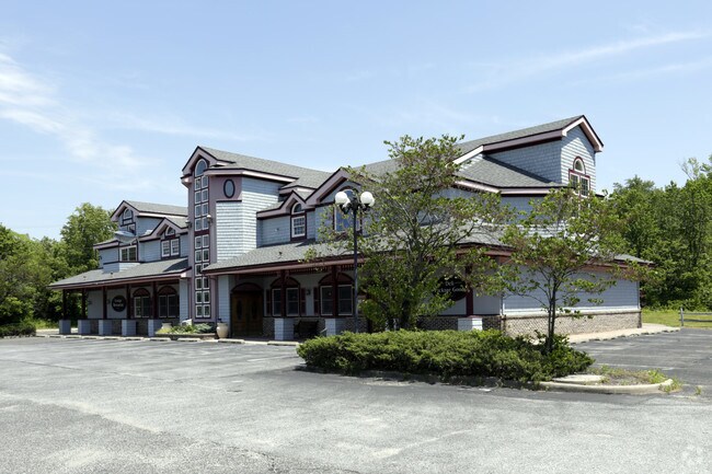
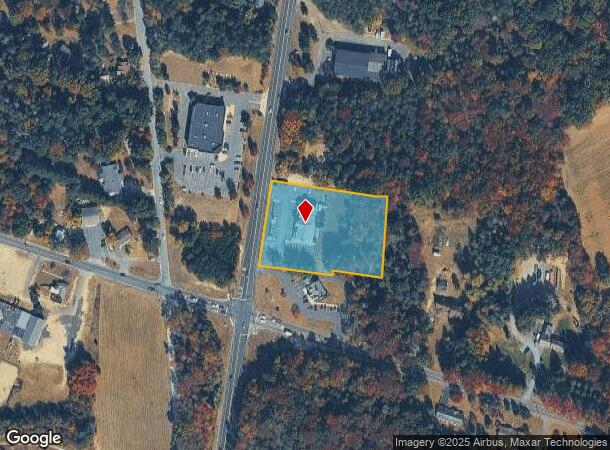
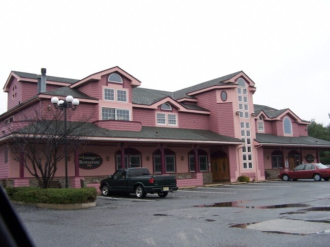
Property Record
1488 Route 206, Tabernacle, NJ 08088
NEARBY LISTINGS FOR SALE OR LEASE
Property Detail
1488 Route 206
Philadelphia-Camden-Wilmington, PA-NJ-DE-MD
ADDITIONAL LOTS: 17-C
35-00903-0000-00017-03
Burlington
Bartavern
New Jersey
X
17.3
34005C0401F
1.13 AC
2024
South Burlington County
2025
Philadelphia
703600
DEMOGRAPHICS near 1488 Route 206
1 Mile
3 Mile
5 Mile
2024 Total Population
1,971
11,120
29,826
2029 Population
2,013
11,262
30,195
Pop Growth 2024-2029
+ 2.13%
+ 1.28%
+ 1.24%
Average Age
43
42
45
2024 Total Households
715
3,847
11,253
HH Growth 2024-2029
+ 2.10%
+ 1.30%
+ 1.32%
Median Household Inc
$98,247
$119,505
$112,700
Avg Household Size
2.70
2.90
2.60
2024 Avg HH Vehicles
2.00
3.00
2.00
Median Home Value
$320,041
$369,161
$348,460
Median Year Built
1972
1977
1976
Nearby Places
Map Layers
Map Styles
 Street
 Aerial
- Restaurants
- Banks
- Shops
- Fitness
- Groceries
PUBLIC TRANSPORTATION
AIRPORT
Trenton Mercer
DRIVE
WALK
Distance
Trenton Mercer
51 min
34.4 mi
Atlantic City International
DRIVE
WALK
Distance
Atlantic City International
67 min
35.9 mi
Philadelphia International
DRIVE
WALK
Distance
Philadelphia International
52 min
36.2 mi
Freight Ports
South Jersey Port
DRIVE
WALK
Distance
South Jersey Port
35 min
24.8 mi
SALE & LEASE HISTORY
LISTING DATE
SALE/LEASE

Sep 23, 2016
For Sale
Oct 12, 2020
For Sale
Oct 11, 2017
For Sale
Dec 08, 2016
For Sale
Nearby Properties
Address
Land Use
TOTAL SIZE
Lot Size
Zoning
Address
Land Use
TOTAL SIZE
Lot Size
Zoning
103.84 AC
PPE
Address
Land Use
TOTAL SIZE
Lot Size
Zoning
46.97 AC
Address
Land Use
TOTAL SIZE
Lot Size
Zoning
Address
Land Use
TOTAL SIZE
Lot Size
Zoning
9.15 AC
Address
Land Use
TOTAL SIZE
Lot Size
Zoning
37.84 AC
RGC
Address
Land Use
TOTAL SIZE
Lot Size
Zoning
20.84 AC
Address
Land Use
TOTAL SIZE
Lot Size
Zoning
1,284 SF
20.03 AC
Address
Land Use
TOTAL SIZE
Lot Size
Zoning
370.06 AC
Address
Land Use
TOTAL SIZE
Lot Size
Zoning
8.95 AC
RG
Address
Land Use
TOTAL SIZE
Lot Size
Zoning
40.08 AC
Address
Land Use
TOTAL SIZE
Lot Size
Zoning
15.20 AC
Address
Land Use
TOTAL SIZE
Lot Size
Zoning
864 SF
4.54 AC
Address
Land Use
TOTAL SIZE
Lot Size
Zoning
2.41 AC
Address
Land Use
TOTAL SIZE
Lot Size
Zoning
4.30 AC
RGD2
Address
Land Use
TOTAL SIZE
Lot Size
Zoning
9,736 SF
4.43 AC
RGD
Address
Land Use
TOTAL SIZE
Lot Size
Zoning
2.36 AC
Address
Land Use
TOTAL SIZE
Lot Size
Zoning
3.31 AC
Address
Land Use
TOTAL SIZE
Lot Size
Zoning
6,082 SF
6.92 AC
AP
Address
Land Use
TOTAL SIZE
Lot Size
Zoning
2.86 AC
Address
Land Use
TOTAL SIZE
Lot Size
Zoning
5,568 SF
3.06 AC
RGC
Address
Land Use
TOTAL SIZE
Lot Size
Zoning
17,792 SF
6.65 AC
RGC
Address
Land Use
TOTAL SIZE
Lot Size
Zoning
3.07 AC
HCPL
Address
Land Use
TOTAL SIZE
Lot Size
Zoning
5.29 AC
HC
Address
Land Use
TOTAL SIZE
Lot Size
Zoning
Address
Land Use
TOTAL SIZE
Lot Size
Zoning
1.10 AC
RDPL
Address
Land Use
TOTAL SIZE
Lot Size
Zoning
3,424 SF
1 AC
Address
Land Use
TOTAL SIZE
Lot Size
Zoning
1,440 SF
0.25 AC
RD-I
Address
Land Use
TOTAL SIZE
Lot Size
Zoning
5,252 SF
0.73 AC
CC
Address
Land Use
TOTAL SIZE
Lot Size
Zoning
4,046 SF
19.49 AC
RD-4
Address
Land Use
TOTAL SIZE
Lot Size
Zoning
558 SF
2.59 AC
The World's #1 Commercial Real Estate Marketplace
Connect with us
© 2026 CoStar Group
The information above has been obtained from sources believed reliable. While we do not doubt its accuracy we have not verified it and make no guarantee, warranty or representation about it. It is your responsibility to independently confirm its accuracy and completeness. Any projections, opinions, assumptions, or estimates used are for example only and do not represent the current or future performance of the property. The value of this transaction to you depends on tax and other factors which should be evaluated by your tax, financial, and legal advisors. You and your advisors should conduct a careful, independent investigation of the property to determine to your satisfaction the suitability of the property for your needs.