Property Record
1489 K St, Sanger, CA 93657
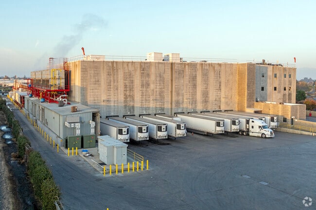

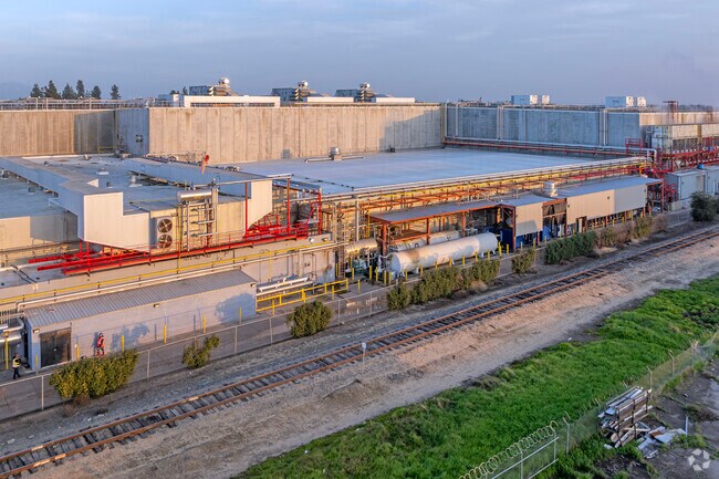

Property Detail
1489 K St
325-030-89S
7.67 AC IN SW 1/4 SEC 23 T14R22
Shipyard
Fresno
M1
California
AO River or stream flood hazard areas, and areas with a 1% or greater chance of shallow flooding each year. These areas have a 26% chance of flooding over the life of a 30-year mortgage.
7.67 AC
2024
Sanger
2025
Fresno
006201
Fresno, CA
119,762 SF
NEARBY LISTINGS FOR SALE OR LEASE
DEMOGRAPHICS near 1489 K St
1 mile
3 mile
5 mile
2025 Total Population
12,472
29,282
32,936
2030 Population
12,685
29,595
33,178
Pop Growth 2025-2030
+ 1.71%
+ 1.07%
+ 0.73%
Average Age
34
35
36
2025 Total Households
3,454
8,354
9,459
HH Growth 2025-2030
+ 1.68%
+ 1.02%
+ 0.68%
Median Household Inc
$52,969
$75,372
$76,121
Avg Household Size
3.60
3.50
3.40
2025 Avg HH Vehicles
2.00
2.00
2.00
Median Home Value
$339,889
$380,130
$386,941
Median Year Built
1968
1979
1979
Nearby Places
Map Layers
Map Styles
 Street
 Aerial
Layers
 Traffic
 Biking
Places
Listings with unknown addresses are not visible on the map
- Restaurants
- Banks
- Shops
- Fitness
- Groceries
PUBLIC TRANSPORTATION
AIRPORT
Fresno Yosemite International
Drive
Walk
Distance
Fresno Yosemite International
20 min
13.9 mi
Nearby Properties
Address
Land Use
TOTAL SIZE
Lot Size
Zoning
Address
Land Use
TOTAL SIZE
Lot Size
Zoning
234,271 SF
16.39 AC
M2
Address
Land Use
TOTAL SIZE
Lot Size
Zoning
16,225 SF
14.92 AC
MH
Address
Land Use
TOTAL SIZE
Lot Size
Zoning
268,401 SF
17.93 AC
ML*TWR
Address
Land Use
TOTAL SIZE
Lot Size
Zoning
109,374 SF
8.61 AC
RM25
Address
Land Use
TOTAL SIZE
Lot Size
Zoning
165,948 SF
16.88 AC
C2
Address
Land Use
TOTAL SIZE
Lot Size
Zoning
71,102 SF
3.56 AC
Address
Land Use
TOTAL SIZE
Lot Size
Zoning
87,150 SF
7.26 AC
RM25
Address
Land Use
TOTAL SIZE
Lot Size
Zoning
67,266 SF
3.35 AC
Address
Land Use
TOTAL SIZE
Lot Size
Zoning
51,204 SF
3.61 AC
RS3
Address
Land Use
TOTAL SIZE
Lot Size
Zoning
54,026 SF
10.83 AC
MH
Address
Land Use
TOTAL SIZE
Lot Size
Zoning
76,216 SF
14.06 AC
ML
Address
Land Use
TOTAL SIZE
Lot Size
Zoning
54,050 SF
6.27 AC
CP
Address
Land Use
TOTAL SIZE
Lot Size
Zoning
44,811 SF
4.53 AC
Address
Land Use
TOTAL SIZE
Lot Size
Zoning
74,874 SF
8.52 AC
RM25
Address
Land Use
TOTAL SIZE
Lot Size
Zoning
55,440 SF
2.55 AC
R4
Address
Land Use
TOTAL SIZE
Lot Size
Zoning
28,125 SF
1.36 AC
ML
Address
Land Use
TOTAL SIZE
Lot Size
Zoning
924 SF
154 AC
AE20
Address
Land Use
TOTAL SIZE
Lot Size
Zoning
46,912 SF
2.82 AC
R2
Address
Land Use
TOTAL SIZE
Lot Size
Zoning
9,190 SF
0.43 AC
RM25
Address
Land Use
TOTAL SIZE
Lot Size
Zoning
15,403 SF
0.34 AC
CR
Address
Land Use
TOTAL SIZE
Lot Size
Zoning
97,815 SF
9.80 AC
C2
Address
Land Use
TOTAL SIZE
Lot Size
Zoning
13,717 SF
1.03 AC
C2
Address
Land Use
TOTAL SIZE
Lot Size
Zoning
58,693 SF
9.85 AC
AE20
Address
Land Use
TOTAL SIZE
Lot Size
Zoning
33,480 SF
1.81 AC
RM2
Address
Land Use
TOTAL SIZE
Lot Size
Zoning
2,024 SF
331.45 AC
AL20
Address
Land Use
TOTAL SIZE
Lot Size
Zoning
107.47 AC
AL20
Address
Land Use
TOTAL SIZE
Lot Size
Zoning
14,888 SF
1.25 AC
CP
Address
Land Use
TOTAL SIZE
Lot Size
Zoning
31,060 SF
2.26 AC
MH
The World's #1 Commercial Real Estate Marketplace
Connect with us
© 2026 CoStar Group
The information above has been obtained from sources believed reliable. While we do not doubt its accuracy we have not verified it and make no guarantee, warranty or representation about it. It is your responsibility to independently confirm its accuracy and completeness. Any projections, opinions, assumptions, or estimates used are for example only and do not represent the current or future performance of the property. The value of this transaction to you depends on tax and other factors which should be evaluated by your tax, financial, and legal advisors. You and your advisors should conduct a careful, independent investigation of the property to determine to your satisfaction the suitability of the property for your needs.