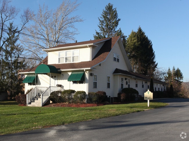
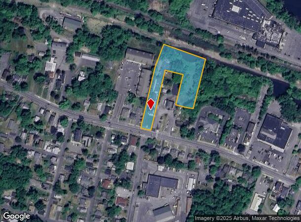
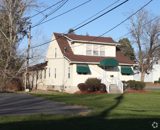
Property Record
149 Hurley Ave, Kingston, NY 12401
NEARBY LISTINGS FOR SALE OR LEASE
Property Detail
149 Hurley Ave
0800-048.071-0002-003.000-0000
Ulster
Professionalbldglegalinsurancerealestateetc
New York
AE
3.000
36111C0460F
1.70 AC
2025
Newburgh/Kingston
2024
Other Market Areas
952400
Kingston, NY
3,240 SF
DEMOGRAPHICS near 149 Hurley Ave
1 Mile
3 Mile
5 Mile
2024 Total Population
5,864
32,931
45,308
2029 Population
5,872
32,840
45,045
Pop Growth 2024-2029
+ 0.14%
(0.28%)
(0.58%)
Average Age
45
43
44
2024 Total Households
2,913
14,218
19,296
HH Growth 2024-2029
+ 0.07%
(0.26%)
(0.60%)
Median Household Inc
$72,125
$71,038
$72,719
Avg Household Size
2.00
2.20
2.20
2024 Avg HH Vehicles
2.00
2.00
2.00
Median Home Value
$306,132
$252,275
$255,920
Median Year Built
1957
1953
1956
Nearby Places
- Restaurants
- Banks
- Shops
- Fitness
- Groceries
Nearby Properties
Address
Land Use
TOTAL SIZE
Lot Size
Zoning
Address
Land Use
TOTAL SIZE
Lot Size
Zoning
21.40 AC
R-1
Address
Land Use
TOTAL SIZE
Lot Size
Zoning
1.58 AC
T5F
Address
Land Use
TOTAL SIZE
Lot Size
Zoning
240,924 SF
17 AC
SD
Address
Land Use
TOTAL SIZE
Lot Size
Zoning
181,151 SF
4.90 AC
SD
Address
Land Use
TOTAL SIZE
Lot Size
Zoning
250,613 SF
11.70 AC
SD
Address
Land Use
TOTAL SIZE
Lot Size
Zoning
135,158 SF
31.80 AC
R-1
Address
Land Use
TOTAL SIZE
Lot Size
Zoning
24,321 SF
46.40 AC
T2C
Address
Land Use
TOTAL SIZE
Lot Size
Zoning
109,860 SF
8.60 AC
35
Address
Land Use
TOTAL SIZE
Lot Size
Zoning
76,788 SF
0.77 AC
T5N
Address
Land Use
TOTAL SIZE
Lot Size
Zoning
16,933 SF
14.90 AC
SD
Address
Land Use
TOTAL SIZE
Lot Size
Zoning
67,180 SF
2.60 AC
T5MS
Address
Land Use
TOTAL SIZE
Lot Size
Zoning
205,740 SF
15 AC
36
Address
Land Use
TOTAL SIZE
Lot Size
Zoning
152,723 SF
9.60 AC
SD
Address
Land Use
TOTAL SIZE
Lot Size
Zoning
97,636 SF
2.60 AC
T5MS
Address
Land Use
TOTAL SIZE
Lot Size
Zoning
53,605 SF
10.83 AC
T5N
Address
Land Use
TOTAL SIZE
Lot Size
Zoning
23.30 AC
37
Address
Land Use
TOTAL SIZE
Lot Size
Zoning
8,674 SF
10.90 AC
SD
Address
Land Use
TOTAL SIZE
Lot Size
Zoning
67,566 SF
2.90 AC
T5N
Address
Land Use
TOTAL SIZE
Lot Size
Zoning
76,577 SF
1.30 AC
T5F
Address
Land Use
TOTAL SIZE
Lot Size
Zoning
4,104 SF
14.38 AC
SD
Address
Land Use
TOTAL SIZE
Lot Size
Zoning
10,124 SF
7.50 AC
SD
Address
Land Use
TOTAL SIZE
Lot Size
Zoning
12.70 AC
36
Address
Land Use
TOTAL SIZE
Lot Size
Zoning
2,670 SF
20.90 AC
SD
Address
Land Use
TOTAL SIZE
Lot Size
Zoning
11,488 SF
10.80 AC
SD
Address
Land Use
TOTAL SIZE
Lot Size
Zoning
6,000 SF
6.40 AC
SD
Address
Land Use
TOTAL SIZE
Lot Size
Zoning
50,350 SF
3.70 AC
SD
Address
Land Use
TOTAL SIZE
Lot Size
Zoning
115,834 SF
11.70 AC
36
Address
Land Use
TOTAL SIZE
Lot Size
Zoning
8,400 SF
9 AC
SD
Address
Land Use
TOTAL SIZE
Lot Size
Zoning
60,105 SF
11.70 AC
36
Address
Land Use
TOTAL SIZE
Lot Size
Zoning
47,038 SF
4.96 AC
T5N
The World's #1 Commercial Real Estate Marketplace
Connect with us
© 2025 CoStar Group
The information above has been obtained from sources believed reliable. While we do not doubt its accuracy we have not verified it and make no guarantee, warranty or representation about it. It is your responsibility to independently confirm its accuracy and completeness. Any projections, opinions, assumptions, or estimates used are for example only and do not represent the current or future performance of the property. The value of this transaction to you depends on tax and other factors which should be evaluated by your tax, financial, and legal advisors. You and your advisors should conduct a careful, independent investigation of the property to determine to your satisfaction the suitability of the property for your needs.