Property Record
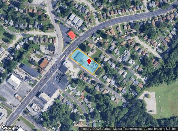
149 Laredo Ave, Saint Louis, MO 63125

NEARBY LISTINGS FOR SALE OR LEASE
Property Detail
149 Laredo Ave
St. Louis, MO-IL
Mcdermott Of Barracks Heights
28H-31-1881
MCDERMOTT OF BARRACKS HEIGHTS LOTS 33 THRU 37 & LOT PTS 1 & 2 & VAC ALLEY PT PER COURT ORDER 5 22 44
Warehouse
St. Louis
X
Missouri
17133C0020F
33-37
2024
0.83 AC
2025
South County
220300
St. Louis
5,316 SF
DEMOGRAPHICS near 149 Laredo Ave
1 Mile
3 Mile
5 Mile
2024 Total Population
9,761
67,161
183,836
2029 Population
9,583
65,590
177,210
Pop Growth 2024-2029
(1.82%)
(2.34%)
(3.60%)
Average Age
42
43
42
2024 Total Households
4,246
29,032
80,884
HH Growth 2024-2029
(1.88%)
(2.40%)
(3.70%)
Median Household Inc
$53,141
$61,015
$64,541
Avg Household Size
2.20
2.20
2.20
2024 Avg HH Vehicles
2.00
2.00
2.00
Median Home Value
$155,656
$171,510
$194,999
Median Year Built
1960
1963
1961
Nearby Places
Map Layers
Map Styles
 Street
 Aerial
- Restaurants
- Banks
- Shops
- Fitness
- Groceries
PUBLIC TRANSPORTATION
COMMUTER RAIL
Shrewsbury-Lansdowne (Shrewsbury-Lansdowne I-44 Emerson Park - St. Louis MetroLink (MetroLink))
DRIVE
WALK
Distance
Shrewsbury-Lansdowne (Shrewsbury-Lansdowne I-44 Emerson Park - St. Louis MetroLink (MetroLink))
16 min
7.2 mi
Sunnen (Shrewsbury-Lansdowne I-44 Emerson Park - St. Louis MetroLink (MetroLink))
DRIVE
WALK
Distance
Sunnen (Shrewsbury-Lansdowne I-44 Emerson Park - St. Louis MetroLink (MetroLink))
18 min
8.7 mi
AIRPORT
St Louis Lambert International
DRIVE
WALK
Distance
St Louis Lambert International
36 min
20.8 mi
Scott AFB/Midamerica St Louis
DRIVE
WALK
Distance
Scott AFB/Midamerica St Louis
53 min
37.1 mi
Freight Ports
Tulsa Port of Inola
DRIVE
WALK
Distance
Tulsa Port of Inola
419 min
379.0 mi
Nearby Properties
Address
Land Use
TOTAL SIZE
Lot Size
Zoning
Address
Land Use
TOTAL SIZE
Lot Size
Zoning
327,966 SF
56.80 AC
FPC8
Address
Land Use
TOTAL SIZE
Lot Size
Zoning
275,354 SF
72.71 AC
FPM2
Address
Land Use
TOTAL SIZE
Lot Size
Zoning
160,931 SF
141.53 AC
NU
Address
Land Use
TOTAL SIZE
Lot Size
Zoning
124,890 SF
11.91 AC
J
Address
Land Use
TOTAL SIZE
Lot Size
Zoning
3,835 SF
29.77 AC
R5
Address
Land Use
TOTAL SIZE
Lot Size
Zoning
739,781 SF
22.08 AC
C3
Address
Land Use
TOTAL SIZE
Lot Size
Zoning
391,268 SF
132.29 AC
R4
Address
Land Use
TOTAL SIZE
Lot Size
Zoning
40.60 AC
R4
Address
Land Use
TOTAL SIZE
Lot Size
Zoning
225,758 SF
16.85 AC
R4
Address
Land Use
TOTAL SIZE
Lot Size
Zoning
140,783 SF
15.51 AC
C-8
Address
Land Use
TOTAL SIZE
Lot Size
Zoning
90,185 SF
407.16 AC
P5
Address
Land Use
TOTAL SIZE
Lot Size
Zoning
342,288 SF
19.97 AC
R7
Address
Land Use
TOTAL SIZE
Lot Size
Zoning
142,800 SF
13.38 AC
106PL1
Address
Land Use
TOTAL SIZE
Lot Size
Zoning
216,121 SF
20.04 AC
C-8
Address
Land Use
TOTAL SIZE
Lot Size
Zoning
386,377 SF
21.34 AC
R7
Address
Land Use
TOTAL SIZE
Lot Size
Zoning
150,982 SF
18.74 AC
C-8
Address
Land Use
TOTAL SIZE
Lot Size
Zoning
163,144 SF
14.14 AC
C-8
Address
Land Use
TOTAL SIZE
Lot Size
Zoning
185,035 SF
8.94 AC
106PL1
Address
Land Use
TOTAL SIZE
Lot Size
Zoning
38.59 AC
NU
Address
Land Use
TOTAL SIZE
Lot Size
Zoning
137,432 SF
9.18 AC
C3
Address
Land Use
TOTAL SIZE
Lot Size
Zoning
127,090 SF
11.28 AC
C-8
Address
Land Use
TOTAL SIZE
Lot Size
Zoning
119,473 SF
8.65 AC
106PL1
Address
Land Use
TOTAL SIZE
Lot Size
Zoning
12.37 AC
R4
Address
Land Use
TOTAL SIZE
Lot Size
Zoning
17.93 AC
R5
Address
Land Use
TOTAL SIZE
Lot Size
Zoning
267,886 SF
27.34 AC
R6
Address
Land Use
TOTAL SIZE
Lot Size
Zoning
152,957 SF
13.77 AC
M1
Address
Land Use
TOTAL SIZE
Lot Size
Zoning
62,006 SF
7.94 AC
C5
Address
Land Use
TOTAL SIZE
Lot Size
Zoning
121,875 SF
6.99 AC
106PL1
Address
Land Use
TOTAL SIZE
Lot Size
Zoning
8.89 AC
R3
Address
Land Use
TOTAL SIZE
Lot Size
Zoning
69,340 SF
5.37 AC
The World's #1 Commercial Real Estate Marketplace
Connect with us
© 2025 CoStar Group
The information above has been obtained from sources believed reliable. While we do not doubt its accuracy we have not verified it and make no guarantee, warranty or representation about it. It is your responsibility to independently confirm its accuracy and completeness. Any projections, opinions, assumptions, or estimates used are for example only and do not represent the current or future performance of the property. The value of this transaction to you depends on tax and other factors which should be evaluated by your tax, financial, and legal advisors. You and your advisors should conduct a careful, independent investigation of the property to determine to your satisfaction the suitability of the property for your needs.