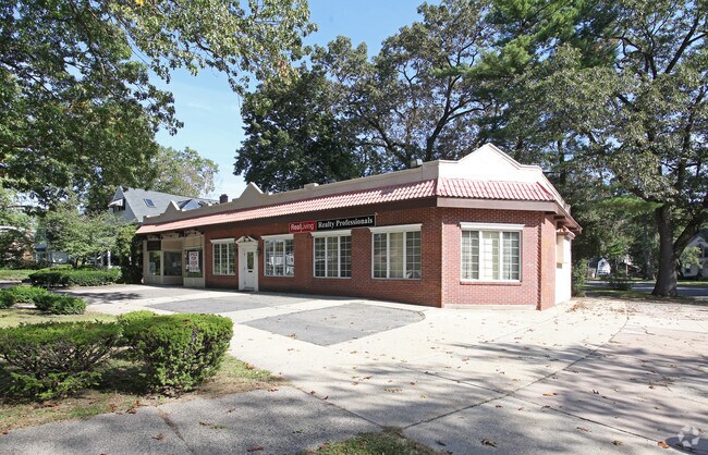
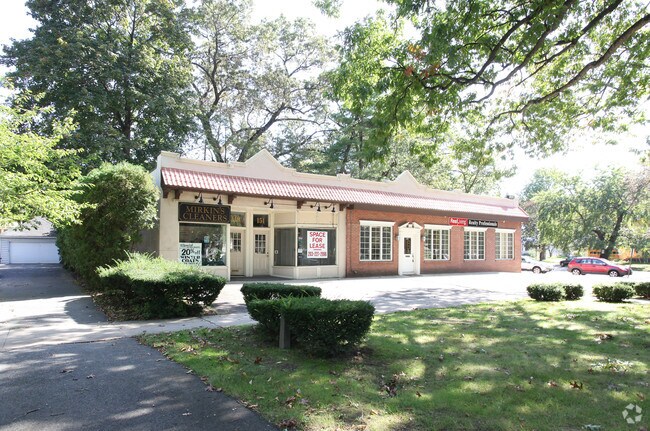
Property Record
149 Longmeadow St, Longmeadow, MA 01106
NEARBY LISTINGS FOR SALE OR LEASE
Property Detail
149 Longmeadow St
LONG-000462-000369-000006
Hampden
Officebuilding
Massachusetts
X
6
25013C0404E
0.14 AC
2025
Hampden County
2025
Hartford
813301
Springfield, MA
3,423 SF
DEMOGRAPHICS near 149 Longmeadow St
1 mile
3 mile
5 mile
2024 Total Population
6,071
85,440
205,939
2029 Population
5,968
83,666
202,394
Pop Growth 2024-2029
(1.70%)
(2.08%)
(1.72%)
Average Age
41
39
39
2024 Total Households
2,192
33,333
78,399
HH Growth 2024-2029
(1.78%)
(2.08%)
(1.80%)
Median Household Inc
$140,429
$56,704
$57,135
Avg Household Size
2.70
2.40
2.40
2024 Avg HH Vehicles
2.00
1.00
1.00
Median Home Value
$380,309
$269,233
$242,763
Median Year Built
1948
1951
1953
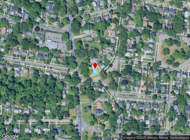
Nearby Places
Map Layers
Map Styles
 Street
 Aerial
Transit
 Traffic
 Biking
Places
Listings with unknown addresses are not visible on the map
- Restaurants
- Banks
- Shops
- Fitness
- Groceries
PUBLIC TRANSPORTATION
COMMUTER RAIL
Drive
Walk
Distance
6 min
3.5 mi
AIRPORT
Bradley International
Drive
Walk
Distance
Bradley International
30 min
13.3 mi
Nearby Properties
Address
Land Use
TOTAL SIZE
Lot Size
Zoning
Address
Land Use
TOTAL SIZE
Lot Size
Zoning
209,471 SF
2.98 AC
SR3C1
Address
Land Use
TOTAL SIZE
Lot Size
Zoning
236,616 SF
31.07 AC
RA1
Address
Land Use
TOTAL SIZE
Lot Size
Zoning
162,232 SF
3.06 AC
R2
Address
Land Use
TOTAL SIZE
Lot Size
Zoning
82,248 SF
4.57 AC
SR3C1
Address
Land Use
TOTAL SIZE
Lot Size
Zoning
227,072 SF
4.37 AC
B3
Address
Land Use
TOTAL SIZE
Lot Size
Zoning
75,000 SF
3.10 AC
B1
Address
Land Use
TOTAL SIZE
Lot Size
Zoning
69.62 AC
MFHD
Address
Land Use
TOTAL SIZE
Lot Size
Zoning
839,347 SF
2.05 AC
B3
Address
Land Use
TOTAL SIZE
Lot Size
Zoning
105,494 SF
2.33 AC
I2
Address
Land Use
TOTAL SIZE
Lot Size
Zoning
232,510 SF
61.40 AC
RB
Address
Land Use
TOTAL SIZE
Lot Size
Zoning
100,000 SF
17.80 AC
WC
Address
Land Use
TOTAL SIZE
Lot Size
Zoning
8,712 SF
25.08 AC
RA1
Address
Land Use
TOTAL SIZE
Lot Size
Zoning
42,412 SF
2.22 AC
SR2B1
Address
Land Use
TOTAL SIZE
Lot Size
Zoning
24,835 SF
2.16 AC
B3
Address
Land Use
TOTAL SIZE
Lot Size
Zoning
5,802 SF
49.19 AC
R2
Address
Land Use
TOTAL SIZE
Lot Size
Zoning
335,105 SF
1.28 AC
B3
Address
Land Use
TOTAL SIZE
Lot Size
Zoning
9.69 AC
B
Address
Land Use
TOTAL SIZE
Lot Size
Zoning
60,620 SF
4.96 AC
SR3B1
Address
Land Use
TOTAL SIZE
Lot Size
Zoning
1,840 SF
148.78 AC
BB
Address
Land Use
TOTAL SIZE
Lot Size
Zoning
27,200 SF
13.22 AC
MULT
Address
Land Use
TOTAL SIZE
Lot Size
Zoning
214,177 SF
23.37 AC
RA1
Address
Land Use
TOTAL SIZE
Lot Size
Zoning
84,605 SF
13.15 AC
RB
Address
Land Use
TOTAL SIZE
Lot Size
Zoning
77,012 SF
1.29 AC
B3
Address
Land Use
TOTAL SIZE
Lot Size
Zoning
4,400 SF
675 AC
SR1R2
Address
Land Use
TOTAL SIZE
Lot Size
Zoning
137,450 SF
16 AC
Address
Land Use
TOTAL SIZE
Lot Size
Zoning
57,593 SF
2.15 AC
SR3C1
Address
Land Use
TOTAL SIZE
Lot Size
Zoning
62,548 SF
10.50 AC
R1
Address
Land Use
TOTAL SIZE
Lot Size
Zoning
184,850 SF
2.39 AC
B3
Address
Land Use
TOTAL SIZE
Lot Size
Zoning
38,850 SF
10.06 AC
R1
Address
Land Use
TOTAL SIZE
Lot Size
Zoning
19,380 SF
3.30 AC
R2
The World's #1 Commercial Real Estate Marketplace
Connect with us
© 2026 CoStar Group
The information above has been obtained from sources believed reliable. While we do not doubt its accuracy we have not verified it and make no guarantee, warranty or representation about it. It is your responsibility to independently confirm its accuracy and completeness. Any projections, opinions, assumptions, or estimates used are for example only and do not represent the current or future performance of the property. The value of this transaction to you depends on tax and other factors which should be evaluated by your tax, financial, and legal advisors. You and your advisors should conduct a careful, independent investigation of the property to determine to your satisfaction the suitability of the property for your needs.