Property Record
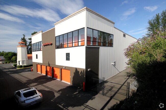
14900 Aurora Ave N, Shoreline, WA 98133


NEARBY LISTINGS FOR SALE OR LEASE
Property Detail
14900 Aurora Ave N
Seattle-Tacoma-Bellevue, WA
Short Plat #1078029
182604-9047
POR OF W 1/2 OF W 1/2 OF SE 1/4 DAF - BEG AT SW COR OF NW 1/4 OF SE 1/4 TH S 88-58-33 E 280.02 FT TO TPOB TH S 00-05-32 W 315.91 FT TH N 88-58-33 W 235.02 FT TO ELY MGN ST HWY #1 TH SLY ALG SD MGN 158.56 FT TH ELY ALG SD MGN 10 FT TH SLY ALG SD MGN 7
Publicstorage
King
X
Washington
53033C0330G
3
2025
4.66 AC
2024
Edmonds/Lynnwood
021000
Seattle/Puget Sound
164,284 SF
DEMOGRAPHICS near 14900 Aurora Ave N
1 Mile
3 Mile
5 Mile
2024 Total Population
20,492
144,907
347,741
2029 Population
20,792
146,399
352,784
Pop Growth 2024-2029
+ 1.46%
+ 1.03%
+ 1.45%
Average Age
42
41
41
2024 Total Households
9,131
62,950
148,796
HH Growth 2024-2029
+ 1.66%
+ 1.05%
+ 1.45%
Median Household Inc
$79,477
$92,912
$111,547
Avg Household Size
2.10
2.20
2.30
2024 Avg HH Vehicles
2.00
2.00
2.00
Median Home Value
$715,620
$765,211
$814,301
Median Year Built
1977
1972
1969
Nearby Places
Map Layers
Map Styles
 Street
 Aerial
- Restaurants
- Banks
- Shops
- Fitness
- Groceries
PUBLIC TRANSPORTATION
COMMUTER RAIL
Edmonds Station (Sounder South Line - Central Puget Sound Regional Transit Authority Rail (Link Light Rail/Sounder))
DRIVE
WALK
Distance
Edmonds Station (Sounder South Line - Central Puget Sound Regional Transit Authority Rail (Link Light Rail/Sounder))
14 min
6.6 mi
AIRPORT
Seattle Paine Field International
DRIVE
WALK
Distance
Seattle Paine Field International
25 min
13.6 mi
Seattle-Tacoma International
DRIVE
WALK
Distance
Seattle-Tacoma International
36 min
24.4 mi
Freight Ports
Port of Seattle
DRIVE
WALK
Distance
Port of Seattle
24 min
14.9 mi
Nearby Properties
Address
Land Use
TOTAL SIZE
Lot Size
Zoning
Address
Land Use
TOTAL SIZE
Lot Size
Zoning
7,549 SF
59.34 AC
MIO-105-LR
Address
Land Use
TOTAL SIZE
Lot Size
Zoning
400,610 SF
77.69 AC
R6
Address
Land Use
TOTAL SIZE
Lot Size
Zoning
172,297 SF
4.21 AC
NC3-95 (M)
Address
Land Use
TOTAL SIZE
Lot Size
Zoning
10,090 SF
11.73 AC
NC3-95 (M)
Address
Land Use
TOTAL SIZE
Lot Size
Zoning
325,905 SF
22.50 AC
RM-1.5
Address
Land Use
TOTAL SIZE
Lot Size
Zoning
162,182 SF
9.10 AC
LR2 (M)
Address
Land Use
TOTAL SIZE
Lot Size
Zoning
207,576 SF
5.98 AC
MR (M)
Address
Land Use
TOTAL SIZE
Lot Size
Zoning
183,056 SF
1.95 AC
C1-55 (M)
Address
Land Use
TOTAL SIZE
Lot Size
Zoning
168,619 SF
7.79 AC
NC3-145 (M
Address
Land Use
TOTAL SIZE
Lot Size
Zoning
119,405 SF
0.97 AC
NC3-95 (M)
Address
Land Use
TOTAL SIZE
Lot Size
Zoning
54,224 SF
2.22 AC
NC3-55 (M)
Address
Land Use
TOTAL SIZE
Lot Size
Zoning
170,408 SF
1.85 AC
NC3-75 (M)
Address
Land Use
TOTAL SIZE
Lot Size
Zoning
131,236 SF
19.14 AC
R6
Address
Land Use
TOTAL SIZE
Lot Size
Zoning
288,283 SF
3.94 AC
NC3-75 (M)
Address
Land Use
TOTAL SIZE
Lot Size
Zoning
46,513 SF
5.90 AC
SM-NG 145
Address
Land Use
TOTAL SIZE
Lot Size
Zoning
220,000 SF
25.47 AC
R6
Address
Land Use
TOTAL SIZE
Lot Size
Zoning
234,128 SF
1.57 AC
NC3-145 (M
Address
Land Use
TOTAL SIZE
Lot Size
Zoning
179,340 SF
6.27 AC
LR2 (M)
Address
Land Use
TOTAL SIZE
Lot Size
Zoning
152,168 SF
3.02 AC
CZ
Address
Land Use
TOTAL SIZE
Lot Size
Zoning
97,381 SF
7.78 AC
NR3
Address
Land Use
TOTAL SIZE
Lot Size
Zoning
172,514 SF
15.34 AC
MB
Address
Land Use
TOTAL SIZE
Lot Size
Zoning
3,284 SF
72.10 AC
R6
Address
Land Use
TOTAL SIZE
Lot Size
Zoning
115,440 SF
1.07 AC
MB
Address
Land Use
TOTAL SIZE
Lot Size
Zoning
236,309 SF
43.88 AC
R6
Address
Land Use
TOTAL SIZE
Lot Size
Zoning
181,168 SF
4.72 AC
MR (M)
Address
Land Use
TOTAL SIZE
Lot Size
Zoning
402,321 SF
32.47 AC
C
Address
Land Use
TOTAL SIZE
Lot Size
Zoning
36,975 SF
4.96 AC
NR2
Address
Land Use
TOTAL SIZE
Lot Size
Zoning
108,040 SF
28.20 AC
R6
Address
Land Use
TOTAL SIZE
Lot Size
Zoning
32,009 SF
1.60 AC
NC3-55 (M)
Address
Land Use
TOTAL SIZE
Lot Size
Zoning
130,572 SF
2 AC
C1-75 (M)
The World's #1 Commercial Real Estate Marketplace
Connect with us
© 2026 CoStar Group
The information above has been obtained from sources believed reliable. While we do not doubt its accuracy we have not verified it and make no guarantee, warranty or representation about it. It is your responsibility to independently confirm its accuracy and completeness. Any projections, opinions, assumptions, or estimates used are for example only and do not represent the current or future performance of the property. The value of this transaction to you depends on tax and other factors which should be evaluated by your tax, financial, and legal advisors. You and your advisors should conduct a careful, independent investigation of the property to determine to your satisfaction the suitability of the property for your needs.